Saint-Valery-en-Caux elevation
Saint-Valery-en-Caux (Normandy, Seine-Maritime), France elevation is 68 meters and Saint-Valery-en-Caux elevation in feet is 223 ft above sea level [src 1]. Saint-Valery-en-Caux is a populated place (feature code) with elevation that is 106 meters (348 ft) smaller than average city elevation in France.
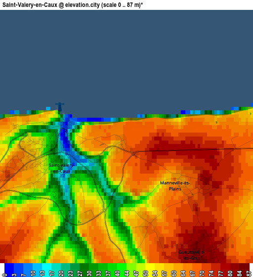
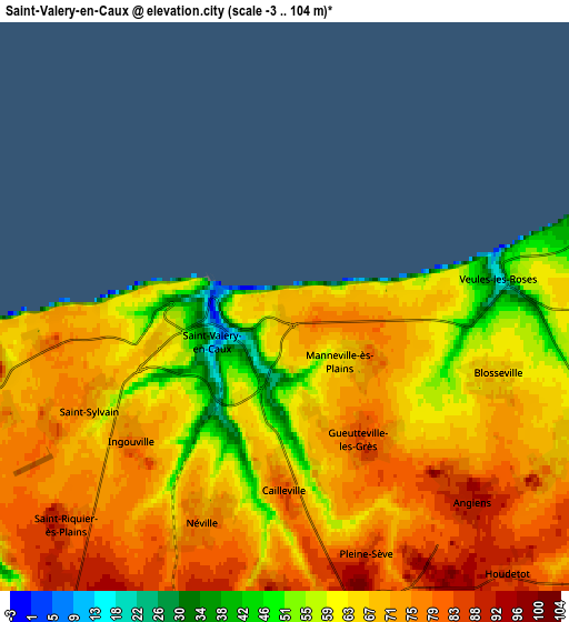
Below is the Elevation map of Saint-Valery-en-Caux, which displays elevation range with different colors. Scale of the first map is from 0 to 87 m (0 to 285 ft) with average elevation of 57.9 meters (=190 ft) [note 1]
These maps also provides idea of topography and contour of this city, they are displayed at different zoom levels. More info about maps, scale and edge coordinates you can find below images.
| \ | Map #1 | Map #2 | Topo.Map |
| Scale [m] | 0..87 m | -3..104 m | × |
| Scale [ft] | 0..285 ft | -10..341 ft | × |
| Average | 57.9 m = 190 ft | 68.3 m = 224 ft | × |
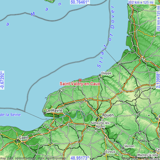
| Width | 6.3 km = 3.9 mi | 12.6 km = 7.8 mi | 201.6 km = 125.3 mi |
| Height | 6.3 km = 3.9 mi | 12.6 km = 7.8 mi | 201.6 km = 125.3 mi |
| ↑Max Latitude | 49.894987° | 49.923288° | 50.76461° |
| Latitude at center | 49.86667° | 49.86667° | 49.86667° |
| ↓Min Latitude | 49.838336° | 49.809985° | 48.95173° |
| ← Min Longitude | 0.689385° | 0.645439° | -0.67292° |
| Longitude center | 0.73333° | 0.73333° | 0.73333° |
| →Max Longitude | 0.777275° | 0.821221° | 2.13958° |
Nearby cities:
Cities around Saint-Valery-en-Caux sort by population:
• Offranville elevation 83 m
22.6 km,  88°
88°
• Cany-Barville 17 m
11.1 km,  218°
218°
• Doudeville 122 m
16.4 km,  167°
167°
• Hautot-sur-Mer 100 m
21.5 km,  80°
80°
• Luneray 76 m
13.8 km,  108°
108°
• Bacqueville-en-Caux 97 m
21 km, 114°
• Saint-Aubin-sur-Scie 22 m
24 km, 88°
• Varengeville-sur-Mer 94 m
19.2 km, 77°
• Néville 71 m
5 km,  200°
200°
• Grainville-la-Teinturière 37 m
14.8 km,  206°
206°
• Ourville-en-Caux 118 m
17.9 km, 211°
• Fontaine-le-Dun 53 m
10.4 km,  125°
125°
Multilingual:
 En español:
Saint-Valery-en-Caux elevación 68 m.
 En France:
Saint-Valery-en-Caux élévation 68 m.
 Auf Deutsch:
Saint-Valery-en-Caux höhe über dem Meeresspiegel ist 68 m.
 На русском:
Saint-Valery-en-Caux высота над уровнем моря 68 м
Sources and notes:
- [note 1] Map square and city borders are not equal. Map elevation data is calculated only from area inside that square.
- [src 1] Elevation data from geonames database provided with same terms of usage.
- [src 2] The elevation map of Saint-Valery-en-Caux is generated using elevation data from NASA's 3 arcsec (90m) resolution SRTM data.
- [src 3] Base (background) map © OpenStreetMap contributors tiles are generated by Geofabrik and OpenTopoMap.
Copyright & License:
This Saint-Valery-en-Caux Elevation Map is licensed under CC BY-SA. You may reuse any part from this page, if you give a proper credit by linking to this URL:
 More info on terms of use page.