Nogent-le-Rotrou elevation
Nogent-le-Rotrou (Centre, Département d'Eure-et-Loir), France elevation is 148 meters and Nogent-le-Rotrou elevation in feet is 486 ft above sea level [src 1]. Nogent-le-Rotrou is a seat of a third-order administrative division (feature code) with elevation that is 26 meters (85 ft) smaller than average city elevation in France.
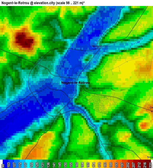
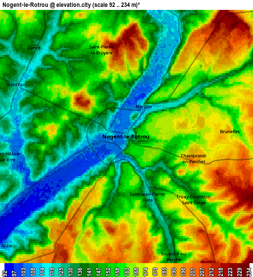
Below is the Elevation map of Nogent-le-Rotrou, which displays elevation range with different colors. Scale of the first map is from 98 to 221 m (322 to 725 ft) with average elevation of 141.4 meters (=464 ft) [note 1]
These maps also provides idea of topography and contour of this city, they are displayed at different zoom levels. More info about maps, scale and edge coordinates you can find below images.
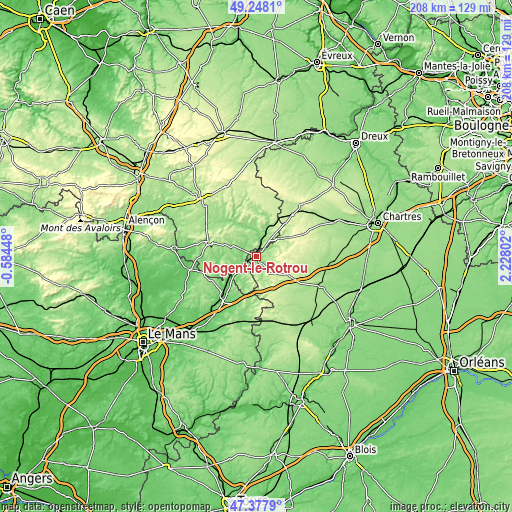
| \ | Map #1 | Map #2 | Topo.Map |
| Scale [m] | 98..221 m | 92..234 m | × |
| Scale [ft] | 322..725 ft | 302..768 ft | × |
| Average | 141.4 m = 464 ft | 155.8 m = 511 ft | × |
| Width | 6.5 km = 4 mi | 13 km = 8.1 mi | 207.9 km = 129.2 mi |
| Height | 6.5 km = 4 mi | 13 km = 8.1 mi | 207.9 km = 129.2 mi |
| ↑Max Latitude | 48.350783° | 48.379979° | 49.2481° |
| Latitude at center | 48.32157° | 48.32157° | 48.32157° |
| ↓Min Latitude | 48.29234° | 48.263094° | 47.3779° |
| ← Min Longitude | 0.777825° | 0.733879° | -0.58448° |
| Longitude center | 0.82177° | 0.82177° | 0.82177° |
| →Max Longitude | 0.865715° | 0.909661° | 2.22802° |
Nearby cities:
Cities around Nogent-le-Rotrou sort by population:
• La Ferté-Bernard elevation 86 m
19.5 km,  219°
219°
• La Loupe 216 m
22.1 km,  40°
40°
• Ceton 120 m
11.9 km,  206°
206°
• Bellême 220 m
19.5 km,  287°
287°
• Cherré 96 m
20.5 km, 216°
• Bretoncelles 155 m
13.1 km,  21°
21°
• Margon 127 m
1.8 km,  31°
31°
• La Bazoche-Gouet 191 m
23.4 km,  149°
149°
• Authon-du-Perche 240 m
14.9 km,  159°
159°
• Rémalard 139 m
12.5 km,  342°
342°
• Condé-sur-Huisne 124 m
7 km, 18°
• Thiron Gardais 245 m
12 km,  92°
92°
Multilingual:
 En español:
Nogent-le-Rotrou elevación 148 m.
 En France:
Nogent-le-Rotrou élévation 148 m.
 Auf Deutsch:
Nogent-le-Rotrou höhe über dem Meeresspiegel ist 148 m.

Sources and notes:
- [note 1] Map square and city borders are not equal. Map elevation data is calculated only from area inside that square.
- [src 1] Elevation data from geonames database provided with same terms of usage.
- [src 2] The elevation map of Nogent-le-Rotrou is generated using elevation data from NASA's 3 arcsec (90m) resolution SRTM data.
- [src 3] Base (background) map © OpenStreetMap contributors tiles are generated by Geofabrik and OpenTopoMap.
Copyright & License:
This Nogent-le-Rotrou Elevation Map is licensed under CC BY-SA. You may reuse any part from this page, if you give a proper credit by linking to this URL:
 More info on terms of use page.