Pouancé elevation
Pouancé (Pays de la Loire, Département de Maine-et-Loire), France elevation is 85 meters and Pouancé elevation in feet is 279 ft above sea level [src 1]. Pouancé is a populated place (feature code) with elevation that is 89 meters (292 ft) smaller than average city elevation in France.
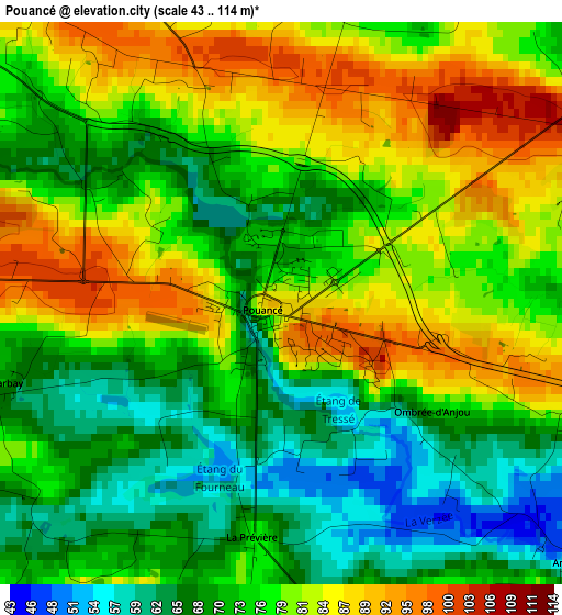
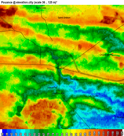
Below is the Elevation map of Pouancé, which displays elevation range with different colors. Scale of the first map is from 43 to 114 m (141 to 374 ft) with average elevation of 76.3 meters (=250 ft) [note 1]
These maps also provides idea of topography and contour of this city, they are displayed at different zoom levels. More info about maps, scale and edge coordinates you can find below images.
| \ | Map #1 | Map #2 | Topo.Map |
| Scale [m] | 43..114 m | 36..125 m | × |
| Scale [ft] | 141..374 ft | 118..410 ft | × |
| Average | 76.3 m = 250 ft | 80.6 m = 264 ft | × |
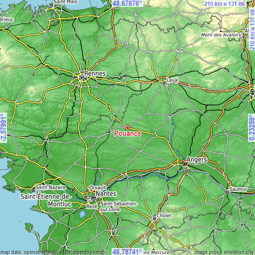
| Width | 6.57 km = 4.1 mi | 13.14 km = 8.2 mi | 210.3 km = 130.7 mi |
| Height | 6.57 km = 4.1 mi | 13.14 km = 8.2 mi | 210.3 km = 130.7 mi |
| ↑Max Latitude | 47.771214° | 47.800741° | 48.67876° |
| Latitude at center | 47.74167° | 47.74167° | 47.74167° |
| ↓Min Latitude | 47.71211° | 47.682532° | 46.78741° |
| ← Min Longitude | -1.217605° | -1.261551° | -2.57991° |
| Longitude center | -1.17366° | -1.17366° | -1.17366° |
| →Max Longitude | -1.129715° | -1.085769° | 0.23259° |
Nearby cities:
Cities around Pouancé sort by population:
• Châteaubriant elevation 67 m
15.4 km,  259°
259°
• Craon 53 m
20.4 km,  55°
55°
• Renazé 72 m
10.6 km, 57°
• Combrée 55 m
11.5 km,  111°
111°
• Martigné-Ferchaud 104 m
14.6 km,  311°
311°
• Erbray 61 m
14.5 km,  228°
228°
• Soudan 78 m
9.9 km,  267°
267°
• Moisdon-la-Rivière 60 m
20 km, 228°
• Noyant-la-Gravoyère 95 m
16.7 km,  104°
104°
• Nyoiseau 43 m
19.4 km, 98°
• Ballots 79 m
19.6 km,  28°
28°
• Congrier 83 m
8.7 km, 29°
Multilingual:
 En español:
Pouancé elevación 85 m.
 En France:
Pouancé élévation 85 m.


Sources and notes:
- [note 1] Map square and city borders are not equal. Map elevation data is calculated only from area inside that square.
- [src 1] Elevation data from geonames database provided with same terms of usage.
- [src 2] The elevation map of Pouancé is generated using elevation data from NASA's 3 arcsec (90m) resolution SRTM data.
- [src 3] Base (background) map © OpenStreetMap contributors tiles are generated by Geofabrik and OpenTopoMap.
Copyright & License:
This Pouancé Elevation Map is licensed under CC BY-SA. You may reuse any part from this page, if you give a proper credit by linking to this URL:
 More info on terms of use page.