Châteaubriant elevation
Châteaubriant (Pays de la Loire, Loire-Atlantique), France elevation is 67 meters and Châteaubriant elevation in feet is 220 ft above sea level [src 1]. Châteaubriant is a seat of a third-order administrative division (feature code) with elevation that is 107 meters (351 ft) smaller than average city elevation in France.
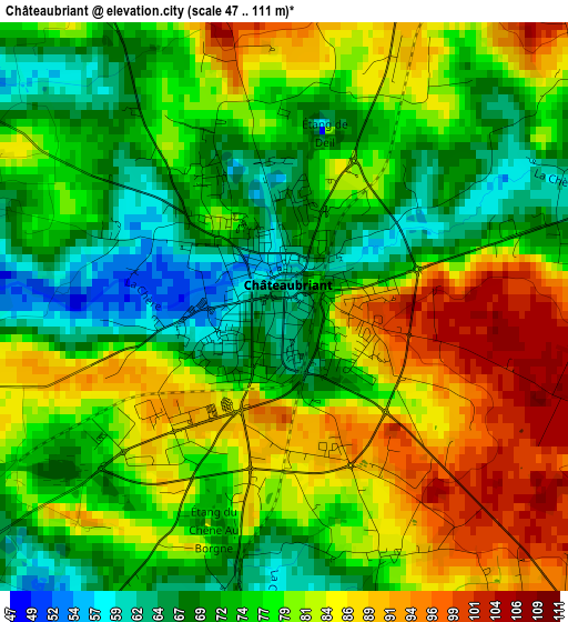
Below is the Elevation map of Châteaubriant, which displays elevation range with different colors. Scale of the first map is from 47 to 111 m (154 to 364 ft) with average elevation of 78 meters (=256 ft) [note 1]
These maps also provides idea of topography and contour of this city, they are displayed at different zoom levels. More info about maps, scale and edge coordinates you can find below images.
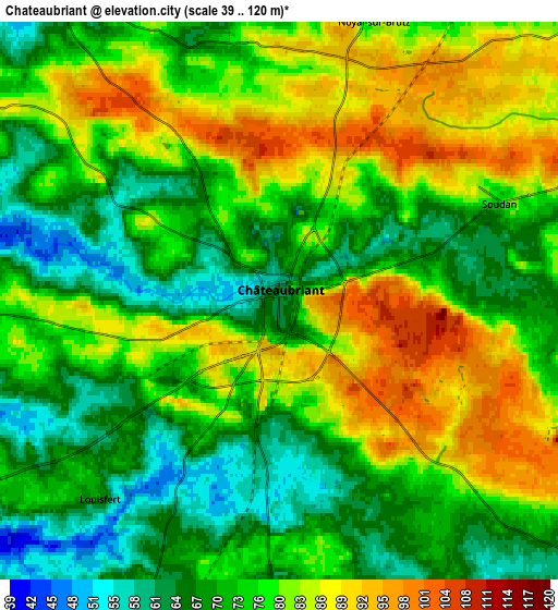
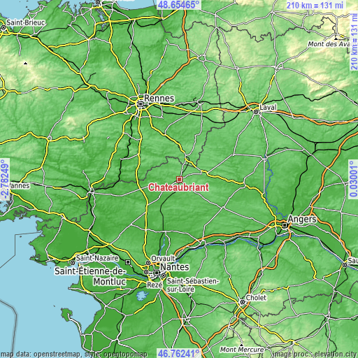
| \ | Map #1 | Map #2 | Topo.Map |
| Scale [m] | 47..111 m | 39..120 m | × |
| Scale [ft] | 154..364 ft | 128..394 ft | × |
| Average | 78 m = 256 ft | 76.3 m = 250 ft | × |
| Width | 6.57 km = 4.1 mi | 13.15 km = 8.2 mi | 210.4 km = 130.7 mi |
| Height | 6.57 km = 4.1 mi | 13.15 km = 8.2 mi | 210.4 km = 130.7 mi |
| ↑Max Latitude | 47.746678° | 47.776219° | 48.65465° |
| Latitude at center | 47.71712° | 47.71712° | 47.71712° |
| ↓Min Latitude | 47.687546° | 47.657954° | 46.76241° |
| ← Min Longitude | -1.420185° | -1.464131° | -2.78249° |
| Longitude center | -1.37624° | -1.37624° | -1.37624° |
| →Max Longitude | -1.332295° | -1.288349° | 0.03001° |
Nearby cities:
Cities around Châteaubriant sort by population:
• Pouancé elevation 85 m
15.4 km,  79°
79°
• Martigné-Ferchaud 104 m
13.2 km,  18°
18°
• Erbray 61 m
8.2 km,  147°
147°
• Rougé 75 m
9.1 km,  324°
324°
• Soudan 78 m
5.8 km,  66°
66°
• Issé 38 m
11.8 km,  208°
208°
• Moisdon-la-Rivière 60 m
10.6 km,  178°
178°
• Sion-les-Mines 68 m
16.2 km,  276°
276°
• Saint-Vincent-des-Landes 56 m
11.2 km,  233°
233°
• Saint-Aubin-des-Châteaux 75 m
8.4 km,  272°
272°
• La Meilleraye-de-Bretagne 87 m
17.6 km,  186°
186°
• Lusanger 67 m
16.4 km,  256°
256°
Multilingual:
 En español:
Châteaubriant elevación 67 m.
 En France:
Châteaubriant élévation 67 m.
 Auf Deutsch:
Châteaubriant höhe über dem Meeresspiegel ist 67 m.

Sources and notes:
- [note 1] Map square and city borders are not equal. Map elevation data is calculated only from area inside that square.
- [src 1] Elevation data from geonames database provided with same terms of usage.
- [src 2] The elevation map of Châteaubriant is generated using elevation data from NASA's 3 arcsec (90m) resolution SRTM data.
- [src 3] Base (background) map © OpenStreetMap contributors tiles are generated by Geofabrik and OpenTopoMap.
Copyright & License:
This Châteaubriant Elevation Map is licensed under CC BY-SA. You may reuse any part from this page, if you give a proper credit by linking to this URL:
 More info on terms of use page.