Saint-Julien-en-Genevois elevation
Saint-Julien-en-Genevois (Auvergne-Rhône-Alpes, Haute-Savoie), France elevation is 464 meters and Saint-Julien-en-Genevois elevation in feet is 1522 ft above sea level [src 1]. Saint-Julien-en-Genevois is a seat of a third-order administrative division (feature code) with elevation that is 290 meters (951 ft) bigger than average city elevation in France.
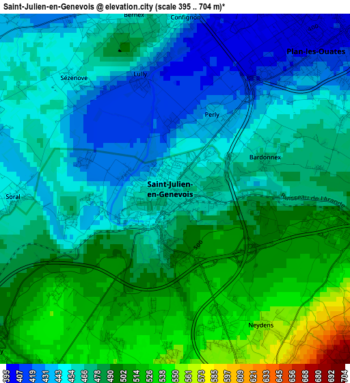
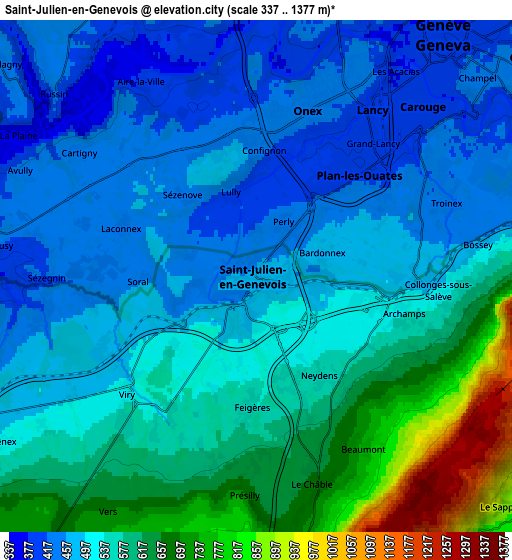
Below is the Elevation map of Saint-Julien-en-Genevois, which displays elevation range with different colors. Scale of the first map is from 395 to 704 m (1296 to 2310 ft) with average elevation of 474.4 meters (=1556 ft) [note 1]
These maps also provides idea of topography and contour of this city, they are displayed at different zoom levels. More info about maps, scale and edge coordinates you can find below images.
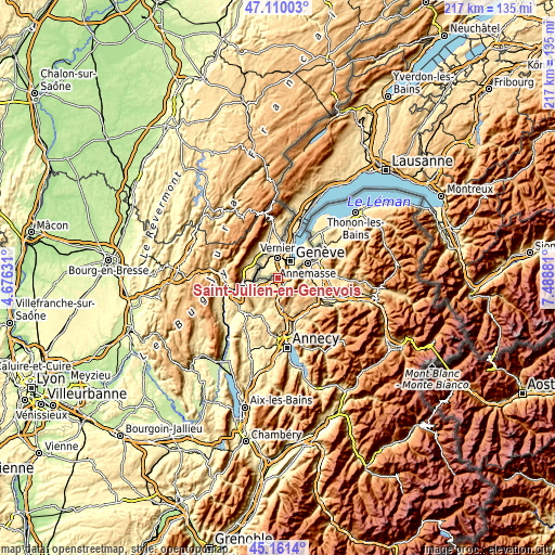
| \ | Map #1 | Map #2 | Topo.Map |
| Scale [m] | 395..704 m | 337..1377 m | × |
| Scale [ft] | 1296..2310 ft | 1106..4518 ft | × |
| Average | 474.4 m = 1556 ft | 539.4 m = 1770 ft | × |
| Width | 6.77 km = 4.2 mi | 13.54 km = 8.4 mi | 216.7 km = 134.7 mi |
| Height | 6.77 km = 4.2 mi | 13.54 km = 8.4 mi | 216.7 km = 134.7 mi |
| ↑Max Latitude | 46.174779° | 46.205201° | 47.11003° |
| Latitude at center | 46.14434° | 46.14434° | 46.14434° |
| ↓Min Latitude | 46.113884° | 46.083412° | 45.1614° |
| ← Min Longitude | 6.038615° | 5.994669° | 4.67631° |
| Longitude center | 6.08256° | 6.08256° | 6.08256° |
| →Max Longitude | 6.126505° | 6.170451° | 7.48881° |
Nearby cities:
Cities around Saint-Julien-en-Genevois sort by population:
• Gaillard elevation 421 m
10.6 km,  64°
64°
• Saint-Genis-Pouilly 453 m
12 km,  336°
336°
• Collonges-sous-Salève 555 m
5.5 km,  93°
93°
• Viry 535 m
4.9 km,  224°
224°
• Valleiry 469 m
9.4 km,  246°
246°
• Monnetier-Mornex 702 m
9.7 km,  79°
79°
• Étrembières 427 m
11.8 km,  70°
70°
• Beaumont 837 m
5.4 km,  146°
146°
• Archamps 588 m
3.6 km,  112°
112°
• Feigères 560 m
3.6 km,  183°
183°
• Neydens 558 m
3 km, 146°
• Challex 508 m
9.3 km,  298°
298°
Multilingual:
 En español:
Saint-Julien-en-Genevois elevación 464 m.
 En France:
Saint-Julien-en-Genevois élévation 464 m.
 Auf Deutsch:
Saint-Julien-en-Genevois höhe über dem Meeresspiegel ist 464 m.
 На русском:
Сен-Жюльен-ан-Женевуа высота над уровнем моря 464 м
Sources and notes:
- [note 1] Map square and city borders are not equal. Map elevation data is calculated only from area inside that square.
- [src 1] Elevation data from geonames database provided with same terms of usage.
- [src 2] The elevation map of Saint-Julien-en-Genevois is generated using elevation data from NASA's 3 arcsec (90m) resolution SRTM data.
- [src 3] Base (background) map © OpenStreetMap contributors tiles are generated by Geofabrik and OpenTopoMap.
Copyright & License:
This Saint-Julien-en-Genevois Elevation Map is licensed under CC BY-SA. You may reuse any part from this page, if you give a proper credit by linking to this URL:
 More info on terms of use page.