Saint-Pierre-de-Chandieu elevation
Saint-Pierre-de-Chandieu (Auvergne-Rhône-Alpes, Département du Rhône), France elevation is 258 meters and Saint-Pierre-de-Chandieu elevation in feet is 846 ft above sea level [src 1]. Saint-Pierre-de-Chandieu is a populated place (feature code) with elevation that is 84 meters (276 ft) bigger than average city elevation in France.
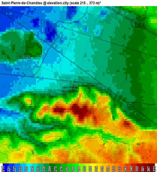
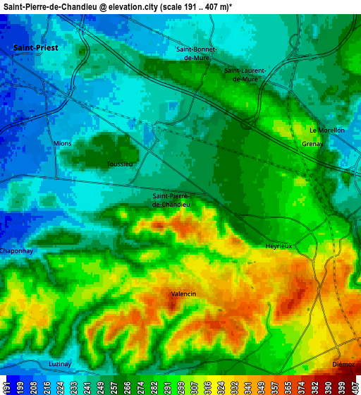
Below is the Elevation map of Saint-Pierre-de-Chandieu, which displays elevation range with different colors. Scale of the first map is from 215 to 373 m (705 to 1224 ft) with average elevation of 272.2 meters (=893 ft) [note 1]
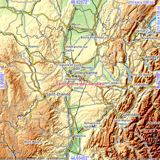
These maps also provides idea of topography and contour of this city, they are displayed at different zoom levels. More info about maps, scale and edge coordinates you can find below images.
| \ | Map #1 | Map #2 | Topo.Map |
| Scale [m] | 215..373 m | 191..407 m | × |
| Scale [ft] | 705..1224 ft | 627..1335 ft | × |
| Average | 272.2 m = 893 ft | 268.8 m = 882 ft | × |
| Width | 6.83 km = 4.2 mi | 13.66 km = 8.5 mi | 218.6 km = 135.8 mi |
| Height | 6.83 km = 4.2 mi | 13.66 km = 8.5 mi | 218.6 km = 135.8 mi |
| ↑Max Latitude | 45.676963° | 45.707659° | 46.62072° |
| Latitude at center | 45.64625° | 45.64625° | 45.64625° |
| ↓Min Latitude | 45.61552° | 45.584773° | 44.65453° |
| ← Min Longitude | 4.970865° | 4.926919° | 3.60856° |
| Longitude center | 5.01481° | 5.01481° | 5.01481° |
| →Max Longitude | 5.058755° | 5.102701° | 6.42106° |
Nearby cities:
Cities around Saint-Pierre-de-Chandieu sort by population:
• Saint-Priest elevation 228 m
7.9 km,  315°
315°
• Mions 251 m
5.2 km,  291°
291°
• Saint-Quentin-Fallavier 225 m
7.6 km,  92°
92°
• Saint-Bonnet-de-Mure 268 m
5 km,  12°
12°
• Saint-Laurent-de-Mure 241 m
5 km,  28°
28°
• Heyrieux 290 m
4.1 km,  113°
113°
• Chaponnay 240 m
6.5 km,  251°
251°
• Saint-Just-Chaleyssin 279 m
5.9 km,  192°
192°
• Valencin 342 m
4.1 km,  163°
163°
• Luzinay 242 m
7.6 km,  214°
214°
• Toussieu 242 m
2.5 km, 291°
• Grenay 300 m
5.4 km,  69°
69°
Multilingual:
 En español:
Saint-Pierre-de-Chandieu elevación 258 m.
 En France:
Saint-Pierre-de-Chandieu élévation 258 m.
 Auf Deutsch:
Saint-Pierre-de-Chandieu höhe über dem Meeresspiegel ist 258 m.
 На русском:
Saint-Pierre-de-Chandieu высота над уровнем моря 258 м
Sources and notes:
- [note 1] Map square and city borders are not equal. Map elevation data is calculated only from area inside that square.
- [src 1] Elevation data from geonames database provided with same terms of usage.
- [src 2] The elevation map of Saint-Pierre-de-Chandieu is generated using elevation data from NASA's 3 arcsec (90m) resolution SRTM data.
- [src 3] Base (background) map © OpenStreetMap contributors tiles are generated by Geofabrik and OpenTopoMap.
Copyright & License:
This Saint-Pierre-de-Chandieu Elevation Map is licensed under CC BY-SA. You may reuse any part from this page, if you give a proper credit by linking to this URL:
 More info on terms of use page.