Saint-Rémy-lès-Chevreuse elevation
Saint-Rémy-lès-Chevreuse (Île-de-France, Yvelines), France elevation is 84 meters and Saint-Rémy-lès-Chevreuse elevation in feet is 276 ft above sea level [src 1]. Saint-Rémy-lès-Chevreuse is a populated place (feature code) with elevation that is 90 meters (295 ft) smaller than average city elevation in France.
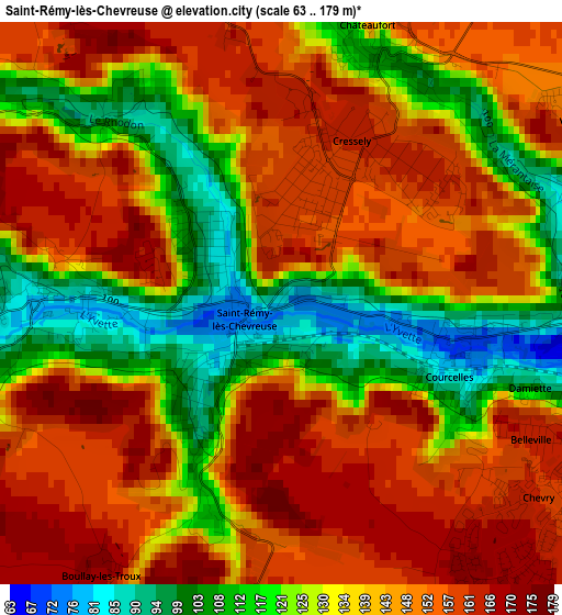
Below is the Elevation map of Saint-Rémy-lès-Chevreuse, which displays elevation range with different colors. Scale of the first map is from 63 to 179 m (207 to 587 ft) with average elevation of 138.8 meters (=455 ft) [note 1]
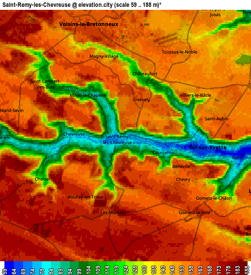
These maps also provides idea of topography and contour of this city, they are displayed at different zoom levels. More info about maps, scale and edge coordinates you can find below images.
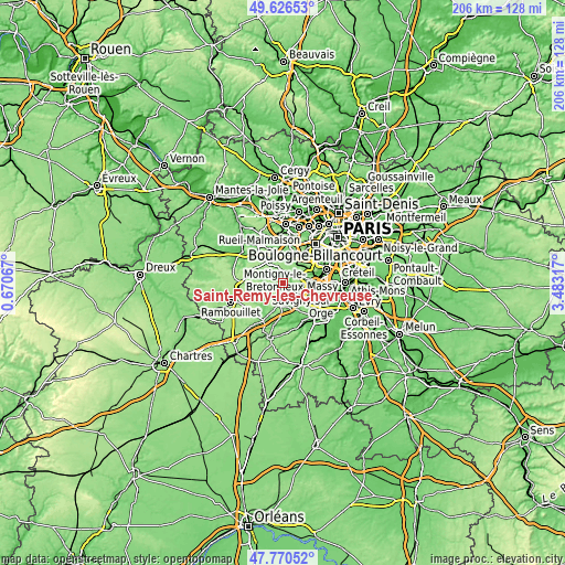
| \ | Map #1 | Map #2 | Topo.Map |
| Scale [m] | 63..179 m | 59..188 m | × |
| Scale [ft] | 207..587 ft | 194..617 ft | × |
| Average | 138.8 m = 455 ft | 151 m = 495 ft | × |
| Width | 6.45 km = 4 mi | 12.9 km = 8 mi | 206.4 km = 128.3 mi |
| Height | 6.45 km = 4 mi | 12.9 km = 8 mi | 206.4 km = 128.3 mi |
| ↑Max Latitude | 48.736072° | 48.765046° | 49.62653° |
| Latitude at center | 48.70708° | 48.70708° | 48.70708° |
| ↓Min Latitude | 48.678072° | 48.649047° | 47.77052° |
| ← Min Longitude | 2.032975° | 1.989029° | 0.67067° |
| Longitude center | 2.07692° | 2.07692° | 2.07692° |
| →Max Longitude | 2.120865° | 2.164811° | 3.48317° |
Nearby cities:
Cities around Saint-Rémy-lès-Chevreuse sort by population:
• Gif-sur-Yvette elevation 147 m
4.9 km,  122°
122°
• Voisins-le-Bretonneux 164 m
6 km,  341°
341°
• Bures-sur-Yvette 62 m
6.9 km,  96°
96°
• Magny-les-Hameaux 154 m
4.2 km, 344°
• Limours 136 m
6.8 km,  180°
180°
• Chevreuse 92 m
3.2 km,  269°
269°
• Gometz-le-Châtel 146 m
5.5 km,  125°
125°
• Les Molières 174 m
3.8 km,  188°
188°
• Châteaufort 153 m
3.4 km,  17°
17°
• Villiers-le-Bâcle 150 m
3.9 km,  52°
52°
• Dampierre-en-Yvelines 96 m
6.9 km,  263°
263°
• Gometz-la-Ville 169 m
5.4 km,  135°
135°
Multilingual:
 En español:
Saint-Rémy-lès-Chevreuse elevación 84 m.
 En France:
Saint-Rémy-lès-Chevreuse élévation 84 m.
 Auf Deutsch:
Saint-Rémy-lès-Chevreuse höhe über dem Meeresspiegel ist 84 m.
 На русском:
Saint-Rémy-lès-Chevreuse высота над уровнем моря 84 м
Sources and notes:
- [note 1] Map square and city borders are not equal. Map elevation data is calculated only from area inside that square.
- [src 1] Elevation data from geonames database provided with same terms of usage.
- [src 2] The elevation map of Saint-Rémy-lès-Chevreuse is generated using elevation data from NASA's 3 arcsec (90m) resolution SRTM data.
- [src 3] Base (background) map © OpenStreetMap contributors tiles are generated by Geofabrik and OpenTopoMap.
Copyright & License:
This Saint-Rémy-lès-Chevreuse Elevation Map is licensed under CC BY-SA. You may reuse any part from this page, if you give a proper credit by linking to this URL:
 More info on terms of use page.