Sourcieux-les-Mines elevation
Sourcieux-les-Mines (Auvergne-Rhône-Alpes, Département du Rhône), France elevation is 403 meters and Sourcieux-les-Mines elevation in feet is 1322 ft above sea level [src 1]. Sourcieux-les-Mines is a populated place (feature code) with elevation that is 229 meters (751 ft) bigger than average city elevation in France.
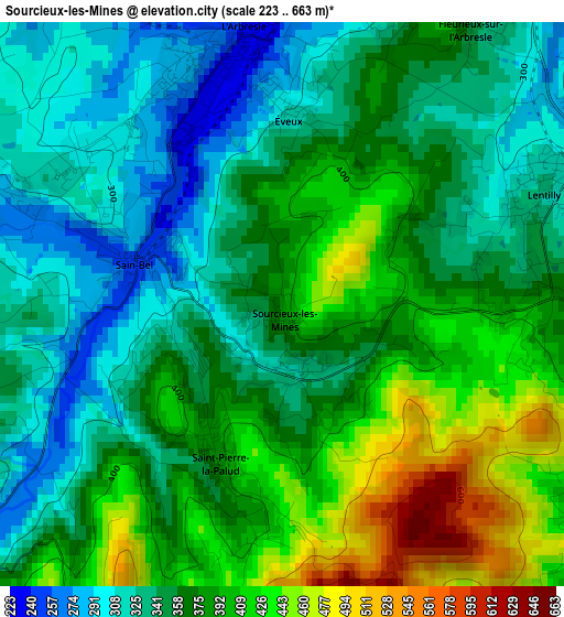
Below is the Elevation map of Sourcieux-les-Mines, which displays elevation range with different colors. Scale of the first map is from 223 to 663 m (732 to 2175 ft) with average elevation of 367.9 meters (=1207 ft) [note 1]
These maps also provides idea of topography and contour of this city, they are displayed at different zoom levels. More info about maps, scale and edge coordinates you can find below images.
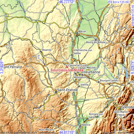
| \ | Map #1 | Topo.Map |
| Scale [m] | 223..663 m | × |
| Scale [ft] | 732..2175 ft | × |
| Average | 367.9 m = 1207 ft | × |
| Width | 6.81 km = 4.2 mi | 218 km = 135.5 mi |
| Height | 6.81 km = 4.2 mi | 218 km = 135.5 mi |
| ↑Max Latitude | 45.836685° | 46.77772° |
| Latitude at center | 45.80606° | 45.80606° |
| ↓Min Latitude | 45.775418° | 44.81715° |
| ← Min Longitude | 4.578595° | 3.21629° |
| Longitude center | 4.62254° | 4.62254° |
| →Max Longitude | 4.666485° | 6.02879° |
Nearby cities:
Cities around Sourcieux-les-Mines sort by population:
• Lentilly elevation 307 m
3.4 km,  65°
65°
• Vaugneray 415 m
8 km,  160°
160°
• La Tour-de-Salvagny 318 m
7.3 km,  83°
83°
• Lozanne 207 m
7.3 km,  38°
38°
• Bessenay 408 m
6.2 km,  238°
238°
• Saint-Pierre-la-Palud 423 m
1.9 km,  206°
206°
• Savigny 284 m
3.9 km,  286°
286°
• Sain-Bel 251 m
2 km,  283°
283°
• Bully 318 m
5.9 km,  328°
328°
• Sainte-Consorce 363 m
6.2 km,  122°
122°
• Pollionnay 427 m
5.5 km,  147°
147°
• Saint-Germain-Nuelles 302 m
5.2 km,  350°
350°
Multilingual:
 En español:
Sourcieux-les-Mines elevación 403 m.
 En France:
Sourcieux-les-Mines élévation 403 m.
 Auf Deutsch:
Sourcieux-les-Mines höhe über dem Meeresspiegel ist 403 m.
 На русском:
Sourcieux-les-Mines высота над уровнем моря 403 м
Sources and notes:
- [note 1] Map square and city borders are not equal. Map elevation data is calculated only from area inside that square.
- [src 1] Elevation data from geonames database provided with same terms of usage.
- [src 2] The elevation map of Sourcieux-les-Mines is generated using elevation data from NASA's 3 arcsec (90m) resolution SRTM data.
- [src 3] Base (background) map © OpenStreetMap contributors tiles are generated by Geofabrik and OpenTopoMap.
Copyright & License:
This Sourcieux-les-Mines Elevation Map is licensed under CC BY-SA. You may reuse any part from this page, if you give a proper credit by linking to this URL:
 More info on terms of use page.