Veigné elevation
Veigné (Centre, Département d'Indre-et-Loire), France elevation is 73 meters and Veigné elevation in feet is 240 ft above sea level [src 1]. Veigné is a populated place (feature code) with elevation that is 101 meters (331 ft) smaller than average city elevation in France.
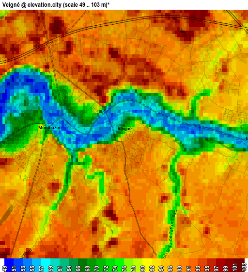
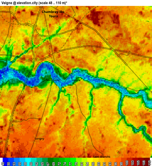
Below is the Elevation map of Veigné, which displays elevation range with different colors. Scale of the first map is from 49 to 103 m (161 to 338 ft) with average elevation of 83.3 meters (=273 ft) [note 1]
These maps also provides idea of topography and contour of this city, they are displayed at different zoom levels. More info about maps, scale and edge coordinates you can find below images.
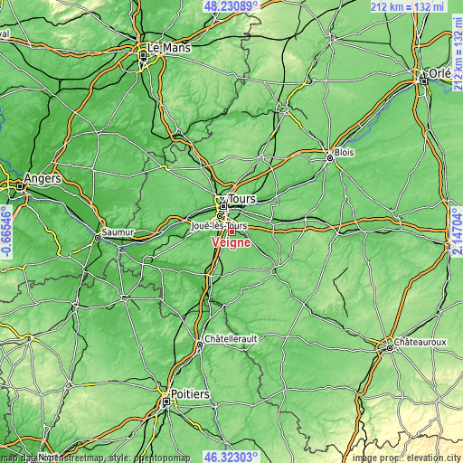
| \ | Map #1 | Map #2 | Topo.Map |
| Scale [m] | 49..103 m | 48..110 m | × |
| Scale [ft] | 161..338 ft | 157..361 ft | × |
| Average | 83.3 m = 273 ft | 87.6 m = 287 ft | × |
| Width | 6.63 km = 4.1 mi | 13.26 km = 8.2 mi | 212.1 km = 131.8 mi |
| Height | 6.63 km = 4.1 mi | 13.26 km = 8.2 mi | 212.1 km = 131.8 mi |
| ↑Max Latitude | 47.315362° | 47.345147° | 48.23089° |
| Latitude at center | 47.28556° | 47.28556° | 47.28556° |
| ↓Min Latitude | 47.255742° | 47.225906° | 46.32303° |
| ← Min Longitude | 0.696845° | 0.652899° | -0.66546° |
| Longitude center | 0.74079° | 0.74079° | 0.74079° |
| →Max Longitude | 0.784735° | 0.828681° | 2.14704° |
Nearby cities:
Cities around Veigné sort by population:
• Joué-lès-Tours elevation 83 m
9.2 km,  323°
323°
• Saint-Avertin 87 m
8.7 km,  359°
359°
• Chambray-lès-Tours 89 m
6.2 km,  332°
332°
• Monts 57 m
8.8 km,  263°
263°
• Esvres 74 m
3.4 km,  90°
90°
• Montbazon 66 m
3.1 km,  265°
265°
• Véretz 76 m
9.3 km,  31°
31°
• Saint-Branchs 96 m
7 km,  159°
159°
• Larçay 82 m
9.5 km,  18°
18°
• Sorigny 97 m
5.8 km,  216°
216°
• Truyes 76 m
8.5 km,  99°
99°
• Cormery 66 m
7.4 km,  105°
105°
Multilingual:
 En español:
Veigné elevación 73 m.
 En France:
Veigné élévation 73 m.


Sources and notes:
- [note 1] Map square and city borders are not equal. Map elevation data is calculated only from area inside that square.
- [src 1] Elevation data from geonames database provided with same terms of usage.
- [src 2] The elevation map of Veigné is generated using elevation data from NASA's 3 arcsec (90m) resolution SRTM data.
- [src 3] Base (background) map © OpenStreetMap contributors tiles are generated by Geofabrik and OpenTopoMap.
Copyright & License:
This Veigné Elevation Map is licensed under CC BY-SA. You may reuse any part from this page, if you give a proper credit by linking to this URL:
 More info on terms of use page.