Chambray-lès-Tours elevation
Chambray-lès-Tours (Centre, Département d'Indre-et-Loire), France elevation is 89 meters and Chambray-lès-Tours elevation in feet is 292 ft above sea level [src 1]. Chambray-lès-Tours is a populated place (feature code) with elevation that is 85 meters (279 ft) smaller than average city elevation in France.
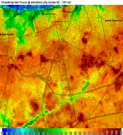
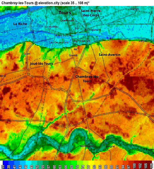
Below is the Elevation map of Chambray-lès-Tours, which displays elevation range with different colors. Scale of the first map is from 42 to 107 m (138 to 351 ft) with average elevation of 86.5 meters (=284 ft) [note 1]
These maps also provides idea of topography and contour of this city, they are displayed at different zoom levels. More info about maps, scale and edge coordinates you can find below images.
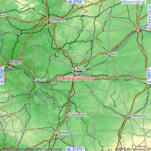
| \ | Map #1 | Map #2 | Topo.Map |
| Scale [m] | 42..107 m | 35..108 m | × |
| Scale [ft] | 138..351 ft | 115..354 ft | × |
| Average | 86.5 m = 284 ft | 75.7 m = 248 ft | × |
| Width | 6.62 km = 4.1 mi | 13.25 km = 8.2 mi | 211.9 km = 131.7 mi |
| Height | 6.62 km = 4.1 mi | 13.25 km = 8.2 mi | 211.9 km = 131.7 mi |
| ↑Max Latitude | 47.365144° | 47.3949° | 48.2798° |
| Latitude at center | 47.33537° | 47.33537° | 47.33537° |
| ↓Min Latitude | 47.30558° | 47.275772° | 46.37374° |
| ← Min Longitude | 0.658915° | 0.614969° | -0.70339° |
| Longitude center | 0.70286° | 0.70286° | 0.70286° |
| →Max Longitude | 0.746805° | 0.790751° | 2.10911° |
Nearby cities:
Cities around Chambray-lès-Tours sort by population:
• Tours elevation 49 m
6.6 km,  0°
0°
• Joué-lès-Tours 83 m
3.2 km,  306°
306°
• Saint-Cyr-sur-Loire 83 m
7.7 km,  339°
339°
• Saint-Avertin 87 m
4.2 km,  41°
41°
• Saint-Pierre-des-Corps 50 m
6.6 km,  31°
31°
• La Riche 51 m
6.5 km, 338°
• Ballan-Miré 92 m
6.7 km,  274°
274°
• Veigné 73 m
6.2 km,  152°
152°
• La Ville-aux-Dames 52 m
8.3 km, 36°
• Montbazon 66 m
5.8 km,  182°
182°
• Véretz 76 m
8.1 km,  72°
72°
• Larçay 82 m
6.9 km,  59°
59°
Multilingual:
 En español:
Chambray-lès-Tours elevación 89 m.
 En France:
Chambray-lès-Tours élévation 89 m.
 Auf Deutsch:
Chambray-lès-Tours höhe über dem Meeresspiegel ist 89 m.

Sources and notes:
- [note 1] Map square and city borders are not equal. Map elevation data is calculated only from area inside that square.
- [src 1] Elevation data from geonames database provided with same terms of usage.
- [src 2] The elevation map of Chambray-lès-Tours is generated using elevation data from NASA's 3 arcsec (90m) resolution SRTM data.
- [src 3] Base (background) map © OpenStreetMap contributors tiles are generated by Geofabrik and OpenTopoMap.
Copyright & License:
This Chambray-lès-Tours Elevation Map is licensed under CC BY-SA. You may reuse any part from this page, if you give a proper credit by linking to this URL:
 More info on terms of use page.