Dubti elevation
Dubti (Āfar), Ethiopia elevation is 381 meters and Dubti elevation in feet is 1250 ft above sea level [src 1]. Dubti is a populated place (feature code) with elevation that is 1515 meters (4970 ft) smaller than average city elevation in Ethiopia.
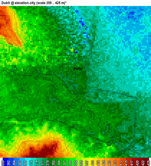
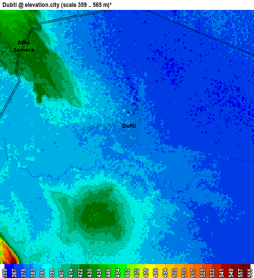
Below is the Elevation map of Dubti, which displays elevation range with different colors. Scale of the first map is from 359 to 425 m (1178 to 1394 ft) with average elevation of 382.4 meters (=1255 ft) [note 1]
These maps also provides idea of topography and contour of this city, they are displayed at different zoom levels. More info about maps, scale and edge coordinates you can find below images.
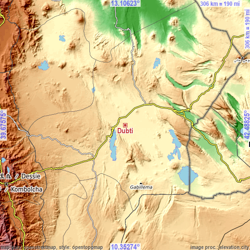
| \ | Map #1 | Map #2 | Topo.Map |
| Scale [m] | 359..425 m | 359..565 m | × |
| Scale [ft] | 1178..1394 ft | 1178..1854 ft | × |
| Average | 382.4 m = 1255 ft | 385.2 m = 1264 ft | × |
| Width | 9.57 km = 5.9 mi | 19.14 km = 11.9 mi | 306.2 km = 190.3 mi |
| Height | 9.57 km = 5.9 mi | 19.14 km = 11.9 mi | 306.2 km = 190.3 mi |
| ↑Max Latitude | 11.775944° | 11.818961° | 13.10623° |
| Latitude at center | 11.73292° | 11.73292° | 11.73292° |
| ↓Min Latitude | 11.68989° | 11.646852° | 10.35274° |
| ← Min Longitude | 41.038055° | 40.994109° | 39.67575° |
| Longitude center | 41.082° | 41.082° | 41.082° |
| →Max Longitude | 41.125945° | 41.169891° | 42.48825° |
Nearby cities:
Cities around Dubti sort by population:
• Desē elevation 2494 m
171.4 km,  247°
247°
• Kombolcha 1883 m
162.9 km,  243°
243°
• Korem 2487 m
190 km,  296°
296°
• Maych’ew 2400 m
204.3 km,  305°
305°
• Kemisē 1438 m
173.9 km,  229°
229°
• Robīt 1597 m
160.8 km,  281°
281°
• Asaita 371 m
42.9 km,  115°
115°
• Batī 1662 m
130.8 km, 242°
• Gewanē 620 m
180.5 km,  195°
195°
• Lalībela 2481 m
223.8 km, 278°
• Were Īlu 2699 m
219.8 km, 234°
• Semera 433 m
10.7 km, 309°
Multilingual:
 En español:
Dubti elevación 381 m.
 En France:
Dubti élévation 381 m.


Sources and notes:
- [note 1] Map square and city borders are not equal. Map elevation data is calculated only from area inside that square.
- [src 1] Elevation data from geonames database provided with same terms of usage.
- [src 2] The elevation map of Dubti is generated using elevation data from NASA's 3 arcsec (90m) resolution SRTM data.
- [src 3] Base (background) map © OpenStreetMap contributors tiles are generated by Geofabrik and OpenTopoMap.
Copyright & License:
This Dubti Elevation Map is licensed under CC BY-SA. You may reuse any part from this page, if you give a proper credit by linking to this URL:
 More info on terms of use page.