Fichē elevation
Fichē (Oromiya), Ethiopia elevation is 2792 meters and Fichē elevation in feet is 9160 ft above sea level [src 1]. Fichē is a populated place (feature code) with elevation that is 896 meters (2940 ft) bigger than average city elevation in Ethiopia.
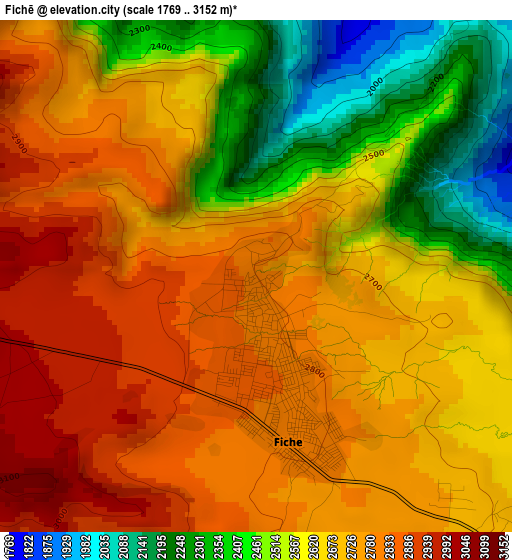
Below is the Elevation map of Fichē, which displays elevation range with different colors. Scale of the first map is from 1769 to 3152 m (5804 to 10341 ft) with average elevation of 2659.8 meters (=8726 ft) [note 1]
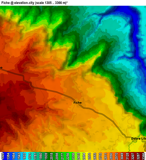
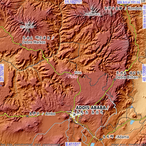
These maps also provides idea of topography and contour of this city, they are displayed at different zoom levels. More info about maps, scale and edge coordinates you can find below images.
| \ | Map #1 | Map #2 | Topo.Map |
| Scale [m] | 1769..3152 m | 1305..3366 m | × |
| Scale [ft] | 5804..10341 ft | 4281..11043 ft | × |
| Average | 2659.8 m = 8726 ft | 2477.3 m = 8128 ft | × |
| Width | 9.63 km = 6 mi | 19.26 km = 12 mi | 308.1 km = 191.4 mi |
| Height | 9.63 km = 6 mi | 19.26 km = 12 mi | 308.2 km = 191.5 mi |
| ↑Max Latitude | 9.843301° | 9.886597° | 11.18271° |
| Latitude at center | 9.8° | 9.8° | 9.8° |
| ↓Min Latitude | 9.756693° | 9.713381° | 8.41151° |
| ← Min Longitude | 38.689385° | 38.645439° | 37.32708° |
| Longitude center | 38.73333° | 38.73333° | 38.73333° |
| →Max Longitude | 38.777275° | 38.821221° | 40.13958° |
Nearby cities:
Cities around Fichē sort by population:
• Addis Ababa elevation 2405 m
86.2 km,  179°
179°
• Debre Birhan 2830 m
88.6 km,  98°
98°
• Genet 2402 m
85.5 km,  197°
197°
• Sebeta 2311 m
99 km,  187°
187°
• Gebre Guracha 2539 m
36.5 km,  270°
270°
• Bichena 2544 m
92.9 km,  321°
321°
• Dejen 2452 m
77.3 km,  301°
301°
• Debre Werk’ 2513 m
114.6 km,  327°
327°
• Ādīs ‘Alem 2315 m
92.8 km, 203°
• Debre Sīna 2703 m
112.6 km,  87°
87°
• Were Īlu 2699 m
116.8 km,  41°
41°
• Sendafa 2560 m
78.8 km,  156°
156°
Multilingual:
 En español:
Fichē elevación 2792 m.
 En France:
Fichē élévation 2792 m.


Sources and notes:
- [note 1] Map square and city borders are not equal. Map elevation data is calculated only from area inside that square.
- [src 1] Elevation data from geonames database provided with same terms of usage.
- [src 2] The elevation map of Fichē is generated using elevation data from NASA's 3 arcsec (90m) resolution SRTM data.
- [src 3] Base (background) map © OpenStreetMap contributors tiles are generated by Geofabrik and OpenTopoMap.
Copyright & License:
This Fichē Elevation Map is licensed under CC BY-SA. You may reuse any part from this page, if you give a proper credit by linking to this URL:
 More info on terms of use page.