La Bonanova elevation
La Bonanova (Catalonia, Província de Barcelona), Spain elevation is 133 meters and La Bonanova elevation in feet is 436 ft above sea level [src 1]. La Bonanova is a section of populated place (feature code) with elevation that is 470 meters (1542 ft) smaller than average city elevation in Spain.
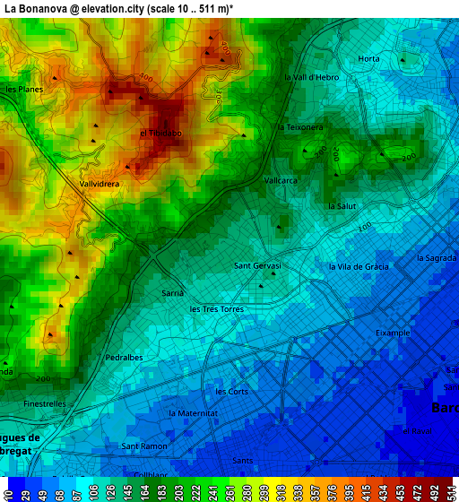
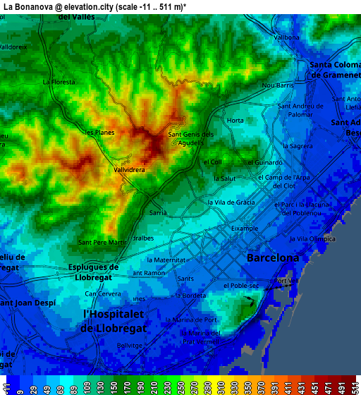
Below is the Elevation map of La Bonanova, which displays elevation range with different colors. Scale of the first map is from 10 to 511 m (33 to 1677 ft) with average elevation of 165.2 meters (=542 ft) [note 1]
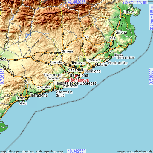
These maps also provides idea of topography and contour of this city, they are displayed at different zoom levels. More info about maps, scale and edge coordinates you can find below images.
| \ | Map #1 | Map #2 | Topo.Map |
| Scale [m] | 10..511 m | -11..511 m | × |
| Scale [ft] | 33..1677 ft | -36..1677 ft | × |
| Average | 165.2 m = 542 ft | 123.8 m = 406 ft | × |
| Width | 7.33 km = 4.6 mi | 14.66 km = 9.1 mi | 234.6 km = 145.8 mi |
| Height | 7.33 km = 4.6 mi | 14.66 km = 9.1 mi | 234.5 km = 145.7 mi |
| ↑Max Latitude | 41.438803° | 41.471738° | 42.45203° |
| Latitude at center | 41.40585° | 41.40585° | 41.40585° |
| ↓Min Latitude | 41.372881° | 41.339895° | 40.34255° |
| ← Min Longitude | 2.088485° | 2.044539° | 0.72618° |
| Longitude center | 2.13243° | 2.13243° | 2.13243° |
| →Max Longitude | 2.176375° | 2.220321° | 3.53868° |
Nearby cities:
Cities around La Bonanova sort by population:
• Sarrià-Sant Gervasi elevation 124 m
0.8 km,  132°
132°
• Gràcia 76 m
2 km,  100°
100°
• Les Corts 73 m
2.1 km,  185°
185°
• la Vila de Gràcia 75 m
2.1 km, 98°
• Sant Gervasi - Galvany 85 m
1.3 km,  136°
136°
• Barri de les Corts 68 m
2.1 km,  174°
174°
• el Putxet i el Farró 111 m
1 km,  82°
82°
• Sarrià 153 m
1.4 km,  255°
255°
• Las Tres Torres 113 m
0.7 km,  201°
201°
• Vallcarca 120 m
1.2 km,  54°
54°
• la Salut 122 m
2 km,  68°
68°
• el Coll 174 m
1.8 km,  44°
44°
Multilingual:
 En español:
Bonanova elevación 133 m.
 En France:
La Bonanova élévation 133 m.
 Auf Deutsch:
La Bonanova höhe über dem Meeresspiegel ist 133 m.

Sources and notes:
- [note 1] Map square and city borders are not equal. Map elevation data is calculated only from area inside that square.
- [src 1] Elevation data from geonames database provided with same terms of usage.
- [src 2] The elevation map of La Bonanova is generated using elevation data from NASA's 3 arcsec (90m) resolution SRTM data.
- [src 3] Base (background) map © OpenStreetMap contributors tiles are generated by Geofabrik and OpenTopoMap.
Copyright & License:
This La Bonanova Elevation Map is licensed under CC BY-SA. You may reuse any part from this page, if you give a proper credit by linking to this URL:
 More info on terms of use page.