Gràcia elevation
Gràcia (Catalonia, Província de Barcelona), Spain elevation is 76 meters and Gràcia elevation in feet is 249 ft above sea level [src 1]. Gràcia is a section of populated place (feature code) with elevation that is 527 meters (1729 ft) smaller than average city elevation in Spain.
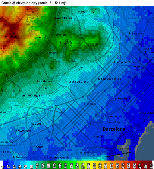
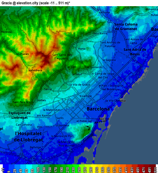
Below is the Elevation map of Gràcia, which displays elevation range with different colors. Scale of the first map is from -3 to 511 m (-10 to 1677 ft) with average elevation of 98.5 meters (=323 ft) [note 1]
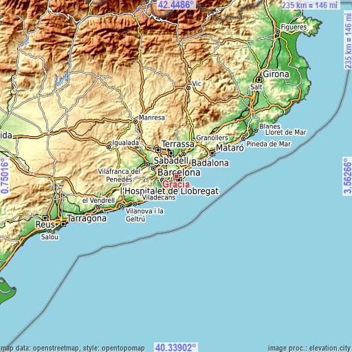
These maps also provides idea of topography and contour of this city, they are displayed at different zoom levels. More info about maps, scale and edge coordinates you can find below images.
| \ | Map #1 | Map #2 | Topo.Map |
| Scale [m] | -3..511 m | -11..511 m | × |
| Scale [ft] | -10..1677 ft | -36..1677 ft | × |
| Average | 98.5 m = 323 ft | 115.4 m = 379 ft | × |
| Width | 7.33 km = 4.6 mi | 14.66 km = 9.1 mi | 234.6 km = 145.8 mi |
| Height | 7.33 km = 4.6 mi | 14.66 km = 9.1 mi | 234.6 km = 145.8 mi |
| ↑Max Latitude | 41.435324° | 41.468262° | 42.4486° |
| Latitude at center | 41.40237° | 41.40237° | 41.40237° |
| ↓Min Latitude | 41.369399° | 41.336411° | 40.33902° |
| ← Min Longitude | 2.112465° | 2.068519° | 0.75016° |
| Longitude center | 2.15641° | 2.15641° | 2.15641° |
| →Max Longitude | 2.200355° | 2.244301° | 3.56266° |
Nearby cities:
Cities around Gràcia sort by population:
• Barcelona elevation 47 m
1.5 km,  171°
171°
• Sarrià-Sant Gervasi 124 m
1.4 km,  264°
264°
• Sagrada Família 50 m
1.4 km,  82°
82°
• la Vila de Gràcia 75 m
0.1 km,  23°
23°
• Sant Gervasi - Galvany 85 m
1.2 km,  244°
244°
• Dreta de l'Eixample 48 m
1.1 km,  128°
128°
• l'Antiga Esquerra de l'Eixample 48 m
1.4 km,  184°
184°
• el Camp d'en Grassot i Gràcia Nova 73 m
0.8 km,  58°
58°
• el Putxet i el Farró 111 m
1.2 km,  295°
295°
• el Baix Guinardó 96 m
1.4 km,  42°
42°
• Vallcarca 120 m
1.5 km,  316°
316°
• la Salut 122 m
1.1 km,  351°
351°
Multilingual:
 En español:
Gràcia, Gracia, Distrito de Gracia elevación 76 m.
 En France:
Gràcia élévation 76 m.


Sources and notes:
- [note 1] Map square and city borders are not equal. Map elevation data is calculated only from area inside that square.
- [src 1] Elevation data from geonames database provided with same terms of usage.
- [src 2] The elevation map of Gràcia is generated using elevation data from NASA's 3 arcsec (90m) resolution SRTM data.
- [src 3] Base (background) map © OpenStreetMap contributors tiles are generated by Geofabrik and OpenTopoMap.
Copyright & License:
This Gràcia Elevation Map is licensed under CC BY-SA. You may reuse any part from this page, if you give a proper credit by linking to this URL:
 More info on terms of use page.