Albesa elevation
Albesa (Catalonia, Província de Lleida), Spain elevation is 243 meters and Albesa elevation in feet is 797 ft above sea level [src 1]. Albesa is a seat of a third-order administrative division (feature code) with elevation that is 360 meters (1181 ft) smaller than average city elevation in Spain.
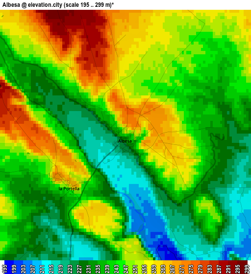
Below is the Elevation map of Albesa, which displays elevation range with different colors. Scale of the first map is from 195 to 299 m (640 to 981 ft) with average elevation of 242.9 meters (=797 ft) [note 1]
These maps also provides idea of topography and contour of this city, they are displayed at different zoom levels. More info about maps, scale and edge coordinates you can find below images.
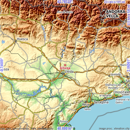
| \ | Map #1 | Topo.Map |
| Scale [m] | 195..299 m | × |
| Scale [ft] | 640..981 ft | × |
| Average | 242.9 m = 797 ft | × |
| Width | 7.29 km = 4.5 mi | 233.3 km = 145 mi |
| Height | 7.29 km = 4.5 mi | 233.3 km = 145 mi |
| ↑Max Latitude | 41.785596° | 42.79333° |
| Latitude at center | 41.75282° | 41.75282° |
| ↓Min Latitude | 41.720027° | 40.69516° |
| ← Min Longitude | 0.615415° | -0.74689° |
| Longitude center | 0.65936° | 0.65936° |
| →Max Longitude | 0.703305° | 2.06561° |
Nearby cities:
Cities around Albesa sort by population:
• Balaguer elevation 223 m
13.3 km,  71°
71°
• Alpicat 260 m
13 km,  221°
221°
• Almenar 307 m
8.9 km,  302°
302°
• Alfarràs 264 m
9.5 km,  318°
318°
• Alguaire 310 m
6.5 km,  254°
254°
• Torrefarrera 218 m
9.9 km,  206°
206°
• Alcoletge 217 m
12 km,  166°
166°
• Vallfogona de Balaguer 236 m
12.8 km,  90°
90°
• Térmens 211 m
9.8 km,  114°
114°
• Corbins 176 m
8.4 km,  156°
156°
• Algerri 348 m
7.2 km,  344°
344°
• Castelló de Farfanya 337 m
9.4 km,  40°
40°
Multilingual:
 En español:
Albesa elevación 243 m.
 En France:
Albesa élévation 243 m.


Sources and notes:
- [note 1] Map square and city borders are not equal. Map elevation data is calculated only from area inside that square.
- [src 1] Elevation data from geonames database provided with same terms of usage.
- [src 2] The elevation map of Albesa is generated using elevation data from NASA's 3 arcsec (90m) resolution SRTM data.
- [src 3] Base (background) map © OpenStreetMap contributors tiles are generated by Geofabrik and OpenTopoMap.
Copyright & License:
This Albesa Elevation Map is licensed under CC BY-SA. You may reuse any part from this page, if you give a proper credit by linking to this URL:
 More info on terms of use page.