Alfambra elevation
Alfambra (Aragon, Provincia de Teruel), Spain elevation is 1044 meters and Alfambra elevation in feet is 3425 ft above sea level [src 1]. Alfambra is a seat of a third-order administrative division (feature code) with elevation that is 441 meters (1447 ft) bigger than average city elevation in Spain.
Below is the Elevation map of Alfambra, which displays elevation range with different colors. Scale of the first map is from 1004 to 1187 m (3294 to 3894 ft) with average elevation of 1080.3 meters (=3544 ft) [note 1]
These maps also provides idea of topography and contour of this city, they are displayed at different zoom levels. More info about maps, scale and edge coordinates you can find below images.
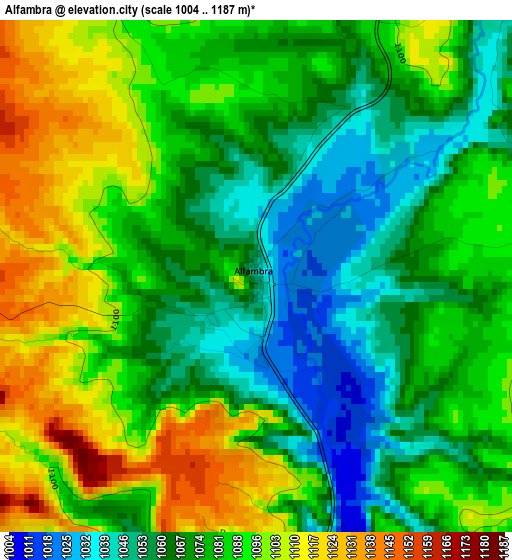
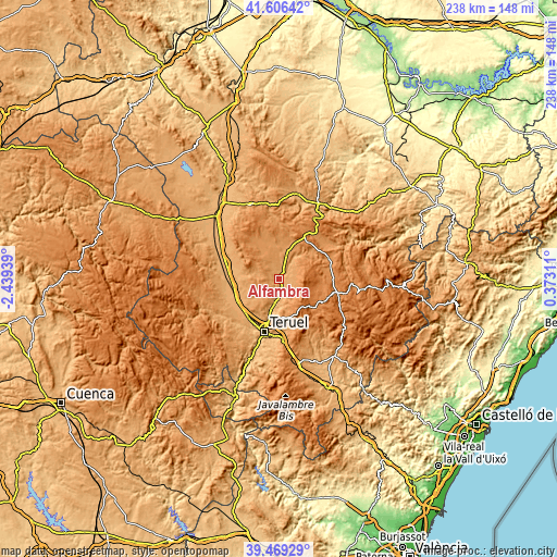
| \ | Map #1 | Topo.Map |
| Scale [m] | 1004..1187 m | × |
| Scale [ft] | 3294..3894 ft | × |
| Average | 1080.3 m = 3544 ft | × |
| Width | 7.43 km = 4.6 mi | 237.6 km = 147.6 mi |
| Height | 7.43 km = 4.6 mi | 237.6 km = 147.6 mi |
| ↑Max Latitude | 40.579765° | 41.60642° |
| Latitude at center | 40.54638° | 40.54638° |
| ↓Min Latitude | 40.512979° | 39.46929° |
| ← Min Longitude | -1.077085° | -2.43939° |
| Longitude center | -1.03314° | -1.03314° |
| →Max Longitude | -0.989195° | 0.37311° |
Nearby cities:
Cities around Alfambra sort by population:
• Perales del Alfambra elevation 1170 m
10.1 km,  15°
15°
• Argente 1249 m
19.2 km,  325°
325°
• Escorihuela 1137 m
5.3 km,  92°
92°
• Visiedo 1187 m
16.4 km,  340°
340°
• Orrios 1065 m
6.2 km,  39°
39°
• Cuevas Labradas 969 m
10.4 km,  187°
187°
• Camañas 1241 m
13.9 km,  320°
320°
• Galve 1198 m
17.6 km,  46°
46°
• Fuentes Calientes 1252 m
18 km, 18°
• Ababuj 1369 m
19.1 km, 89°
• Peralejos 1012 m
6.9 km,  180°
180°
• Corbalán 1267 m
16.4 km,  165°
165°
Multilingual:
 En español:
Alfambra elevación 1044 m.
 En France:
Alfambra élévation 1044 m.
 Auf Deutsch:
Alfambra höhe über dem Meeresspiegel ist 1044 m.

Sources and notes:
- [note 1] Map square and city borders are not equal. Map elevation data is calculated only from area inside that square.
- [src 1] Elevation data from geonames database provided with same terms of usage.
- [src 2] The elevation map of Alfambra is generated using elevation data from NASA's 3 arcsec (90m) resolution SRTM data.
- [src 3] Base (background) map © OpenStreetMap contributors tiles are generated by Geofabrik and OpenTopoMap.
Copyright & License:
This Alfambra Elevation Map is licensed under CC BY-SA. You may reuse any part from this page, if you give a proper credit by linking to this URL:
 More info on terms of use page.