Bea elevation
Bea (Aragon, Provincia de Teruel), Spain elevation is 1127 meters and Bea elevation in feet is 3698 ft above sea level [src 1]. Bea is a seat of a third-order administrative division (feature code) with elevation that is 524 meters (1719 ft) bigger than average city elevation in Spain.
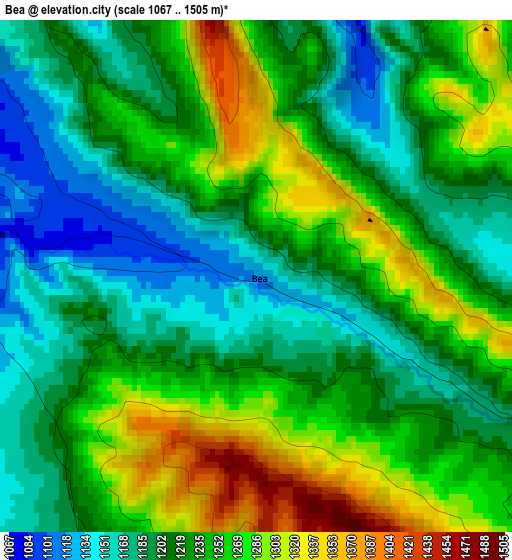
Below is the Elevation map of Bea, which displays elevation range with different colors. Scale of the first map is from 1067 to 1505 m (3501 to 4938 ft) with average elevation of 1231.1 meters (=4039 ft) [note 1]
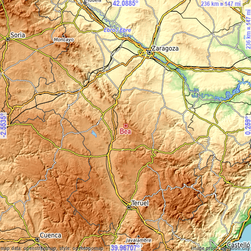
These maps also provides idea of topography and contour of this city, they are displayed at different zoom levels. More info about maps, scale and edge coordinates you can find below images.
| \ | Map #1 | Topo.Map |
| Scale [m] | 1067..1505 m | × |
| Scale [ft] | 3501..4938 ft | × |
| Average | 1231.1 m = 4039 ft | × |
| Width | 7.37 km = 4.6 mi | 235.9 km = 146.6 mi |
| Height | 7.37 km = 4.6 mi | 235.9 km = 146.6 mi |
| ↑Max Latitude | 41.069469° | 42.0885° |
| Latitude at center | 41.03633° | 41.03633° |
| ↓Min Latitude | 41.003174° | 39.96707° |
| ← Min Longitude | -1.191195° | -2.5535° |
| Longitude center | -1.14725° | -1.14725° |
| →Max Longitude | -1.103305° | 0.259° |
Nearby cities:
Cities around Bea sort by population:
• Loscos elevation 982 m
10 km,  60°
60°
• Villahermosa del Campo 962 m
11.7 km,  314°
314°
• Cucalón 1035 m
7.9 km, 314°
• Monforte de Moyuela 1004 m
11.4 km,  79°
79°
• Ferreruela de Huerva 1018 m
7.8 km,  292°
292°
• Lagueruela 1070 m
3.9 km,  280°
280°
• Santa Cruz de Nogueras 894 m
10 km,  29°
29°
• Lanzuela 1013 m
8.5 km,  324°
324°
• Fonfría 1249 m
6.9 km,  130°
130°
• Bádenas 1007 m
6.5 km,  18°
18°
• Fombuena 1018 m
12.6 km,  342°
342°
• Allueva 1197 m
10.5 km,  122°
122°
Multilingual:
 En español:
Bea elevación 1127 m.
 En France:
Bea élévation 1127 m.


Sources and notes:
- [note 1] Map square and city borders are not equal. Map elevation data is calculated only from area inside that square.
- [src 1] Elevation data from geonames database provided with same terms of usage.
- [src 2] The elevation map of Bea is generated using elevation data from NASA's 3 arcsec (90m) resolution SRTM data.
- [src 3] Base (background) map © OpenStreetMap contributors tiles are generated by Geofabrik and OpenTopoMap.
Copyright & License:
This Bea Elevation Map is licensed under CC BY-SA. You may reuse any part from this page, if you give a proper credit by linking to this URL:
 More info on terms of use page.