Calanda elevation
Calanda (Aragon, Provincia de Teruel), Spain elevation is 464 meters and Calanda elevation in feet is 1522 ft above sea level [src 1]. Calanda is a seat of a third-order administrative division (feature code) with elevation that is 139 meters (456 ft) smaller than average city elevation in Spain.
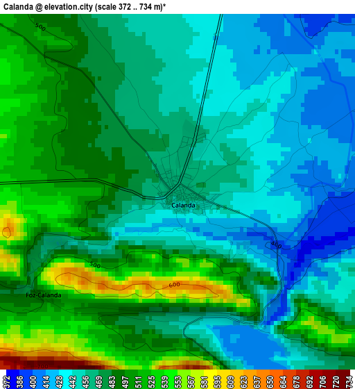
Below is the Elevation map of Calanda, which displays elevation range with different colors. Scale of the first map is from 372 to 734 m (1220 to 2408 ft) with average elevation of 475.3 meters (=1559 ft) [note 1]
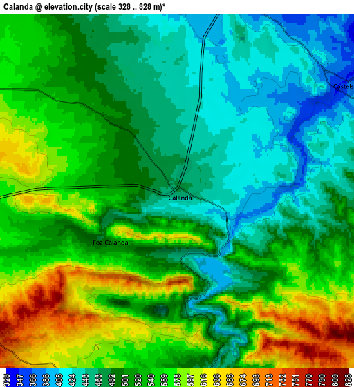
These maps also provides idea of topography and contour of this city, they are displayed at different zoom levels. More info about maps, scale and edge coordinates you can find below images.
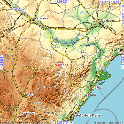
| \ | Map #1 | Map #2 | Topo.Map |
| Scale [m] | 372..734 m | 328..828 m | × |
| Scale [ft] | 1220..2408 ft | 1076..2717 ft | × |
| Average | 475.3 m = 1559 ft | 513.3 m = 1684 ft | × |
| Width | 7.38 km = 4.6 mi | 14.76 km = 9.2 mi | 236.2 km = 146.8 mi |
| Height | 7.38 km = 4.6 mi | 14.76 km = 9.2 mi | 236.2 km = 146.8 mi |
| ↑Max Latitude | 40.974717° | 41.007887° | 41.99523° |
| Latitude at center | 40.94153° | 40.94153° | 40.94153° |
| ↓Min Latitude | 40.908326° | 40.875106° | 39.87075° |
| ← Min Longitude | -0.276375° | -0.320321° | -1.63868° |
| Longitude center | -0.23243° | -0.23243° | -0.23243° |
| →Max Longitude | -0.188485° | -0.144539° | 1.17382° |
Nearby cities:
Cities around Calanda sort by population:
• Alcañiz elevation 346 m
14.7 km,  34°
34°
• Alcorisa 631 m
13.7 km,  246°
246°
• Mas de las Matas 505 m
12 km,  184°
184°
• Castelserás 370 m
8.5 km,  58°
58°
• Castellote 772 m
17.4 km,  205°
205°
• Valdealgorfa 510 m
17.5 km,  71°
71°
• Aguaviva 540 m
13.6 km,  166°
166°
• Torrecilla de Alcañiz 451 m
12.1 km,  79°
79°
• Foz-Calanda 502 m
3.5 km,  231°
231°
• La Ginebrosa 715 m
11.4 km,  134°
134°
• Torrevelilla 624 m
11.2 km,  113°
113°
• Seno 811 m
16.9 km, 211°
Multilingual:
 En español:
Calanda elevación 464 m.
 En France:
Calanda élévation 464 m.


Sources and notes:
- [note 1] Map square and city borders are not equal. Map elevation data is calculated only from area inside that square.
- [src 1] Elevation data from geonames database provided with same terms of usage.
- [src 2] The elevation map of Calanda is generated using elevation data from NASA's 3 arcsec (90m) resolution SRTM data.
- [src 3] Base (background) map © OpenStreetMap contributors tiles are generated by Geofabrik and OpenTopoMap.
Copyright & License:
This Calanda Elevation Map is licensed under CC BY-SA. You may reuse any part from this page, if you give a proper credit by linking to this URL:
 More info on terms of use page.