Catí elevation
Catí (Valencia, Província de Castelló), Spain elevation is 665 meters and Catí elevation in feet is 2182 ft above sea level [src 1]. Catí is a seat of a third-order administrative division (feature code) with elevation that is 62 meters (203 ft) bigger than average city elevation in Spain.
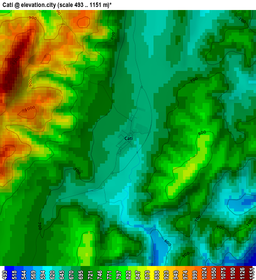
Below is the Elevation map of Catí, which displays elevation range with different colors. Scale of the first map is from 493 to 1151 m (1617 to 3776 ft) with average elevation of 742.4 meters (=2436 ft) [note 1]
These maps also provides idea of topography and contour of this city, they are displayed at different zoom levels. More info about maps, scale and edge coordinates you can find below images.
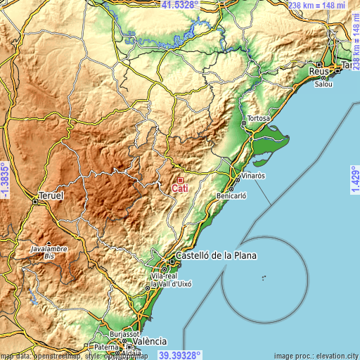
| \ | Map #1 | Topo.Map |
| Scale [m] | 493..1151 m | × |
| Scale [ft] | 1617..3776 ft | × |
| Average | 742.4 m = 2436 ft | × |
| Width | 7.43 km = 4.6 mi | 237.9 km = 147.8 mi |
| Height | 7.43 km = 4.6 mi | 237.9 km = 147.8 mi |
| ↑Max Latitude | 40.504982° | 41.5328° |
| Latitude at center | 40.47156° | 40.47156° |
| ↓Min Latitude | 40.438121° | 39.39328° |
| ← Min Longitude | -0.021195° | -1.3835° |
| Longitude center | 0.02275° | 0.02275° |
| →Max Longitude | 0.066695° | 1.429° |
Nearby cities:
Cities around Catí sort by population:
• Morella elevation 972 m
19.4 km,  328°
328°
• Cuevas de Vinromá 189 m
19.8 km,  155°
155°
• Albocàsser 564 m
13.5 km,  176°
176°
• Benassal 845 m
17.3 km,  232°
232°
• Canet lo Roig 333 m
20.6 km,  64°
64°
• Chert/Xert 456 m
12.6 km,  65°
65°
• Cervera del Maestre 273 m
21.6 km,  95°
95°
• Ares del Maestre 1198 m
13.3 km,  262°
262°
• Castellfort 1156 m
18.4 km,  280°
280°
• Sarratella 774 m
17.7 km, 177°
• Vallibona 668 m
14.8 km,  7°
7°
• Castell de Cabres 1139 m
21.1 km,  4°
4°
Multilingual:
 En español:
Catí elevación 665 m.
 En France:
Catí élévation 665 m.


Sources and notes:
- [note 1] Map square and city borders are not equal. Map elevation data is calculated only from area inside that square.
- [src 1] Elevation data from geonames database provided with same terms of usage.
- [src 2] The elevation map of Catí is generated using elevation data from NASA's 3 arcsec (90m) resolution SRTM data.
- [src 3] Base (background) map © OpenStreetMap contributors tiles are generated by Geofabrik and OpenTopoMap.
Copyright & License:
This Catí Elevation Map is licensed under CC BY-SA. You may reuse any part from this page, if you give a proper credit by linking to this URL:
 More info on terms of use page.