Fontanar elevation
Fontanar (Castille-La Mancha, Provincia de Guadalajara), Spain elevation is 677 meters and Fontanar elevation in feet is 2221 ft above sea level [src 1]. Fontanar is a seat of a third-order administrative division (feature code) with elevation that is 74 meters (243 ft) bigger than average city elevation in Spain.
Below is the Elevation map of Fontanar, which displays elevation range with different colors. Scale of the first map is from 648 to 814 m (2126 to 2671 ft) with average elevation of 705.7 meters (=2315 ft) [note 1]
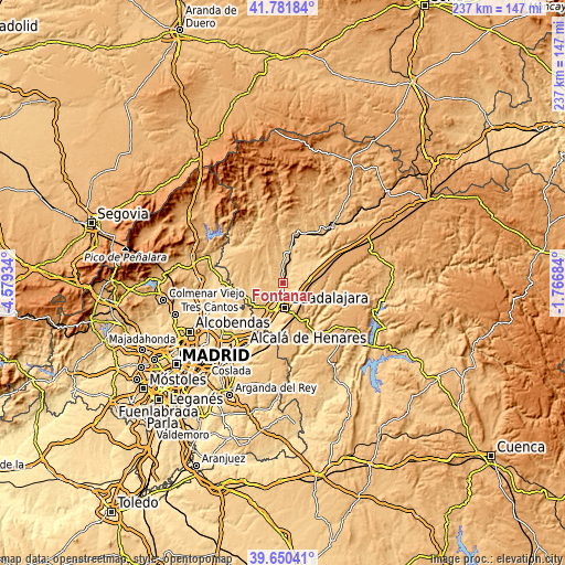
These maps also provides idea of topography and contour of this city, they are displayed at different zoom levels. More info about maps, scale and edge coordinates you can find below images.
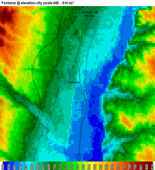
| \ | Map #1 | Topo.Map |
| Scale [m] | 648..814 m | × |
| Scale [ft] | 2126..2671 ft | × |
| Average | 705.7 m = 2315 ft | × |
| Width | 7.41 km = 4.6 mi | 237 km = 147.3 mi |
| Height | 7.41 km = 4.6 mi | 237 km = 147.3 mi |
| ↑Max Latitude | 40.757956° | 41.78184° |
| Latitude at center | 40.72466° | 40.72466° |
| ↓Min Latitude | 40.691348° | 39.65041° |
| ← Min Longitude | -3.217035° | -4.57934° |
| Longitude center | -3.17309° | -3.17309° |
| →Max Longitude | -3.129145° | -1.76684° |
Nearby cities:
Cities around Fontanar sort by population:
• Guadalajara elevation 722 m
10.7 km,  174°
174°
• Cabanillas del Campo 673 m
11.2 km,  205°
205°
• Marchamalo 674 m
6.8 km,  198°
198°
• Yunquera de Henares 688 m
3.1 km,  16°
16°
• Humanes 746 m
11.4 km,  8°
8°
• Tórtola de Henares 730 m
4.8 km,  118°
118°
• Málaga del Fresno 773 m
9.2 km,  319°
319°
• Mohernando 770 m
8.5 km,  0°
0°
• Torre del Burgo 745 m
11 km,  47°
47°
• Aldeanueva de Guadalajara 892 m
11.9 km,  114°
114°
• Cañizar 802 m
10.4 km,  62°
62°
• Ciruelas 871 m
7.9 km,  68°
68°
Multilingual:
 En español:
Fontanar elevación 677 m.
 En France:
Fontanar élévation 677 m.
 Auf Deutsch:
Fontanar höhe über dem Meeresspiegel ist 677 m.

Sources and notes:
- [note 1] Map square and city borders are not equal. Map elevation data is calculated only from area inside that square.
- [src 1] Elevation data from geonames database provided with same terms of usage.
- [src 2] The elevation map of Fontanar is generated using elevation data from NASA's 3 arcsec (90m) resolution SRTM data.
- [src 3] Base (background) map © OpenStreetMap contributors tiles are generated by Geofabrik and OpenTopoMap.
Copyright & License:
This Fontanar Elevation Map is licensed under CC BY-SA. You may reuse any part from this page, if you give a proper credit by linking to this URL:
 More info on terms of use page.