Cabanillas del Campo elevation
Cabanillas del Campo (Castille-La Mancha, Provincia de Guadalajara), Spain elevation is 673 meters and Cabanillas del Campo elevation in feet is 2208 ft above sea level [src 1]. Cabanillas del Campo is a seat of a third-order administrative division (feature code) with elevation that is 70 meters (230 ft) bigger than average city elevation in Spain.
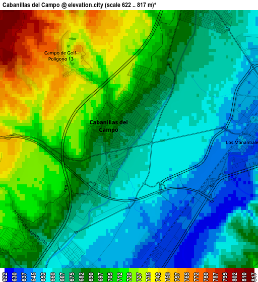
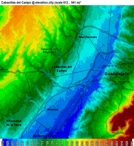
Below is the Elevation map of Cabanillas del Campo, which displays elevation range with different colors. Scale of the first map is from 622 to 817 m (2041 to 2680 ft) with average elevation of 687.1 meters (=2254 ft) [note 1]
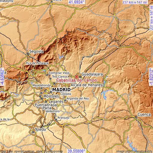
These maps also provides idea of topography and contour of this city, they are displayed at different zoom levels. More info about maps, scale and edge coordinates you can find below images.
| \ | Map #1 | Map #2 | Topo.Map |
| Scale [m] | 622..817 m | 612..941 m | × |
| Scale [ft] | 2041..2680 ft | 2008..3087 ft | × |
| Average | 687.1 m = 2254 ft | 722.3 m = 2370 ft | × |
| Width | 7.42 km = 4.6 mi | 14.83 km = 9.2 mi | 237.3 km = 147.5 mi |
| Height | 7.42 km = 4.6 mi | 14.83 km = 9.2 mi | 237.3 km = 147.5 mi |
| ↑Max Latitude | 40.667101° | 40.700426° | 41.6924° |
| Latitude at center | 40.63376° | 40.63376° | 40.63376° |
| ↓Min Latitude | 40.600402° | 40.567028° | 39.55806° |
| ← Min Longitude | -3.273315° | -3.317261° | -4.63562° |
| Longitude center | -3.22937° | -3.22937° | -3.22937° |
| →Max Longitude | -3.185425° | -3.141479° | -1.82312° |
Nearby cities:
Cities around Cabanillas del Campo sort by population:
• Guadalajara elevation 722 m
5.7 km,  95°
95°
• Azuqueca de Henares 633 m
8.2 km,  203°
203°
• Alovera 644 m
4.7 km, 196°
• Villanueva de la Torre 708 m
8.1 km,  225°
225°
• Marchamalo 674 m
4.5 km,  34°
34°
• Torrejón del Rey 725 m
8.9 km,  276°
276°
• Chiloeches 857 m
9.2 km,  140°
140°
• Fontanar 677 m
11.2 km, 25°
• Quer 692 m
5 km, 230°
• Galápagos 740 m
11.1 km,  306°
306°
• Valdeavero 714 m
8.5 km,  267°
267°
• Valdeaveruelo 744 m
7.1 km, 270°
Multilingual:
 En español:
Cabanillas del Campo elevación 673 m.
 En France:
Cabanillas del Campo élévation 673 m.
 Auf Deutsch:
Cabanillas del Campo höhe über dem Meeresspiegel ist 673 m.
 На русском:
Кабанильяс-дель-Кампо высота над уровнем моря 673 м
Sources and notes:
- [note 1] Map square and city borders are not equal. Map elevation data is calculated only from area inside that square.
- [src 1] Elevation data from geonames database provided with same terms of usage.
- [src 2] The elevation map of Cabanillas del Campo is generated using elevation data from NASA's 3 arcsec (90m) resolution SRTM data.
- [src 3] Base (background) map © OpenStreetMap contributors tiles are generated by Geofabrik and OpenTopoMap.
Copyright & License:
This Cabanillas del Campo Elevation Map is licensed under CC BY-SA. You may reuse any part from this page, if you give a proper credit by linking to this URL:
 More info on terms of use page.