Galapagar elevation
Galapagar (Madrid, Provincia de Madrid), Spain elevation is 883 meters and Galapagar elevation in feet is 2897 ft above sea level [src 1]. Galapagar is a seat of a third-order administrative division (feature code) with elevation that is 280 meters (919 ft) bigger than average city elevation in Spain.
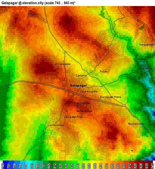
Below is the Elevation map of Galapagar, which displays elevation range with different colors. Scale of the first map is from 743 to 943 m (2438 to 3094 ft) with average elevation of 872.6 meters (=2863 ft) [note 1]
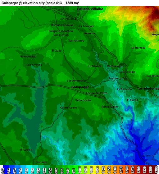
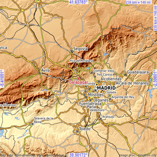
These maps also provides idea of topography and contour of this city, they are displayed at different zoom levels. More info about maps, scale and edge coordinates you can find below images.
| \ | Map #1 | Map #2 | Topo.Map |
| Scale [m] | 743..943 m | 613..1389 m | × |
| Scale [ft] | 2438..3094 ft | 2011..4557 ft | × |
| Average | 872.6 m = 2863 ft | 866.2 m = 2842 ft | × |
| Width | 7.42 km = 4.6 mi | 14.84 km = 9.2 mi | 237.5 km = 147.6 mi |
| Height | 7.42 km = 4.6 mi | 14.84 km = 9.2 mi | 237.5 km = 147.6 mi |
| ↑Max Latitude | 40.611669° | 40.645021° | 41.63783° |
| Latitude at center | 40.5783° | 40.5783° | 40.5783° |
| ↓Min Latitude | 40.544914° | 40.511512° | 39.50172° |
| ← Min Longitude | -4.048205° | -4.092151° | -5.41051° |
| Longitude center | -4.00426° | -4.00426° | -4.00426° |
| →Max Longitude | -3.960315° | -3.916369° | -2.59801° |
Nearby cities:
Cities around Galapagar sort by population:
• Collado-Villalba elevation 884 m
6.3 km,  359°
359°
• Torrelodones 856 m
6.6 km,  91°
91°
• San Lorenzo de El Escorial 1049 m
12.2 km,  276°
276°
• Villanueva del Pardillo 654 m
10.4 km,  160°
160°
• El Escorial 917 m
10.5 km,  272°
272°
• Las Matas 736 m
9.8 km,  103°
103°
• Alpedrete 919 m
9.1 km,  348°
348°
• Moralzarzal 975 m
11.5 km,  14°
14°
• Valdemorillo 811 m
10.1 km,  211°
211°
• Colmenarejo 871 m
2.2 km, 208°
• Hoyo de Manzanares 1005 m
9.6 km,  58°
58°
• Navalquejigo 889 m
5 km,  309°
309°
Multilingual:
 En español:
Galapagar elevación 883 m.
 En France:
Galapagar élévation 883 m.
 Auf Deutsch:
Galapagar höhe über dem Meeresspiegel ist 883 m.

Sources and notes:
- [note 1] Map square and city borders are not equal. Map elevation data is calculated only from area inside that square.
- [src 1] Elevation data from geonames database provided with same terms of usage.
- [src 2] The elevation map of Galapagar is generated using elevation data from NASA's 3 arcsec (90m) resolution SRTM data.
- [src 3] Base (background) map © OpenStreetMap contributors tiles are generated by Geofabrik and OpenTopoMap.
Copyright & License:
This Galapagar Elevation Map is licensed under CC BY-SA. You may reuse any part from this page, if you give a proper credit by linking to this URL:
 More info on terms of use page.