Granucillo elevation
Granucillo (Castille and León, Provincia de Zamora), Spain elevation is 722 meters and Granucillo elevation in feet is 2369 ft above sea level [src 1]. Granucillo is a seat of a third-order administrative division (feature code) with elevation that is 119 meters (390 ft) bigger than average city elevation in Spain.
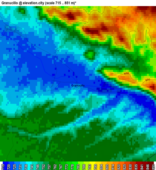
Below is the Elevation map of Granucillo, which displays elevation range with different colors. Scale of the first map is from 715 to 851 m (2346 to 2792 ft) with average elevation of 755.4 meters (=2478 ft) [note 1]
These maps also provides idea of topography and contour of this city, they are displayed at different zoom levels. More info about maps, scale and edge coordinates you can find below images.
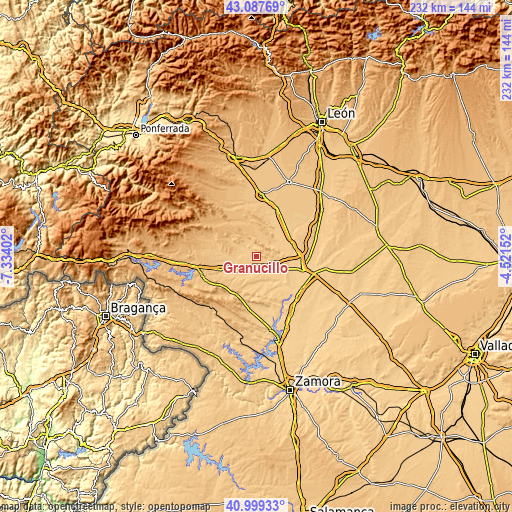
| \ | Map #1 | Topo.Map |
| Scale [m] | 715..851 m | × |
| Scale [ft] | 2346..2792 ft | × |
| Average | 755.4 m = 2478 ft | × |
| Width | 7.26 km = 4.5 mi | 232.2 km = 144.3 mi |
| Height | 7.26 km = 4.5 mi | 232.2 km = 144.3 mi |
| ↑Max Latitude | 42.084713° | 43.08769° |
| Latitude at center | 42.05209° | 42.05209° |
| ↓Min Latitude | 42.019451° | 40.99933° |
| ← Min Longitude | -5.971715° | -7.33402° |
| Longitude center | -5.92777° | -5.92777° |
| →Max Longitude | -5.883825° | -4.52152° |
Nearby cities:
Cities around Granucillo sort by population:
• Santibáñez de Vidriales elevation 745 m
7.6 km,  288°
288°
• Quiruelas de Vidriales 716 m
9 km,  115°
115°
• Santibáñez de Tera 733 m
7.4 km,  176°
176°
• Micereces de Tera 721 m
8.4 km,  146°
146°
• Santa Croya de Tera 727 m
8.7 km,  208°
208°
• Arrabalde 776 m
6.8 km,  24°
24°
• Alcubilla de Nogales 779 m
8.4 km,  3°
3°
• Villaferrueña 744 m
7.7 km,  48°
48°
• Brime de Urz 719 m
4.8 km,  109°
109°
• Quintanilla de Urz 715 m
6.9 km, 108°
• Fuente Encalada 752 m
8.6 km,  318°
318°
• Villageriz 779 m
7.8 km,  342°
342°
Multilingual:
 En español:
Granucillo elevación 722 m.
 En France:
Granucillo élévation 722 m.
 Auf Deutsch:
Granucillo höhe über dem Meeresspiegel ist 722 m.

Sources and notes:
- [note 1] Map square and city borders are not equal. Map elevation data is calculated only from area inside that square.
- [src 1] Elevation data from geonames database provided with same terms of usage.
- [src 2] The elevation map of Granucillo is generated using elevation data from NASA's 3 arcsec (90m) resolution SRTM data.
- [src 3] Base (background) map © OpenStreetMap contributors tiles are generated by Geofabrik and OpenTopoMap.
Copyright & License:
This Granucillo Elevation Map is licensed under CC BY-SA. You may reuse any part from this page, if you give a proper credit by linking to this URL:
 More info on terms of use page.