Isuerre elevation
Isuerre (Aragon, Provincia de Zaragoza), Spain elevation is 612 meters and Isuerre elevation in feet is 2008 ft above sea level [src 1]. Isuerre is a seat of a third-order administrative division (feature code) with elevation that is 9 meters (30 ft) bigger than average city elevation in Spain.
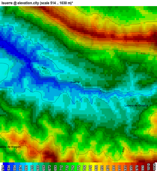
Below is the Elevation map of Isuerre, which displays elevation range with different colors. Scale of the first map is from 514 to 1030 m (1686 to 3379 ft) with average elevation of 716.9 meters (=2352 ft) [note 1]
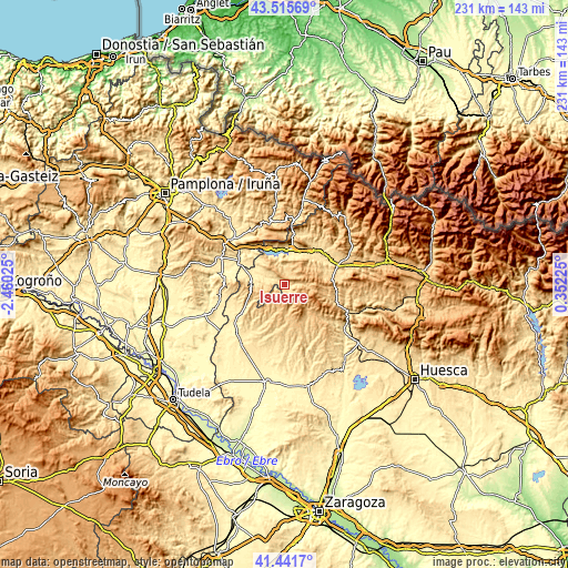
These maps also provides idea of topography and contour of this city, they are displayed at different zoom levels. More info about maps, scale and edge coordinates you can find below images.
| \ | Map #1 | Topo.Map |
| Scale [m] | 514..1030 m | × |
| Scale [ft] | 1686..3379 ft | × |
| Average | 716.9 m = 2352 ft | × |
| Width | 7.21 km = 4.5 mi | 230.6 km = 143.3 mi |
| Height | 7.21 km = 4.5 mi | 230.6 km = 143.3 mi |
| ↑Max Latitude | 42.519688° | 43.51569° |
| Latitude at center | 42.48729° | 42.48729° |
| ↓Min Latitude | 42.454875° | 41.4417° |
| ← Min Longitude | -1.097945° | -2.46025° |
| Longitude center | -1.054° | -1.054° |
| →Max Longitude | -1.010055° | 0.35225° |
Nearby cities:
Cities around Isuerre sort by population:
• Sos del Rey Católico elevation 634 m
13.3 km,  274°
274°
• Luesia 794 m
13.3 km,  169°
169°
• Biel 766 m
14.4 km,  140°
140°
• Lobera de Onsella 668 m
2.8 km,  110°
110°
• Undués de Lerda 628 m
12.9 km,  312°
312°
• Longás 750 m
9.8 km,  94°
94°
• Urriés 548 m
7.2 km,  299°
299°
• Navardún 484 m
8.2 km,  289°
289°
• Mianos 624 m
13.6 km,  36°
36°
• Bagüés 825 m
11.2 km,  52°
52°
• Petilla de Aragón 935 m
6.6 km,  231°
231°
• Artieda 635 m
12.3 km,  27°
27°
Multilingual:
 En español:
Isuerre elevación 612 m.
 En France:
Isuerre élévation 612 m.


Sources and notes:
- [note 1] Map square and city borders are not equal. Map elevation data is calculated only from area inside that square.
- [src 1] Elevation data from geonames database provided with same terms of usage.
- [src 2] The elevation map of Isuerre is generated using elevation data from NASA's 3 arcsec (90m) resolution SRTM data.
- [src 3] Base (background) map © OpenStreetMap contributors tiles are generated by Geofabrik and OpenTopoMap.
Copyright & License:
This Isuerre Elevation Map is licensed under CC BY-SA. You may reuse any part from this page, if you give a proper credit by linking to this URL:
 More info on terms of use page.