La Lastrilla elevation
La Lastrilla (Castille and León, Provincia de Segovia), Spain elevation is 1059 meters and La Lastrilla elevation in feet is 3474 ft above sea level [src 1]. La Lastrilla is a populated place (feature code) with elevation that is 456 meters (1496 ft) bigger than average city elevation in Spain.
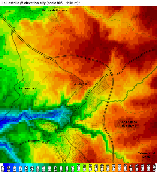
Below is the Elevation map of La Lastrilla, which displays elevation range with different colors. Scale of the first map is from 905 to 1101 m (2969 to 3612 ft) with average elevation of 1034.4 meters (=3394 ft) [note 1]
These maps also provides idea of topography and contour of this city, they are displayed at different zoom levels. More info about maps, scale and edge coordinates you can find below images.
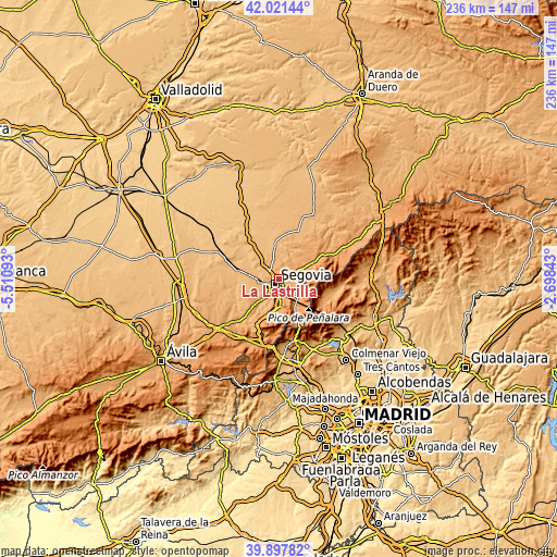
| \ | Map #1 | Topo.Map |
| Scale [m] | 905..1101 m | × |
| Scale [ft] | 2969..3612 ft | × |
| Average | 1034.4 m = 3394 ft | × |
| Width | 7.38 km = 4.6 mi | 236.1 km = 146.7 mi |
| Height | 7.38 km = 4.6 mi | 236.1 km = 146.7 mi |
| ↑Max Latitude | 41.001344° | 42.02144° |
| Latitude at center | 40.96817° | 40.96817° |
| ↓Min Latitude | 40.93498° | 39.89782° |
| ← Min Longitude | -4.148625° | -5.51093° |
| Longitude center | -4.10468° | -4.10468° |
| →Max Longitude | -4.060735° | -2.69843° |
Nearby cities:
Cities around La Lastrilla sort by population:
• Segovia elevation 996 m
2.5 km,  207°
207°
• Palazuelos de Eresma 1084 m
5.6 km,  138°
138°
• San Cristóbal de Segovia 1076 m
3 km,  126°
126°
• Torrecaballeros 1160 m
7.2 km,  68°
68°
• Espirdo 1069 m
4.2 km,  38°
38°
• Valseca 948 m
6.9 km,  300°
300°
• Trescasas 1131 m
5.8 km,  94°
94°
• Hontanares de Eresma 880 m
8.5 km,  280°
280°
• Basardilla 1094 m
9.3 km,  45°
45°
• Roda de Eresma 939 m
9.3 km,  316°
316°
• Encinillas 947 m
7.1 km, 321°
• Brieva 1092 m
8.6 km,  30°
30°
Multilingual:
 En español:
La Lastrilla elevación 1059 m.
 En France:
La Lastrilla élévation 1059 m.
 Auf Deutsch:
La Lastrilla höhe über dem Meeresspiegel ist 1059 m.

Sources and notes:
- [note 1] Map square and city borders are not equal. Map elevation data is calculated only from area inside that square.
- [src 1] Elevation data from geonames database provided with same terms of usage.
- [src 2] The elevation map of La Lastrilla is generated using elevation data from NASA's 3 arcsec (90m) resolution SRTM data.
- [src 3] Base (background) map © OpenStreetMap contributors tiles are generated by Geofabrik and OpenTopoMap.
Copyright & License:
This La Lastrilla Elevation Map is licensed under CC BY-SA. You may reuse any part from this page, if you give a proper credit by linking to this URL:
 More info on terms of use page.