Ordes elevation
Ordes (Galicia, Provincia da Coruña), Spain elevation is 277 meters and Ordes elevation in feet is 909 ft above sea level [src 1]. Ordes is a populated place (feature code) with elevation that is 326 meters (1070 ft) smaller than average city elevation in Spain.
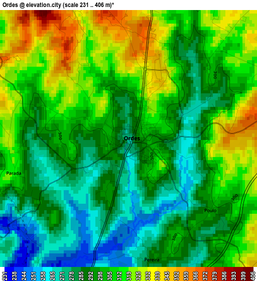
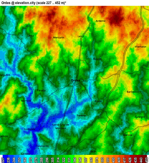
Below is the Elevation map of Ordes, which displays elevation range with different colors. Scale of the first map is from 231 to 406 m (758 to 1332 ft) with average elevation of 301.1 meters (=988 ft) [note 1]
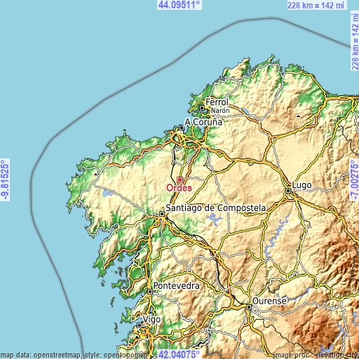
These maps also provides idea of topography and contour of this city, they are displayed at different zoom levels. More info about maps, scale and edge coordinates you can find below images.
| \ | Map #1 | Map #2 | Topo.Map |
| Scale [m] | 231..406 m | 227..452 m | × |
| Scale [ft] | 758..1332 ft | 745..1483 ft | × |
| Average | 301.1 m = 988 ft | 319.7 m = 1049 ft | × |
| Width | 7.14 km = 4.4 mi | 14.28 km = 8.9 mi | 228.4 km = 141.9 mi |
| Height | 7.14 km = 4.4 mi | 14.28 km = 8.9 mi | 228.4 km = 141.9 mi |
| ↑Max Latitude | 43.108631° | 43.140705° | 44.09511° |
| Latitude at center | 43.07654° | 43.07654° | 43.07654° |
| ↓Min Latitude | 43.044432° | 43.012307° | 42.04075° |
| ← Min Longitude | -8.452945° | -8.496891° | -9.81525° |
| Longitude center | -8.409° | -8.409° | -8.409° |
| →Max Longitude | -8.365055° | -8.321109° | -7.00275° |
Nearby cities:
Cities around Ordes sort by population:
• Culleredo elevation 80 m
23.6 km,  4°
4°
• Oroso 274 m
10.6 km,  190°
190°
• Abegondo 97 m
18.6 km,  33°
33°
• Carral 144 m
17.5 km,  14°
14°
• Trazo 307 m
12.1 km,  236°
236°
• Mesia 378 m
11.8 km,  77°
77°
• Boimorto 482 m
24 km,  110°
110°
• Cesuras 329 m
20 km,  57°
57°
• Vilasantar 435 m
23.3 km,  91°
91°
• Curtis 534 m
21.8 km, 76°
• Cerceda 365 m
13.3 km,  333°
333°
• Frades 361 m
9.8 km, 107°
Multilingual:
 En español:
Ordes elevación 277 m.
 En France:
Ordes élévation 277 m.


Sources and notes:
- [note 1] Map square and city borders are not equal. Map elevation data is calculated only from area inside that square.
- [src 1] Elevation data from geonames database provided with same terms of usage.
- [src 2] The elevation map of Ordes is generated using elevation data from NASA's 3 arcsec (90m) resolution SRTM data.
- [src 3] Base (background) map © OpenStreetMap contributors tiles are generated by Geofabrik and OpenTopoMap.
Copyright & License:
This Ordes Elevation Map is licensed under CC BY-SA. You may reuse any part from this page, if you give a proper credit by linking to this URL:
 More info on terms of use page.