Culleredo elevation
Culleredo (Galicia, Provincia da Coruña), Spain elevation is 80 meters and Culleredo elevation in feet is 262 ft above sea level [src 1]. Culleredo is a seat of a third-order administrative division (feature code) with elevation that is 523 meters (1716 ft) smaller than average city elevation in Spain.
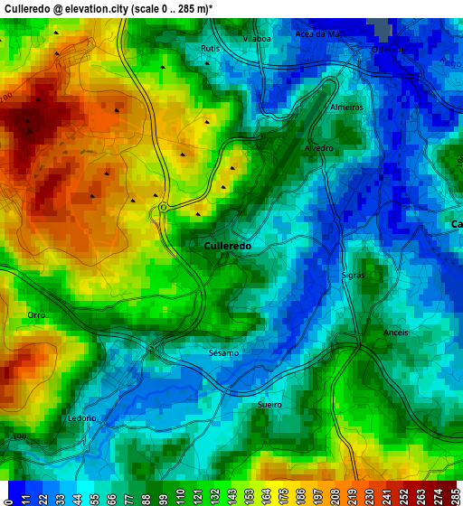
Below is the Elevation map of Culleredo, which displays elevation range with different colors. Scale of the first map is from 0 to 285 m (0 to 935 ft) with average elevation of 102.6 meters (=337 ft) [note 1]
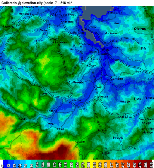
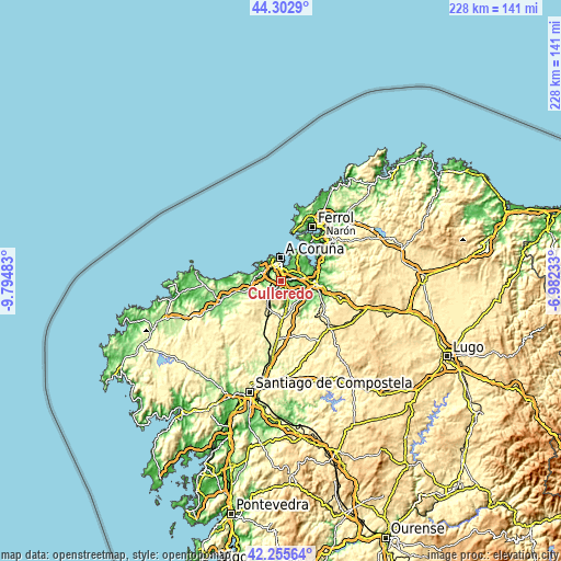
These maps also provides idea of topography and contour of this city, they are displayed at different zoom levels. More info about maps, scale and edge coordinates you can find below images.
| \ | Map #1 | Map #2 | Topo.Map |
| Scale [m] | 0..285 m | -7..518 m | × |
| Scale [ft] | 0..935 ft | -23..1699 ft | × |
| Average | 102.6 m = 337 ft | 127.4 m = 418 ft | × |
| Width | 7.11 km = 4.4 mi | 14.23 km = 8.8 mi | 227.6 km = 141.4 mi |
| Height | 7.11 km = 4.4 mi | 14.23 km = 8.8 mi | 227.6 km = 141.4 mi |
| ↑Max Latitude | 43.31986° | 43.351824° | 44.3029° |
| Latitude at center | 43.28788° | 43.28788° | 43.28788° |
| ↓Min Latitude | 43.255883° | 43.223869° | 42.25564° |
| ← Min Longitude | -8.432525° | -8.476471° | -9.79483° |
| Longitude center | -8.38858° | -8.38858° | -8.38858° |
| →Max Longitude | -8.344635° | -8.300689° | -6.98233° |
Nearby cities:
Cities around Culleredo sort by population:
• A Coruña elevation 22 m
9.3 km,  356°
356°
• Oleiros 127 m
7.7 km,  49°
49°
• Arteixo 24 m
9.8 km,  281°
281°
• Cambre 49 m
3.4 km,  77°
77°
• Sada 44 m
13 km, 54°
• Betanzos 2 m
14.1 km,  93°
93°
• Laracha 163 m
16.4 km,  256°
256°
• Bergondo 113 m
13 km, 75°
• Abegondo 97 m
11.6 km,  132°
132°
• Carral 144 m
7.1 km,  157°
157°
• Pastoriza 162 m
8.1 km,  308°
308°
• Cerceda 365 m
13.9 km,  213°
213°
Multilingual:
 En español:
Culleredo elevación 80 m.
 En France:
Culleredo élévation 80 m.
 Auf Deutsch:
Culleredo höhe über dem Meeresspiegel ist 80 m.

Sources and notes:
- [note 1] Map square and city borders are not equal. Map elevation data is calculated only from area inside that square.
- [src 1] Elevation data from geonames database provided with same terms of usage.
- [src 2] The elevation map of Culleredo is generated using elevation data from NASA's 3 arcsec (90m) resolution SRTM data.
- [src 3] Base (background) map © OpenStreetMap contributors tiles are generated by Geofabrik and OpenTopoMap.
Copyright & License:
This Culleredo Elevation Map is licensed under CC BY-SA. You may reuse any part from this page, if you give a proper credit by linking to this URL:
 More info on terms of use page.