Patones elevation
Patones (Madrid, Provincia de Madrid), Spain elevation is 714 meters and Patones elevation in feet is 2343 ft above sea level [src 1]. Patones is a seat of a third-order administrative division (feature code) with elevation that is 111 meters (364 ft) bigger than average city elevation in Spain.
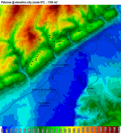
Below is the Elevation map of Patones, which displays elevation range with different colors. Scale of the first map is from 672 to 1165 m (2205 to 3822 ft) with average elevation of 817.8 meters (=2683 ft) [note 1]
These maps also provides idea of topography and contour of this city, they are displayed at different zoom levels. More info about maps, scale and edge coordinates you can find below images.
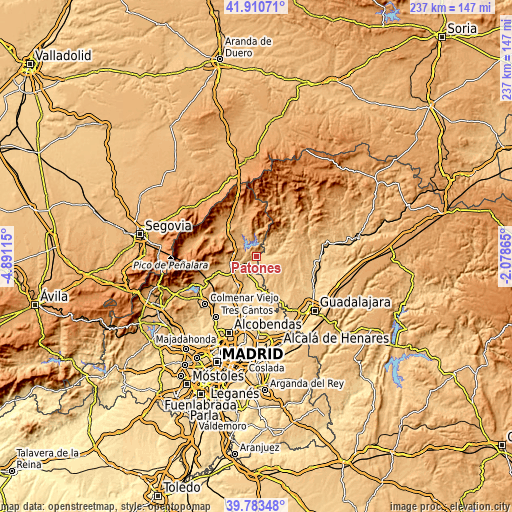
| \ | Map #1 | Topo.Map |
| Scale [m] | 672..1165 m | × |
| Scale [ft] | 2205..3822 ft | × |
| Average | 817.8 m = 2683 ft | × |
| Width | 7.39 km = 4.6 mi | 236.5 km = 147 mi |
| Height | 7.39 km = 4.6 mi | 236.5 km = 147 mi |
| ↑Max Latitude | 40.88886° | 41.91071° |
| Latitude at center | 40.85563° | 40.85563° |
| ↓Min Latitude | 40.822383° | 39.78348° |
| ← Min Longitude | -3.528845° | -4.89115° |
| Longitude center | -3.4849° | -3.4849° |
| →Max Longitude | -3.440955° | -2.07865° |
Nearby cities:
Cities around Patones sort by population:
• Torrelaguna elevation 736 m
5.4 km,  234°
234°
• La Cabrera 1033 m
10.8 km,  274°
274°
• Uceda 785 m
2.7 km,  131°
131°
• Cabanillas de la Sierra 905 m
12.4 km,  251°
251°
• Torremocha de Jarama 715 m
1.9 km,  212°
212°
• Valdepiélagos 752 m
11 km,  169°
169°
• Redueña 796 m
10.5 km, 245°
• Valdepeñas de la Sierra 844 m
10.1 km,  56°
56°
• Cervera de Buitrago 948 m
8 km,  333°
333°
• Casa de Uceda 917 m
9.9 km,  99°
99°
• Robledillo de la Jara 1028 m
11 km,  343°
343°
• Villaseca de Uceda 899 m
12.2 km,  109°
109°
Multilingual:
 En español:
Patones elevación 714 m.
 En France:
Patones élévation 714 m.


Sources and notes:
- [note 1] Map square and city borders are not equal. Map elevation data is calculated only from area inside that square.
- [src 1] Elevation data from geonames database provided with same terms of usage.
- [src 2] The elevation map of Patones is generated using elevation data from NASA's 3 arcsec (90m) resolution SRTM data.
- [src 3] Base (background) map © OpenStreetMap contributors tiles are generated by Geofabrik and OpenTopoMap.
Copyright & License:
This Patones Elevation Map is licensed under CC BY-SA. You may reuse any part from this page, if you give a proper credit by linking to this URL:
 More info on terms of use page.