Rincón de Soto elevation
Rincón de Soto (La Rioja, Provincia de La Rioja), Spain elevation is 291 meters and Rincón de Soto elevation in feet is 955 ft above sea level [src 1]. Rincón de Soto is a seat of a third-order administrative division (feature code) with elevation that is 312 meters (1024 ft) smaller than average city elevation in Spain.
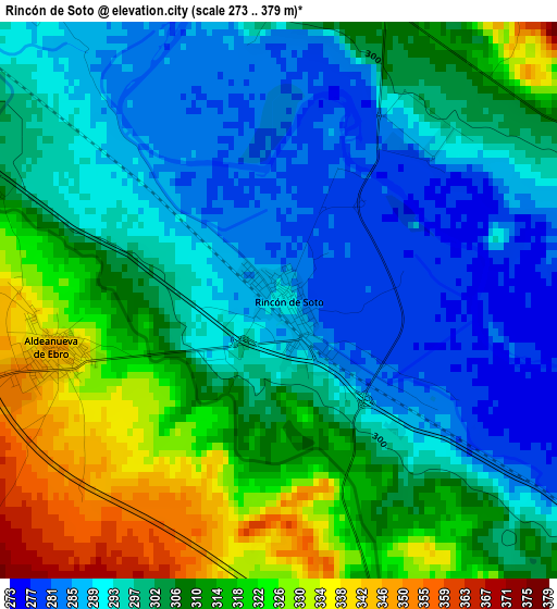
Below is the Elevation map of Rincón de Soto, which displays elevation range with different colors. Scale of the first map is from 273 to 379 m (896 to 1243 ft) with average elevation of 303.6 meters (=996 ft) [note 1]
These maps also provides idea of topography and contour of this city, they are displayed at different zoom levels. More info about maps, scale and edge coordinates you can find below images.
| \ | Map #1 | Map #2 | Topo.Map |
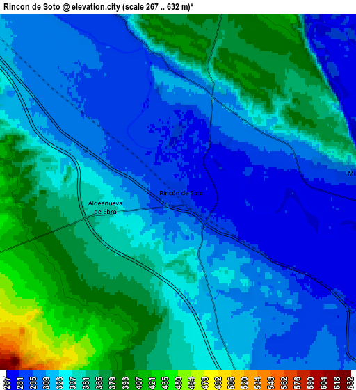
| Scale [m] | 273..379 m | 267..632 m | × |
| Scale [ft] | 896..1243 ft | 876..2073 ft | × |
| Average | 303.6 m = 996 ft | 331.9 m = 1089 ft | × |
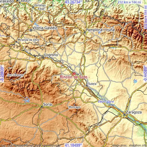
| Width | 7.24 km = 4.5 mi | 14.47 km = 9 mi | 231.5 km = 143.8 mi |
| Height | 7.24 km = 4.5 mi | 14.47 km = 9 mi | 231.5 km = 143.8 mi |
| ↑Max Latitude | 42.267279° | 42.29979° | 43.26734° |
| Latitude at center | 42.23475° | 42.23475° | 42.23475° |
| ↓Min Latitude | 42.202205° | 42.169642° | 41.18499° |
| ← Min Longitude | -1.896085° | -1.940031° | -3.25839° |
| Longitude center | -1.85214° | -1.85214° | -1.85214° |
| →Max Longitude | -1.808195° | -1.764249° | -0.44589° |
Nearby cities:
Cities around Rincón de Soto sort by population:
• Calahorra elevation 352 m
12.2 km,  310°
310°
• Alfaro 298 m
10.4 km,  125°
125°
• San Adrián 301 m
13 km,  328°
328°
• Peralta 290 m
12.3 km,  20°
20°
• Autol 434 m
12.8 km,  260°
260°
• Azagra 289 m
8.3 km, 331°
• Milagro 295 m
7.1 km,  83°
83°
• Villafranca 288 m
10 km,  60°
60°
• Marcilla 293 m
14 km,  42°
42°
• Aldeanueva de Ebro 348 m
3 km, 257°
• Funes 285 m
10 km,  25°
25°
• Cadreita 285 m
14 km,  98°
98°
Multilingual:
 En español:
Rincón de Soto elevación 291 m.
 En France:
Rincón de Soto élévation 291 m.
 Auf Deutsch:
Rincón de Soto höhe über dem Meeresspiegel ist 291 m.

Sources and notes:
- [note 1] Map square and city borders are not equal. Map elevation data is calculated only from area inside that square.
- [src 1] Elevation data from geonames database provided with same terms of usage.
- [src 2] The elevation map of Rincón de Soto is generated using elevation data from NASA's 3 arcsec (90m) resolution SRTM data.
- [src 3] Base (background) map © OpenStreetMap contributors tiles are generated by Geofabrik and OpenTopoMap.
Copyright & License:
This Rincón de Soto Elevation Map is licensed under CC BY-SA. You may reuse any part from this page, if you give a proper credit by linking to this URL:
 More info on terms of use page.