Santa Colomba de Curueño elevation
Santa Colomba de Curueño (Castille and León, Provincia de León), Spain elevation is 927 meters and Santa Colomba de Curueño elevation in feet is 3041 ft above sea level [src 1]. Santa Colomba de Curueño is a seat of a third-order administrative division (feature code) with elevation that is 324 meters (1063 ft) bigger than average city elevation in Spain.
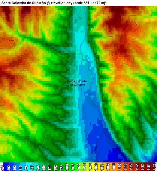
Below is the Elevation map of Santa Colomba de Curueño, which displays elevation range with different colors. Scale of the first map is from 881 to 1172 m (2890 to 3845 ft) with average elevation of 1015.8 meters (=3333 ft) [note 1]
These maps also provides idea of topography and contour of this city, they are displayed at different zoom levels. More info about maps, scale and edge coordinates you can find below images.
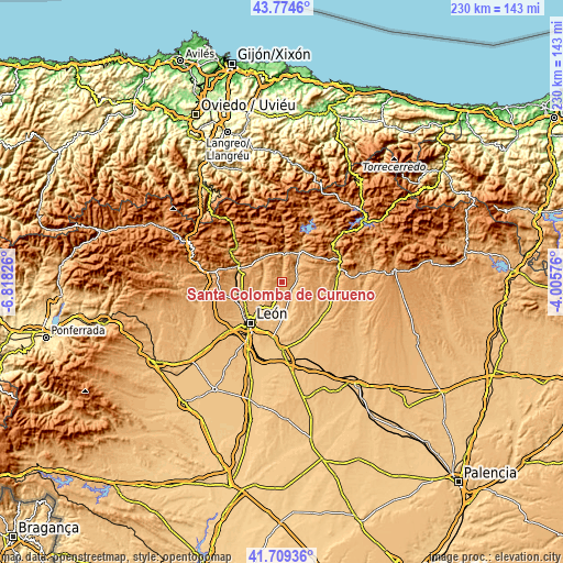
| \ | Map #1 | Topo.Map |
| Scale [m] | 881..1172 m | × |
| Scale [ft] | 2890..3845 ft | × |
| Average | 1015.8 m = 3333 ft | × |
| Width | 7.18 km = 4.5 mi | 229.6 km = 142.7 mi |
| Height | 7.18 km = 4.5 mi | 229.6 km = 142.7 mi |
| ↑Max Latitude | 42.782841° | 43.7746° |
| Latitude at center | 42.75058° | 42.75058° |
| ↓Min Latitude | 42.718302° | 41.70936° |
| ← Min Longitude | -5.455955° | -6.81826° |
| Longitude center | -5.41201° | -5.41201° |
| →Max Longitude | -5.368065° | -4.00576° |
Nearby cities:
Cities around Santa Colomba de Curueño sort by population:
• León elevation 844 m
21.2 km,  217°
217°
• Villaquilambre 893 m
16.6 km,  226°
226°
• La Robla 955 m
18.6 km,  288°
288°
• Boñar 975 m
14.8 km,  29°
29°
• Valdefresno 872 m
18.5 km,  201°
201°
• Cuadros 901 m
19 km,  256°
256°
• Matallana de Torío 1020 m
15.5 km,  325°
325°
• Gradefes 854 m
20.7 km,  132°
132°
• Garrafe de Torío 916 m
9.3 km, 257°
• Vegaquemada 938 m
10 km,  40°
40°
• Valdepiélago 1040 m
13.2 km,  5°
5°
• Vegacervera 1057 m
18.3 km, 326°
Multilingual:
 En español:
Santa Colomba de Curueño elevación 927 m.
 En France:
Santa Colomba de Curueño élévation 927 m.
 Auf Deutsch:
Santa Colomba de Curueño höhe über dem Meeresspiegel ist 927 m.
 На русском:
Santa Colomba de Curueño высота над уровнем моря 927 м
Sources and notes:
- [note 1] Map square and city borders are not equal. Map elevation data is calculated only from area inside that square.
- [src 1] Elevation data from geonames database provided with same terms of usage.
- [src 2] The elevation map of Santa Colomba de Curueño is generated using elevation data from NASA's 3 arcsec (90m) resolution SRTM data.
- [src 3] Base (background) map © OpenStreetMap contributors tiles are generated by Geofabrik and OpenTopoMap.
Copyright & License:
This Santa Colomba de Curueño Elevation Map is licensed under CC BY-SA. You may reuse any part from this page, if you give a proper credit by linking to this URL:
 More info on terms of use page.