Zaorejas elevation
Zaorejas (Castille-La Mancha, Provincia de Guadalajara), Spain elevation is 1229 meters and Zaorejas elevation in feet is 4032 ft above sea level [src 1]. Zaorejas is a seat of a third-order administrative division (feature code) with elevation that is 626 meters (2054 ft) bigger than average city elevation in Spain.
Below is the Elevation map of Zaorejas, which displays elevation range with different colors. Scale of the first map is from 859 to 1320 m (2818 to 4331 ft) with average elevation of 1177.6 meters (=3864 ft) [note 1]
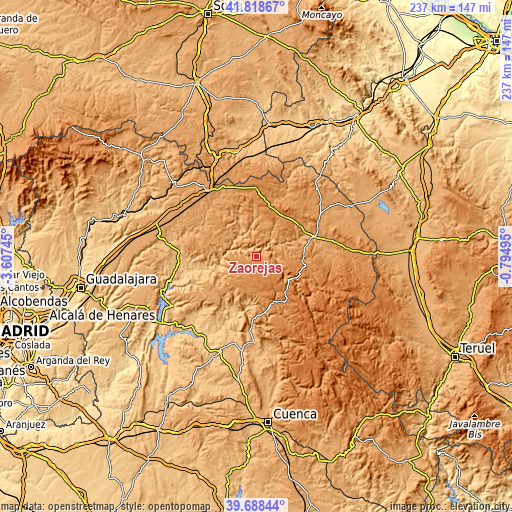
These maps also provides idea of topography and contour of this city, they are displayed at different zoom levels. More info about maps, scale and edge coordinates you can find below images.
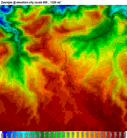
| \ | Map #1 | Topo.Map |
| Scale [m] | 859..1320 m | × |
| Scale [ft] | 2818..4331 ft | × |
| Average | 1177.6 m = 3864 ft | × |
| Width | 7.4 km = 4.6 mi | 236.9 km = 147.2 mi |
| Height | 7.4 km = 4.6 mi | 236.9 km = 147.2 mi |
| ↑Max Latitude | 40.795367° | 41.81867° |
| Latitude at center | 40.76209° | 40.76209° |
| ↓Min Latitude | 40.728796° | 39.68844° |
| ← Min Longitude | -2.245145° | -3.60745° |
| Longitude center | -2.2012° | -2.2012° |
| →Max Longitude | -2.157255° | -0.79495° |
Nearby cities:
Cities around Zaorejas sort by population:
• Villanueva de Alcorón elevation 1263 m
10.1 km,  204°
204°
• Ablanque 1033 m
15.3 km,  352°
352°
• Peñalén 1356 m
15.4 km,  134°
134°
• Olmeda de Cobeta 1135 m
11 km,  8°
8°
• Cobeta 1123 m
12.5 km,  23°
23°
• Huertahernando 1151 m
9.9 km,  313°
313°
• Valsalobre 1225 m
18.5 km,  150°
150°
• Armallones 1208 m
9 km,  251°
251°
• Esplegares 1154 m
17.7 km, 306°
• Ocentejo 865 m
16.6 km,  273°
273°
• Valtablado del Río 842 m
17.8 km, 252°
• Fuembellida 1222 m
17.1 km,  92°
92°
Multilingual:
 En español:
Zaorejas elevación 1229 m.
 En France:
Zaorejas élévation 1229 m.
 Auf Deutsch:
Zaorejas höhe über dem Meeresspiegel ist 1229 m.

Sources and notes:
- [note 1] Map square and city borders are not equal. Map elevation data is calculated only from area inside that square.
- [src 1] Elevation data from geonames database provided with same terms of usage.
- [src 2] The elevation map of Zaorejas is generated using elevation data from NASA's 3 arcsec (90m) resolution SRTM data.
- [src 3] Base (background) map © OpenStreetMap contributors tiles are generated by Geofabrik and OpenTopoMap.
Copyright & License:
This Zaorejas Elevation Map is licensed under CC BY-SA. You may reuse any part from this page, if you give a proper credit by linking to this URL:
 More info on terms of use page.