Abanilla elevation
Abanilla (Murcia), Spain elevation is 207 meters and Abanilla elevation in feet is 679 ft above sea level [src 1]. Abanilla is a seat of a third-order administrative division (feature code) with elevation that is 396 meters (1299 ft) smaller than average city elevation in Spain.
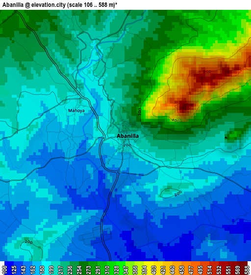
Below is the Elevation map of Abanilla, which displays elevation range with different colors. Scale of the first map is from 106 to 588 m (348 to 1929 ft) with average elevation of 219 meters (=719 ft) [note 1]
These maps also provides idea of topography and contour of this city, they are displayed at different zoom levels. More info about maps, scale and edge coordinates you can find below images.
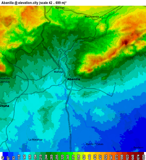
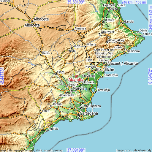
| \ | Map #1 | Map #2 | Topo.Map |
| Scale [m] | 106..588 m | 42..699 m | × |
| Scale [ft] | 348..1929 ft | 138..2293 ft | × |
| Average | 219 m = 719 ft | 236.3 m = 775 ft | × |
| Width | 7.68 km = 4.8 mi | 15.36 km = 9.5 mi | 245.7 km = 152.7 mi |
| Height | 7.68 km = 4.8 mi | 15.36 km = 9.5 mi | 245.7 km = 152.7 mi |
| ↑Max Latitude | 38.239894° | 38.274402° | 39.30199° |
| Latitude at center | 38.20537° | 38.20537° | 38.20537° |
| ↓Min Latitude | 38.17083° | 38.136273° | 37.09198° |
| ← Min Longitude | -1.085475° | -1.129421° | -2.44778° |
| Longitude center | -1.04153° | -1.04153° | -1.04153° |
| →Max Longitude | -0.997585° | -0.953639° | 0.36472° |
Nearby cities:
Cities around Abanilla sort by population:
• Orihuela elevation 32 m
15.9 km,  147°
147°
• Callosa de Segura 23 m
16.8 km,  122°
122°
• Santomera 38 m
16 km,  182°
182°
• Albatera 21 m
15.2 km,  101°
101°
• Fortuna 205 m
7.8 km,  250°
250°
• Redován 26 m
15.2 km,  130°
130°
• Cox 22 m
15.2 km, 117°
• Granja de Rocamora 20 m
14.4 km,  114°
114°
• Cobatillas 56 m
17 km,  190°
190°
• Benferri 55 m
9.9 km,  135°
135°
• Algueña 537 m
15.2 km,  12°
12°
• Hondón de los Frailes 423 m
12.4 km,  52°
52°
Multilingual:
 En español:
Abanilla elevación 207 m.
 En France:
Abanilla élévation 207 m.
 Auf Deutsch:
Abanilla höhe über dem Meeresspiegel ist 207 m.

Sources and notes:
- [note 1] Map square and city borders are not equal. Map elevation data is calculated only from area inside that square.
- [src 1] Elevation data from geonames database provided with same terms of usage.
- [src 2] The elevation map of Abanilla is generated using elevation data from NASA's 3 arcsec (90m) resolution SRTM data.
- [src 3] Base (background) map © OpenStreetMap contributors tiles are generated by Geofabrik and OpenTopoMap.
Copyright & License:
This Abanilla Elevation Map is licensed under CC BY-SA. You may reuse any part from this page, if you give a proper credit by linking to this URL:
 More info on terms of use page.