Badajoz elevation
Badajoz (Extremadura, Provincia de Badajoz), Spain elevation is 192 meters and Badajoz elevation in feet is 630 ft above sea level [src 1]. Badajoz is a seat of a third-order administrative division (feature code) with elevation that is 411 meters (1348 ft) smaller than average city elevation in Spain.
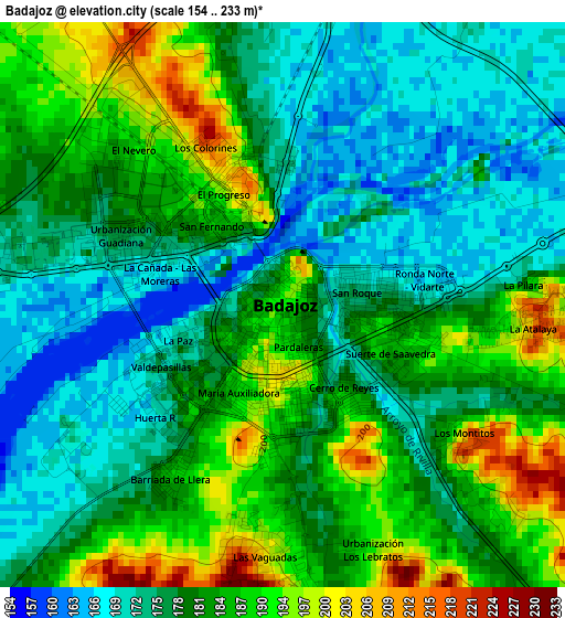
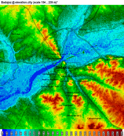
Below is the Elevation map of Badajoz, which displays elevation range with different colors. Scale of the first map is from 154 to 233 m (505 to 764 ft) with average elevation of 181 meters (=594 ft) [note 1]
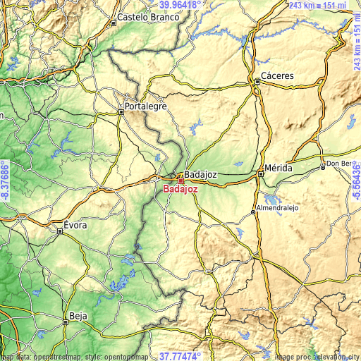
These maps also provides idea of topography and contour of this city, they are displayed at different zoom levels. More info about maps, scale and edge coordinates you can find below images.
| \ | Map #1 | Map #2 | Topo.Map |
| Scale [m] | 154..233 m | 154..239 m | × |
| Scale [ft] | 505..764 ft | 505..784 ft | × |
| Average | 181 m = 594 ft | 186.7 m = 613 ft | × |
| Width | 7.61 km = 4.7 mi | 15.22 km = 9.5 mi | 243.4 km = 151.2 mi |
| Height | 7.61 km = 4.7 mi | 15.22 km = 9.5 mi | 243.4 km = 151.2 mi |
| ↑Max Latitude | 38.912093° | 38.946279° | 39.96418° |
| Latitude at center | 38.87789° | 38.87789° | 38.87789° |
| ↓Min Latitude | 38.843671° | 38.809435° | 37.77474° |
| ← Min Longitude | -7.014555° | -7.058501° | -8.37686° |
| Longitude center | -6.97061° | -6.97061° | -6.97061° |
| →Max Longitude | -6.926665° | -6.882719° | -5.56436° |
Nearby cities:
Cities around Badajoz sort by population:
• Montijo elevation 201 m
30.7 km,  83°
83°
• Olivenza 262 m
24.4 km,  207°
207°
• Puebla de la Calzada 194 m
29.9 km,  86°
86°
• Talavera La Real 188 m
17.5 km, 89°
• Valverde de Leganés 295 m
23.1 km,  182°
182°
• Valdelacalzada 184 m
23.4 km, 86°
• Lobón 241 m
30.2 km,  96°
96°
• Villar del Rey 247 m
30.3 km,  20°
20°
• La Albuera 258 m
21.9 km,  144°
144°
• Almendral 325 m
32.1 km,  156°
156°
• Corte de Peleas 246 m
31 km,  122°
122°
• Entrín Bajo 244 m
28.5 km,  128°
128°
Multilingual:
 En español:
Badajoz elevación 192 m.
 En France:
Badajoz élévation 192 m.


Sources and notes:
- [note 1] Map square and city borders are not equal. Map elevation data is calculated only from area inside that square.
- [src 1] Elevation data from geonames database provided with same terms of usage.
- [src 2] The elevation map of Badajoz is generated using elevation data from NASA's 3 arcsec (90m) resolution SRTM data.
- [src 3] Base (background) map © OpenStreetMap contributors tiles are generated by Geofabrik and OpenTopoMap.
Copyright & License:
This Badajoz Elevation Map is licensed under CC BY-SA. You may reuse any part from this page, if you give a proper credit by linking to this URL:
 More info on terms of use page.