Benigànim elevation
Benigànim (Valencia, Província de València), Spain elevation is 210 meters and Benigànim elevation in feet is 689 ft above sea level [src 1]. Benigànim is a populated place (feature code) with elevation that is 393 meters (1289 ft) smaller than average city elevation in Spain.
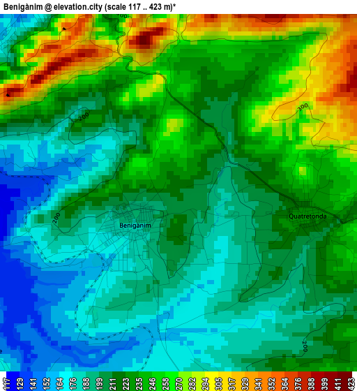
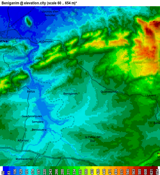
Below is the Elevation map of Benigànim, which displays elevation range with different colors. Scale of the first map is from 117 to 423 m (384 to 1388 ft) with average elevation of 218.6 meters (=717 ft) [note 1]
These maps also provides idea of topography and contour of this city, they are displayed at different zoom levels. More info about maps, scale and edge coordinates you can find below images.
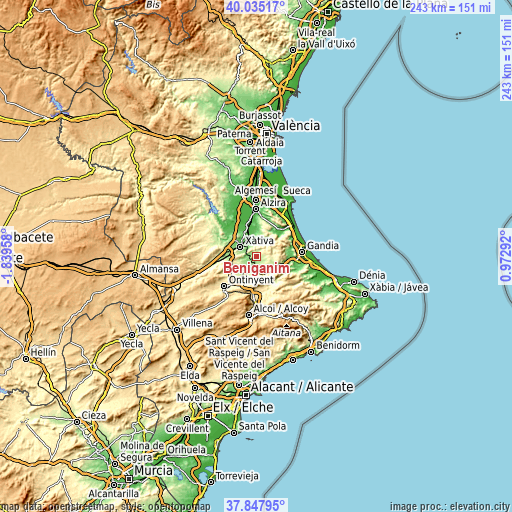
| \ | Map #1 | Map #2 | Topo.Map |
| Scale [m] | 117..423 m | 60..654 m | × |
| Scale [ft] | 384..1388 ft | 197..2146 ft | × |
| Average | 218.6 m = 717 ft | 224.1 m = 735 ft | × |
| Width | 7.6 km = 4.7 mi | 15.2 km = 9.4 mi | 243.2 km = 151.1 mi |
| Height | 7.6 km = 4.7 mi | 15.2 km = 9.4 mi | 243.2 km = 151.1 mi |
| ↑Max Latitude | 38.984168° | 39.018319° | 40.03517° |
| Latitude at center | 38.95° | 38.95° | 38.95° |
| ↓Min Latitude | 38.915816° | 38.881615° | 37.84795° |
| ← Min Longitude | -0.477275° | -0.521221° | -1.83958° |
| Longitude center | -0.43333° | -0.43333° | -0.43333° |
| →Max Longitude | -0.389385° | -0.345439° | 0.97292° |
Nearby cities:
Cities around Benigànim sort by population:
• Xàtiva elevation 108 m
8.6 km,  301°
301°
• Genovés 142 m
5.4 km,  323°
323°
• Quatretonda 226 m
2.9 km,  90°
90°
• Llutxent 250 m
7.4 km,  104°
104°
• Montaberner 184 m
8.6 km,  219°
219°
• Barxeta 145 m
7.6 km,  10°
10°
• Alfarrasí 193 m
8 km,  226°
226°
• Benicolet 238 m
8.2 km,  114°
114°
• Guadasequies 165 m
5.3 km,  238°
238°
• Bellús 135 m
4.7 km,  264°
264°
• Benisuera 169 m
5.6 km, 223°
• Sempere 168 m
5.3 km, 231°
Multilingual:
 En español:
Benigánim elevación 210 m.
 En France:
Benigànim élévation 210 m.
 Auf Deutsch:
Benigànim höhe über dem Meeresspiegel ist 210 m.

Sources and notes:
- [note 1] Map square and city borders are not equal. Map elevation data is calculated only from area inside that square.
- [src 1] Elevation data from geonames database provided with same terms of usage.
- [src 2] The elevation map of Benigànim is generated using elevation data from NASA's 3 arcsec (90m) resolution SRTM data.
- [src 3] Base (background) map © OpenStreetMap contributors tiles are generated by Geofabrik and OpenTopoMap.
Copyright & License:
This Benigànim Elevation Map is licensed under CC BY-SA. You may reuse any part from this page, if you give a proper credit by linking to this URL:
 More info on terms of use page.