Bugarra elevation
Bugarra (Valencia, Província de València), Spain elevation is 225 meters and Bugarra elevation in feet is 738 ft above sea level [src 1]. Bugarra is a seat of a third-order administrative division (feature code) with elevation that is 378 meters (1240 ft) smaller than average city elevation in Spain.
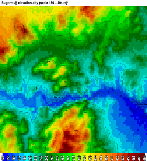
Below is the Elevation map of Bugarra, which displays elevation range with different colors. Scale of the first map is from 136 to 494 m (446 to 1621 ft) with average elevation of 264.7 meters (=868 ft) [note 1]
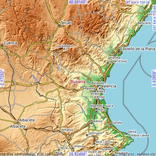
These maps also provides idea of topography and contour of this city, they are displayed at different zoom levels. More info about maps, scale and edge coordinates you can find below images.
| \ | Map #1 | Topo.Map |
| Scale [m] | 136..494 m | × |
| Scale [ft] | 446..1621 ft | × |
| Average | 264.7 m = 868 ft | × |
| Width | 7.53 km = 4.7 mi | 240.9 km = 149.7 mi |
| Height | 7.53 km = 4.7 mi | 240.9 km = 149.7 mi |
| ↑Max Latitude | 39.650514° | 40.69145° |
| Latitude at center | 39.61667° | 39.61667° |
| ↓Min Latitude | 39.582809° | 38.52494° |
| ← Min Longitude | -0.810615° | -2.17292° |
| Longitude center | -0.76667° | -0.76667° |
| →Max Longitude | -0.722725° | 0.63958° |
Nearby cities:
Cities around Bugarra sort by population:
• Llíria elevation 174 m
14.5 km,  84°
84°
• Benaguasil 103 m
15.8 km,  96°
96°
• Vilamarxant 114 m
13.3 km,  113°
113°
• Villar del Arzobispo 486 m
13.7 km,  341°
341°
• Pedralba 149 m
4.7 km, 113°
• Casinos 300 m
10.9 km,  31°
31°
• Loriguilla 525 m
14.8 km,  299°
299°
• Chulilla 339 m
10.7 km,  290°
290°
• Gestalgar 186 m
6 km,  252°
252°
• Domeño 210 m
9.6 km,  58°
58°
• Losa del Obispo 460 m
12.6 km,  317°
317°
• Sot de Chera 430 m
11.6 km,  279°
279°
Multilingual:
 En español:
Bugarra elevación 225 m.
 En France:
Bugarra élévation 225 m.


Sources and notes:
- [note 1] Map square and city borders are not equal. Map elevation data is calculated only from area inside that square.
- [src 1] Elevation data from geonames database provided with same terms of usage.
- [src 2] The elevation map of Bugarra is generated using elevation data from NASA's 3 arcsec (90m) resolution SRTM data.
- [src 3] Base (background) map © OpenStreetMap contributors tiles are generated by Geofabrik and OpenTopoMap.
Copyright & License:
This Bugarra Elevation Map is licensed under CC BY-SA. You may reuse any part from this page, if you give a proper credit by linking to this URL:
 More info on terms of use page.