Carmona elevation
Carmona (Andalusia, Provincia de Sevilla), Spain elevation is 221 meters and Carmona elevation in feet is 725 ft above sea level [src 1]. Carmona is a seat of a third-order administrative division (feature code) with elevation that is 382 meters (1253 ft) smaller than average city elevation in Spain.
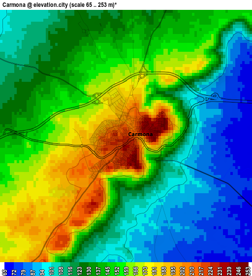
Below is the Elevation map of Carmona, which displays elevation range with different colors. Scale of the first map is from 65 to 253 m (213 to 830 ft) with average elevation of 136.4 meters (=448 ft) [note 1]
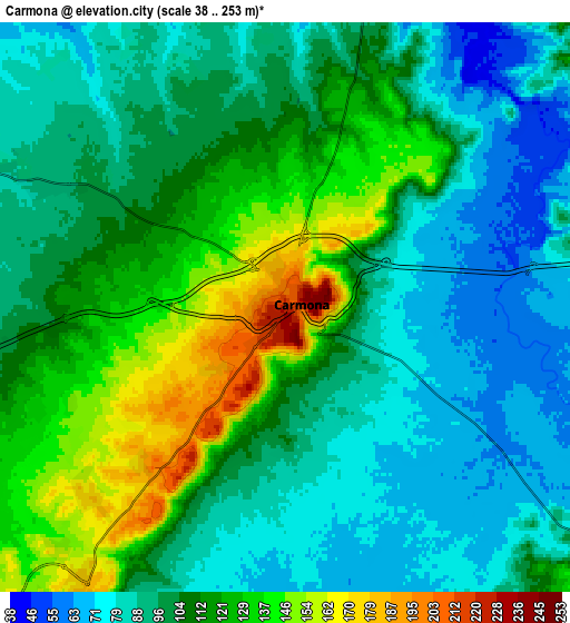
These maps also provides idea of topography and contour of this city, they are displayed at different zoom levels. More info about maps, scale and edge coordinates you can find below images.
| \ | Map #1 | Map #2 | Topo.Map |
| Scale [m] | 65..253 m | 38..253 m | × |
| Scale [ft] | 213..830 ft | 125..830 ft | × |
| Average | 136.4 m = 448 ft | 104.6 m = 343 ft | × |
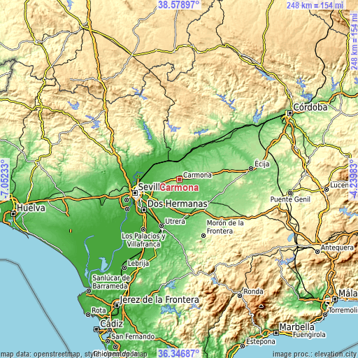
| Width | 7.76 km = 4.8 mi | 15.51 km = 9.6 mi | 248.2 km = 154.2 mi |
| Height | 7.76 km = 4.8 mi | 15.51 km = 9.6 mi | 248.2 km = 154.2 mi |
| ↑Max Latitude | 37.506119° | 37.540973° | 38.57897° |
| Latitude at center | 37.47125° | 37.47125° | 37.47125° |
| ↓Min Latitude | 37.436364° | 37.401462° | 36.34687° |
| ← Min Longitude | -5.690025° | -5.733971° | -7.05233° |
| Longitude center | -5.64608° | -5.64608° | -5.64608° |
| →Max Longitude | -5.602135° | -5.558189° | -4.23983° |
Nearby cities:
Cities around Carmona sort by population:
• Alcalá de Guadaira elevation 71 m
22.6 km,  229°
229°
• Mairena del Alcor 135 m
14.2 km,  219°
219°
• Lora del Río 41 m
23.3 km,  26°
26°
• El Viso del Alcor 167 m
11 km, 216°
• Brenes 21 m
21.7 km,  293°
293°
• Cantillana 32 m
22.1 km,  314°
314°
• Tocina 29 m
17.2 km,  333°
333°
• Paradas 120 m
24 km,  146°
146°
• Villaverde del Río 19 m
24 km,  303°
303°
• Villanueva del Río y Minas 67 m
21.3 km,  343°
343°
• La Campana 140 m
22.2 km,  60°
60°
• Alcolea del Río 36 m
16.1 km,  353°
353°
Multilingual:
 En español:
Carmona elevación 221 m.
 En France:
Carmona élévation 221 m.


Sources and notes:
- [note 1] Map square and city borders are not equal. Map elevation data is calculated only from area inside that square.
- [src 1] Elevation data from geonames database provided with same terms of usage.
- [src 2] The elevation map of Carmona is generated using elevation data from NASA's 3 arcsec (90m) resolution SRTM data.
- [src 3] Base (background) map © OpenStreetMap contributors tiles are generated by Geofabrik and OpenTopoMap.
Copyright & License:
This Carmona Elevation Map is licensed under CC BY-SA. You may reuse any part from this page, if you give a proper credit by linking to this URL:
 More info on terms of use page.