Brenes elevation
Brenes (Andalusia, Provincia de Sevilla), Spain elevation is 21 meters and Brenes elevation in feet is 69 ft above sea level [src 1]. Brenes is a seat of a third-order administrative division (feature code) with elevation that is 582 meters (1909 ft) smaller than average city elevation in Spain.
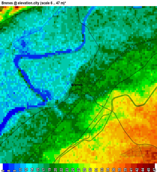
Below is the Elevation map of Brenes, which displays elevation range with different colors. Scale of the first map is from 6 to 47 m (20 to 154 ft) with average elevation of 20.3 meters (=67 ft) [note 1]
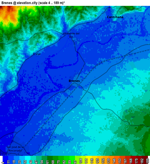
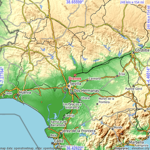
These maps also provides idea of topography and contour of this city, they are displayed at different zoom levels. More info about maps, scale and edge coordinates you can find below images.
| \ | Map #1 | Map #2 | Topo.Map |
| Scale [m] | 6..47 m | 4..189 m | × |
| Scale [ft] | 20..154 ft | 13..620 ft | × |
| Average | 20.3 m = 67 ft | 30.9 m = 101 ft | × |
| Width | 7.75 km = 4.8 mi | 15.5 km = 9.6 mi | 247.9 km = 154 mi |
| Height | 7.75 km = 4.8 mi | 15.5 km = 9.6 mi | 247.9 km = 154 mi |
| ↑Max Latitude | 37.584273° | 37.61909° | 38.65599° |
| Latitude at center | 37.54944° | 37.54944° | 37.54944° |
| ↓Min Latitude | 37.514591° | 37.479725° | 36.42622° |
| ← Min Longitude | -5.915335° | -5.959281° | -7.27764° |
| Longitude center | -5.87139° | -5.87139° | -5.87139° |
| →Max Longitude | -5.827445° | -5.783499° | -4.46514° |
Nearby cities:
Cities around Brenes sort by population:
• La Rinconada elevation 10 m
12 km,  233°
233°
• La Algaba 11 m
15.6 km, 232°
• Guillena 25 m
16.3 km,  267°
267°
• Alcalá del Río 22 m
10.4 km,  250°
250°
• Cantillana 32 m
7.9 km,  31°
31°
• Tocina 29 m
13.8 km,  61°
61°
• Villaverde del Río 19 m
4.4 km,  356°
356°
• Villanueva del Río y Minas 67 m
18.2 km,  49°
49°
• Castilblanco de los Arroyos 325 m
17.4 km,  323°
323°
• Burguillos 76 m
9.2 km,  294°
294°
• Alcolea del Río 36 m
19.4 km,  67°
67°
• Valdezorras 24 m
14.2 km,  199°
199°
Multilingual:
 En español:
Brenes elevación 21 m.
 En France:
Brenes élévation 21 m.


Sources and notes:
- [note 1] Map square and city borders are not equal. Map elevation data is calculated only from area inside that square.
- [src 1] Elevation data from geonames database provided with same terms of usage.
- [src 2] The elevation map of Brenes is generated using elevation data from NASA's 3 arcsec (90m) resolution SRTM data.
- [src 3] Base (background) map © OpenStreetMap contributors tiles are generated by Geofabrik and OpenTopoMap.
Copyright & License:
This Brenes Elevation Map is licensed under CC BY-SA. You may reuse any part from this page, if you give a proper credit by linking to this URL:
 More info on terms of use page.