La Algaba elevation
La Algaba (Andalusia, Provincia de Sevilla), Spain elevation is 11 meters and La Algaba elevation in feet is 36 ft above sea level [src 1]. La Algaba is a populated place (feature code) with elevation that is 592 meters (1942 ft) smaller than average city elevation in Spain.
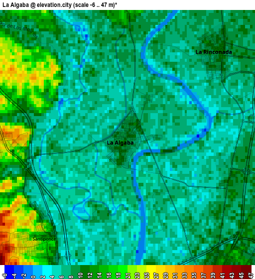
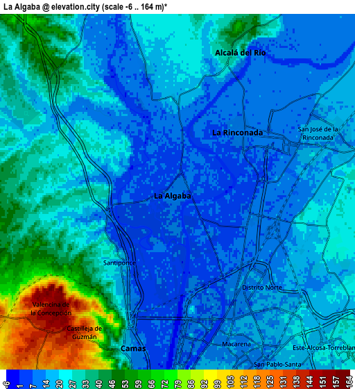
Below is the Elevation map of La Algaba, which displays elevation range with different colors. Scale of the first map is from -6 to 47 m (-20 to 154 ft) with average elevation of 9.4 meters (=31 ft) [note 1]
These maps also provides idea of topography and contour of this city, they are displayed at different zoom levels. More info about maps, scale and edge coordinates you can find below images.
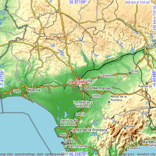
| \ | Map #1 | Map #2 | Topo.Map |
| Scale [m] | -6..47 m | -6..164 m | × |
| Scale [ft] | -20..154 ft | -20..538 ft | × |
| Average | 9.4 m = 31 ft | 25.2 m = 83 ft | × |
| Width | 7.76 km = 4.8 mi | 15.51 km = 9.6 mi | 248.2 km = 154.2 mi |
| Height | 7.76 km = 4.8 mi | 15.51 km = 9.6 mi | 248.2 km = 154.2 mi |
| ↑Max Latitude | 37.498123° | 37.53298° | 38.57109° |
| Latitude at center | 37.46325° | 37.46325° | 37.46325° |
| ↓Min Latitude | 37.428361° | 37.393455° | 36.33875° |
| ← Min Longitude | -6.055075° | -6.099021° | -7.41738° |
| Longitude center | -6.01113° | -6.01113° | -6.01113° |
| →Max Longitude | -5.967185° | -5.923239° | -4.60488° |
Nearby cities:
Cities around La Algaba sort by population:
• Sevilla elevation 16 m
9.5 km,  159°
159°
• La Rinconada 10 m
3.7 km,  46°
46°
• Camas 11 m
7.1 km,  195°
195°
• Castilleja de la Cuesta 101 m
9.3 km, 203°
• Gines 119 m
10.3 km,  214°
214°
• Guillena 25 m
9.7 km,  335°
335°
• Alcalá del Río 22 m
6.6 km,  23°
23°
• Santiponce 12 m
4.1 km,  220°
220°
• Valencina de la Concepción 151 m
7.6 km,  226°
226°
• Salteras 156 m
10 km,  241°
241°
• Valdezorras 24 m
8.4 km,  116°
116°
• Castilleja de Guzmán 135 m
7.1 km, 213°
Multilingual:
 En español:
La Algaba elevación 11 m.
 En France:
La Algaba élévation 11 m.
 Auf Deutsch:
La Algaba höhe über dem Meeresspiegel ist 11 m.

Sources and notes:
- [note 1] Map square and city borders are not equal. Map elevation data is calculated only from area inside that square.
- [src 1] Elevation data from geonames database provided with same terms of usage.
- [src 2] The elevation map of La Algaba is generated using elevation data from NASA's 3 arcsec (90m) resolution SRTM data.
- [src 3] Base (background) map © OpenStreetMap contributors tiles are generated by Geofabrik and OpenTopoMap.
Copyright & License:
This La Algaba Elevation Map is licensed under CC BY-SA. You may reuse any part from this page, if you give a proper credit by linking to this URL:
 More info on terms of use page.