Fuencaliente elevation
Fuencaliente (Castille-La Mancha, Provincia de Ciudad Real), Spain elevation is 692 meters and Fuencaliente elevation in feet is 2270 ft above sea level [src 1]. Fuencaliente is a seat of a third-order administrative division (feature code) with elevation that is 89 meters (292 ft) bigger than average city elevation in Spain.
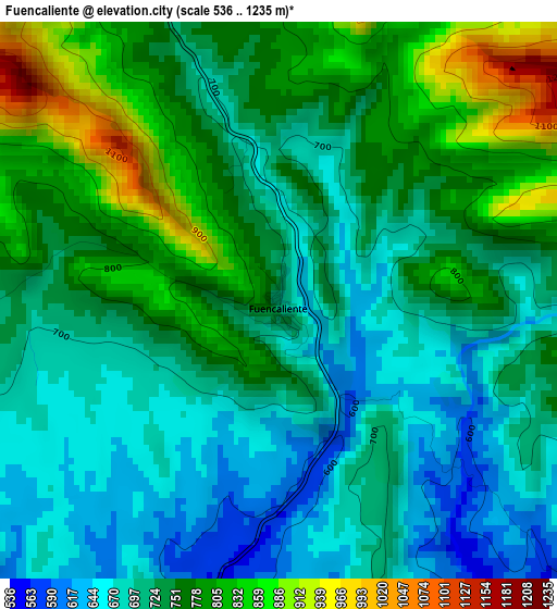
Below is the Elevation map of Fuencaliente, which displays elevation range with different colors. Scale of the first map is from 536 to 1235 m (1759 to 4052 ft) with average elevation of 740.9 meters (=2431 ft) [note 1]
These maps also provides idea of topography and contour of this city, they are displayed at different zoom levels. More info about maps, scale and edge coordinates you can find below images.
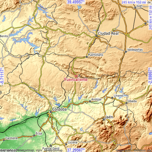
| \ | Map #1 | Topo.Map |
| Scale [m] | 536..1235 m | × |
| Scale [ft] | 1759..4052 ft | × |
| Average | 740.9 m = 2431 ft | × |
| Width | 7.66 km = 4.8 mi | 245.1 km = 152.3 mi |
| Height | 7.66 km = 4.8 mi | 245 km = 152.2 mi |
| ↑Max Latitude | 38.440449° | 39.49957° |
| Latitude at center | 38.40602° | 38.40602° |
| ↓Min Latitude | 38.371575° | 37.29567° |
| ← Min Longitude | -4.348865° | -5.71117° |
| Longitude center | -4.30492° | -4.30492° |
| →Max Longitude | -4.260975° | -2.89867° |
Nearby cities:
Cities around Fuencaliente sort by population:
• Puertollano elevation 701 m
35.7 km,  28°
28°
• Villanueva de Córdoba 729 m
29.7 km,  251°
251°
• Marmolejo 248 m
41.8 km,  163°
163°
• Almodóvar del Campo 675 m
35.5 km,  17°
17°
• Argamasilla de Calatrava 668 m
41.1 km, 28°
• Cardeña 747 m
15.2 km,  186°
186°
• Pedroche 628 m
40 km,  273°
273°
• Torrecampo 601 m
32.2 km,  282°
282°
• Brazatortas 729 m
28.1 km,  1°
1°
• Mestanza 736 m
27.8 km,  47°
47°
• Hinojosas de Calatrava 753 m
27.3 km, 31°
• Conquista 594 m
17 km, 267°
Multilingual:
 En español:
Fuencaliente elevación 692 m.
 En France:
Fuencaliente élévation 692 m.
 Auf Deutsch:
Fuencaliente höhe über dem Meeresspiegel ist 692 m.

Sources and notes:
- [note 1] Map square and city borders are not equal. Map elevation data is calculated only from area inside that square.
- [src 1] Elevation data from geonames database provided with same terms of usage.
- [src 2] The elevation map of Fuencaliente is generated using elevation data from NASA's 3 arcsec (90m) resolution SRTM data.
- [src 3] Base (background) map © OpenStreetMap contributors tiles are generated by Geofabrik and OpenTopoMap.
Copyright & License:
This Fuencaliente Elevation Map is licensed under CC BY-SA. You may reuse any part from this page, if you give a proper credit by linking to this URL:
 More info on terms of use page.