Puertollano elevation
Puertollano (Castille-La Mancha, Provincia de Ciudad Real), Spain elevation is 701 meters and Puertollano elevation in feet is 2300 ft above sea level [src 1]. Puertollano is a seat of a third-order administrative division (feature code) with elevation that is 98 meters (322 ft) bigger than average city elevation in Spain.
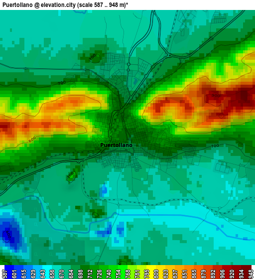
Below is the Elevation map of Puertollano, which displays elevation range with different colors. Scale of the first map is from 587 to 948 m (1926 to 3110 ft) with average elevation of 705.6 meters (=2315 ft) [note 1]
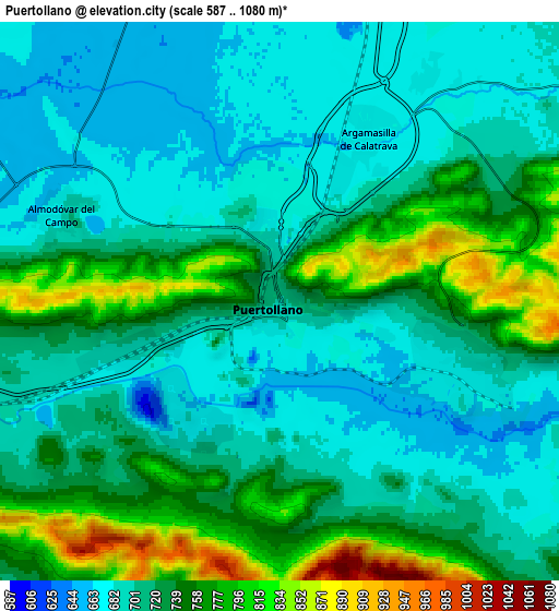
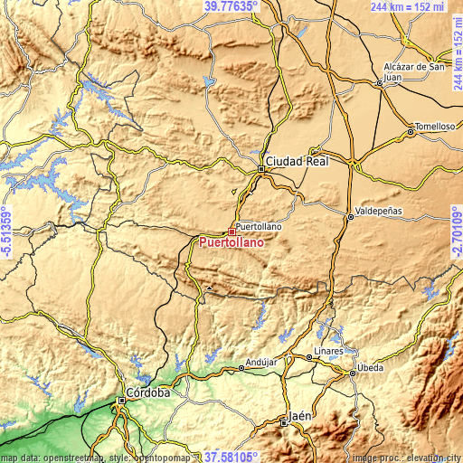
These maps also provides idea of topography and contour of this city, they are displayed at different zoom levels. More info about maps, scale and edge coordinates you can find below images.
| \ | Map #1 | Map #2 | Topo.Map |
| Scale [m] | 587..948 m | 587..1080 m | × |
| Scale [ft] | 1926..3110 ft | 1926..3543 ft | × |
| Average | 705.6 m = 2315 ft | 721.4 m = 2367 ft | × |
| Width | 7.63 km = 4.7 mi | 15.26 km = 9.5 mi | 244.1 km = 151.7 mi |
| Height | 7.63 km = 4.7 mi | 15.26 km = 9.5 mi | 244.1 km = 151.7 mi |
| ↑Max Latitude | 38.721414° | 38.755692° | 39.77635° |
| Latitude at center | 38.68712° | 38.68712° | 38.68712° |
| ↓Min Latitude | 38.652809° | 38.618482° | 37.58105° |
| ← Min Longitude | -4.151285° | -4.195231° | -5.51359° |
| Longitude center | -4.10734° | -4.10734° | -4.10734° |
| →Max Longitude | -4.063395° | -4.019449° | -2.70109° |
Nearby cities:
Cities around Puertollano sort by population:
• Almodóvar del Campo elevation 675 m
6.7 km,  291°
291°
• Argamasilla de Calatrava 668 m
5.5 km,  29°
29°
• Aldea del Rey 668 m
23.9 km,  76°
76°
• Corral de Calatrava 596 m
19.1 km,  6°
6°
• Brazatortas 729 m
16.5 km,  258°
258°
• Mestanza 736 m
12.7 km,  165°
165°
• Hinojosas de Calatrava 753 m
8.6 km,  199°
199°
• Villamayor de Calatrava 661 m
11.5 km,  346°
346°
• Villanueva de San Carlos 656 m
18.7 km,  112°
112°
• Villar del Pozo 639 m
22 km, 34°
• Cañada de Calatrava 650 m
20 km,  21°
21°
• Ballesteros de Calatrava 654 m
21.6 km,  40°
40°
Multilingual:
 En español:
Puertollano elevación 701 m.
 En France:
Puertollano élévation 701 m.
 Auf Deutsch:
Puertollano höhe über dem Meeresspiegel ist 701 m.

Sources and notes:
- [note 1] Map square and city borders are not equal. Map elevation data is calculated only from area inside that square.
- [src 1] Elevation data from geonames database provided with same terms of usage.
- [src 2] The elevation map of Puertollano is generated using elevation data from NASA's 3 arcsec (90m) resolution SRTM data.
- [src 3] Base (background) map © OpenStreetMap contributors tiles are generated by Geofabrik and OpenTopoMap.
Copyright & License:
This Puertollano Elevation Map is licensed under CC BY-SA. You may reuse any part from this page, if you give a proper credit by linking to this URL:
 More info on terms of use page.