Ibi elevation
Ibi (Valencia, Provincia de Alicante), Spain elevation is 748 meters and Ibi elevation in feet is 2454 ft above sea level [src 1]. Ibi is a seat of a third-order administrative division (feature code) with elevation that is 145 meters (476 ft) bigger than average city elevation in Spain.
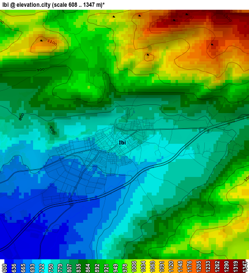
Below is the Elevation map of Ibi, which displays elevation range with different colors. Scale of the first map is from 608 to 1347 m (1995 to 4419 ft) with average elevation of 862.9 meters (=2831 ft) [note 1]
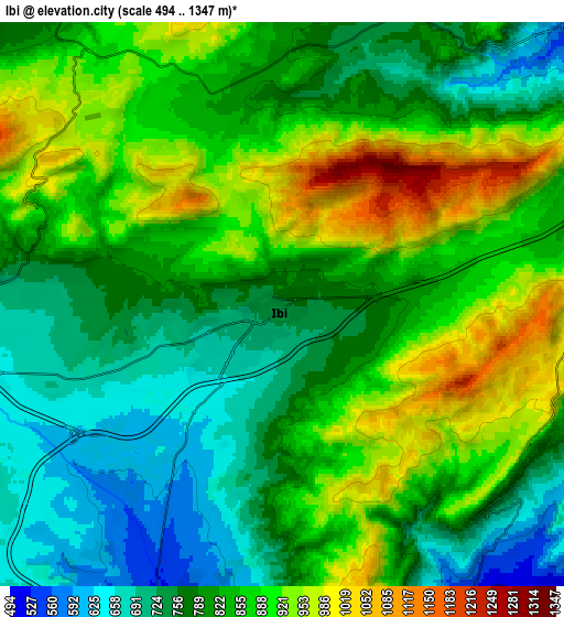
These maps also provides idea of topography and contour of this city, they are displayed at different zoom levels. More info about maps, scale and edge coordinates you can find below images.
| \ | Map #1 | Map #2 | Topo.Map |
| Scale [m] | 608..1347 m | 494..1347 m | × |
| Scale [ft] | 1995..4419 ft | 1621..4419 ft | × |
| Average | 862.9 m = 2831 ft | 830.4 m = 2724 ft | × |
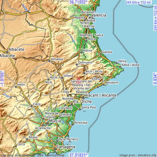
| Width | 7.63 km = 4.7 mi | 15.27 km = 9.5 mi | 244.3 km = 151.8 mi |
| Height | 7.63 km = 4.7 mi | 15.27 km = 9.5 mi | 244.3 km = 151.8 mi |
| ↑Max Latitude | 38.659654° | 38.693961° | 39.71552° |
| Latitude at center | 38.62533° | 38.62533° | 38.62533° |
| ↓Min Latitude | 38.59099° | 38.556633° | 37.51831° |
| ← Min Longitude | -0.616195° | -0.660141° | -1.9785° |
| Longitude center | -0.57225° | -0.57225° | -0.57225° |
| →Max Longitude | -0.528305° | -0.484359° | 0.834° |
Nearby cities:
Cities around Ibi sort by population:
• Alcoy elevation 554 m
12.3 km,  43°
43°
• Cocentaina 458 m
17.1 km, 42°
• Castalla 700 m
9.2 km,  249°
249°
• Onil 676 m
8.8 km,  270°
270°
• Jijona 446 m
11.2 km,  147°
147°
• Bocairent 668 m
16.2 km,  346°
346°
• Biar 723 m
16.7 km, 272°
• Tibi 534 m
10.5 km,  182°
182°
• Benilloba 541 m
17.9 km,  62°
62°
• Agres 671 m
18.2 km,  15°
15°
• Alfafara 581 m
16.5 km,  5°
5°
• Benifallim 740 m
15.5 km,  74°
74°
Multilingual:
 En español:
Ibi elevación 748 m.
 En France:
Ibi élévation 748 m.


Sources and notes:
- [note 1] Map square and city borders are not equal. Map elevation data is calculated only from area inside that square.
- [src 1] Elevation data from geonames database provided with same terms of usage.
- [src 2] The elevation map of Ibi is generated using elevation data from NASA's 3 arcsec (90m) resolution SRTM data.
- [src 3] Base (background) map © OpenStreetMap contributors tiles are generated by Geofabrik and OpenTopoMap.
Copyright & License:
This Ibi Elevation Map is licensed under CC BY-SA. You may reuse any part from this page, if you give a proper credit by linking to this URL:
 More info on terms of use page.