Las Mesas elevation
Las Mesas (Castille-La Mancha, Provincia de Cuenca), Spain elevation is 684 meters and Las Mesas elevation in feet is 2244 ft above sea level [src 1]. Las Mesas is a populated place (feature code) with elevation that is 81 meters (266 ft) bigger than average city elevation in Spain.
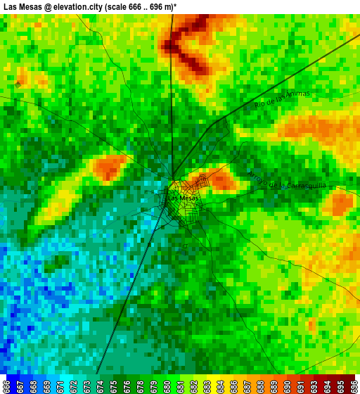
Below is the Elevation map of Las Mesas, which displays elevation range with different colors. Scale of the first map is from 666 to 696 m (2185 to 2283 ft) with average elevation of 678.8 meters (=2227 ft) [note 1]
These maps also provides idea of topography and contour of this city, they are displayed at different zoom levels. More info about maps, scale and edge coordinates you can find below images.
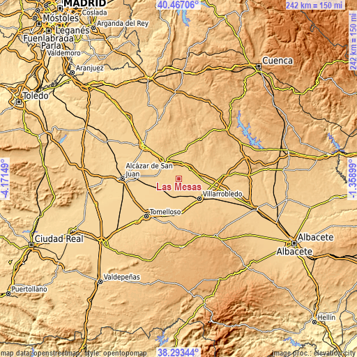
| \ | Map #1 | Topo.Map |
| Scale [m] | 666..696 m | × |
| Scale [ft] | 2185..2283 ft | × |
| Average | 678.8 m = 2227 ft | × |
| Width | 7.55 km = 4.7 mi | 241.7 km = 150.2 mi |
| Height | 7.55 km = 4.7 mi | 241.7 km = 150.2 mi |
| ↑Max Latitude | 39.422665° | 40.46706° |
| Latitude at center | 39.38871° | 39.38871° |
| ↓Min Latitude | 39.354738° | 38.29344° |
| ← Min Longitude | -2.809185° | -4.17149° |
| Longitude center | -2.76524° | -2.76524° |
| →Max Longitude | -2.721295° | -1.35899° |
Nearby cities:
Cities around Las Mesas sort by population:
• Villarrobledo elevation 729 m
19.3 km,  133°
133°
• Socuéllamos 682 m
11.7 km,  191°
191°
• Pedro Muñoz 666 m
15.7 km,  275°
275°
• Las Pedroñeras 706 m
10.4 km,  49°
49°
• Mota del Cuervo 710 m
15.5 km,  324°
324°
• El Provencio 703 m
16.4 km,  94°
94°
• Belmonte 749 m
19.5 km,  15°
15°
• El Toboso 698 m
24.3 km,  304°
304°
• El Pedernoso 712 m
10.9 km,  8°
8°
• Los Hinojosos 772 m
24.5 km,  347°
347°
• Monreal del Llano 735 m
20 km,  1°
1°
• Rada de Haro 825 m
23.7 km,  31°
31°
Multilingual:
 En español:
Las Mesas elevación 684 m.
 En France:
Las Mesas élévation 684 m.
 Auf Deutsch:
Las Mesas höhe über dem Meeresspiegel ist 684 m.

Sources and notes:
- [note 1] Map square and city borders are not equal. Map elevation data is calculated only from area inside that square.
- [src 1] Elevation data from geonames database provided with same terms of usage.
- [src 2] The elevation map of Las Mesas is generated using elevation data from NASA's 3 arcsec (90m) resolution SRTM data.
- [src 3] Base (background) map © OpenStreetMap contributors tiles are generated by Geofabrik and OpenTopoMap.
Copyright & License:
This Las Mesas Elevation Map is licensed under CC BY-SA. You may reuse any part from this page, if you give a proper credit by linking to this URL:
 More info on terms of use page.