Villarrobledo elevation
Villarrobledo (Castille-La Mancha, Provincia de Albacete), Spain elevation is 729 meters and Villarrobledo elevation in feet is 2392 ft above sea level [src 1]. Villarrobledo is a seat of a third-order administrative division (feature code) with elevation that is 126 meters (413 ft) bigger than average city elevation in Spain.
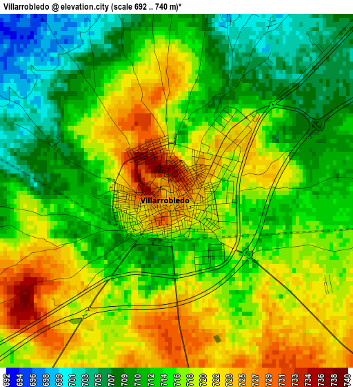
Below is the Elevation map of Villarrobledo, which displays elevation range with different colors. Scale of the first map is from 692 to 740 m (2270 to 2428 ft) with average elevation of 715.7 meters (=2348 ft) [note 1]
These maps also provides idea of topography and contour of this city, they are displayed at different zoom levels. More info about maps, scale and edge coordinates you can find below images.
| \ | Map #1 | Map #2 | Topo.Map |
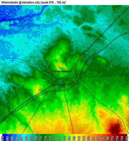
| Scale [m] | 692..740 m | 678..782 m | × |
| Scale [ft] | 2270..2428 ft | 2224..2566 ft | × |
| Average | 715.7 m = 2348 ft | 714.3 m = 2344 ft | × |
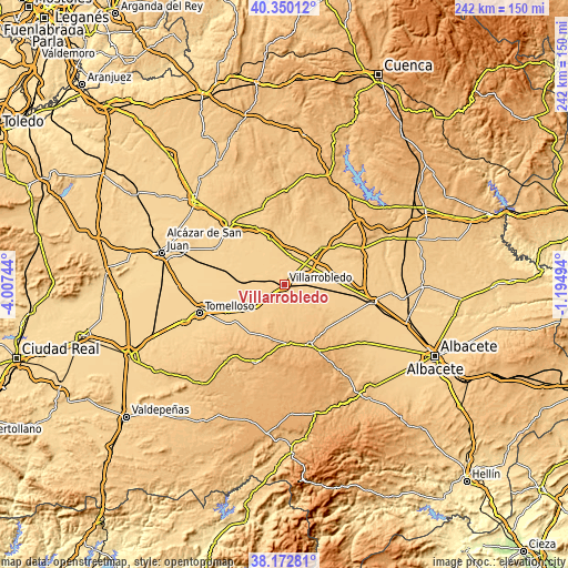
| Width | 7.57 km = 4.7 mi | 15.13 km = 9.4 mi | 242.1 km = 150.4 mi |
| Height | 7.57 km = 4.7 mi | 15.13 km = 9.4 mi | 242.1 km = 150.4 mi |
| ↑Max Latitude | 39.303933° | 39.337929° | 40.35012° |
| Latitude at center | 39.26992° | 39.26992° | 39.26992° |
| ↓Min Latitude | 39.23589° | 39.201844° | 38.17281° |
| ← Min Longitude | -2.645135° | -2.689081° | -4.00744° |
| Longitude center | -2.60119° | -2.60119° | -2.60119° |
| →Max Longitude | -2.557245° | -2.513299° | -1.19494° |
Nearby cities:
Cities around Villarrobledo sort by population:
• Socuéllamos elevation 682 m
16.5 km,  276°
276°
• Las Pedroñeras 706 m
21 km,  342°
342°
• San Clemente 728 m
21.1 km,  44°
44°
• Munera 923 m
27.4 km,  157°
157°
• El Provencio 703 m
12.2 km,  10°
10°
• Las Mesas 684 m
19.3 km,  313°
313°
• La Alberca de Záncara 800 m
28.8 km,  18°
18°
• Minaya 730 m
24.1 km,  89°
89°
• Casas de Fernando Alonso 725 m
25.5 km,  69°
69°
• El Pedernoso 712 m
27.1 km,  332°
332°
• Casas de Haro 724 m
29.1 km,  75°
75°
• Casas de los Pinos 727 m
21.1 km, 70°
Multilingual:
 En español:
Villarrobledo elevación 729 m.
 En France:
Villarrobledo élévation 729 m.
 Auf Deutsch:
Villarrobledo höhe über dem Meeresspiegel ist 729 m.

Sources and notes:
- [note 1] Map square and city borders are not equal. Map elevation data is calculated only from area inside that square.
- [src 1] Elevation data from geonames database provided with same terms of usage.
- [src 2] The elevation map of Villarrobledo is generated using elevation data from NASA's 3 arcsec (90m) resolution SRTM data.
- [src 3] Base (background) map © OpenStreetMap contributors tiles are generated by Geofabrik and OpenTopoMap.
Copyright & License:
This Villarrobledo Elevation Map is licensed under CC BY-SA. You may reuse any part from this page, if you give a proper credit by linking to this URL:
 More info on terms of use page.