Mancha Real elevation
Mancha Real (Andalusia, Provincia de Jaén), Spain elevation is 756 meters and Mancha Real elevation in feet is 2480 ft above sea level [src 1]. Mancha Real is a seat of a third-order administrative division (feature code) with elevation that is 153 meters (502 ft) bigger than average city elevation in Spain.
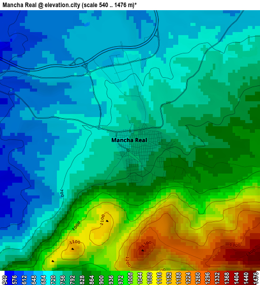
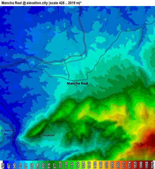
Below is the Elevation map of Mancha Real, which displays elevation range with different colors. Scale of the first map is from 540 to 1476 m (1772 to 4843 ft) with average elevation of 813.6 meters (=2669 ft) [note 1]
These maps also provides idea of topography and contour of this city, they are displayed at different zoom levels. More info about maps, scale and edge coordinates you can find below images.
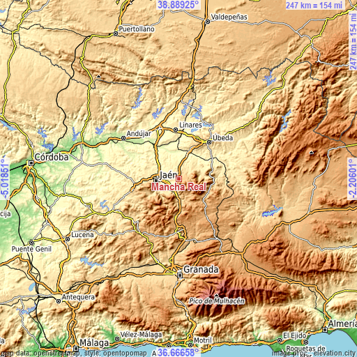
| \ | Map #1 | Map #2 | Topo.Map |
| Scale [m] | 540..1476 m | 426..2019 m | × |
| Scale [ft] | 1772..4843 ft | 1398..6624 ft | × |
| Average | 813.6 m = 2669 ft | 770 m = 2526 ft | × |
| Width | 7.72 km = 4.8 mi | 15.45 km = 9.6 mi | 247.1 km = 153.5 mi |
| Height | 7.72 km = 4.8 mi | 15.45 km = 9.6 mi | 247.1 km = 153.5 mi |
| ↑Max Latitude | 37.820992° | 37.855697° | 38.88925° |
| Latitude at center | 37.78627° | 37.78627° | 37.78627° |
| ↓Min Latitude | 37.751532° | 37.716777° | 36.66658° |
| ← Min Longitude | -3.656205° | -3.700151° | -5.01851° |
| Longitude center | -3.61226° | -3.61226° | -3.61226° |
| →Max Longitude | -3.568315° | -3.524369° | -2.20601° |
Nearby cities:
Cities around Mancha Real sort by population:
• Jaén elevation 558 m
15.8 km,  263°
263°
• Jódar 648 m
23.6 km,  75°
75°
• Huelma 1004 m
20.4 km,  138°
138°
• Los Villares 617 m
21 km,  239°
239°
• Begíjar 575 m
23.2 km,  17°
17°
• Pegalajar 821 m
6.1 km,  212°
212°
• Cambil 773 m
12.6 km,  160°
160°
• Torreblascopedro 333 m
23.6 km,  354°
354°
• La Guardia de Jaén 596 m
8.6 km, 235°
• Bélmez de la Moraleda 869 m
21.4 km,  108°
108°
• Torres 885 m
9.1 km,  90°
90°
• Jimena 593 m
13.4 km,  62°
62°
Multilingual:
 En español:
Mancha Real elevación 756 m.
 En France:
Mancha Real élévation 756 m.
 Auf Deutsch:
Mancha Real höhe über dem Meeresspiegel ist 756 m.

Sources and notes:
- [note 1] Map square and city borders are not equal. Map elevation data is calculated only from area inside that square.
- [src 1] Elevation data from geonames database provided with same terms of usage.
- [src 2] The elevation map of Mancha Real is generated using elevation data from NASA's 3 arcsec (90m) resolution SRTM data.
- [src 3] Base (background) map © OpenStreetMap contributors tiles are generated by Geofabrik and OpenTopoMap.
Copyright & License:
This Mancha Real Elevation Map is licensed under CC BY-SA. You may reuse any part from this page, if you give a proper credit by linking to this URL:
 More info on terms of use page.