Robledollano elevation
Robledollano (Extremadura, Provincia de Cáceres), Spain elevation is 713 meters and Robledollano elevation in feet is 2339 ft above sea level [src 1]. Robledollano is a seat of a third-order administrative division (feature code) with elevation that is 110 meters (361 ft) bigger than average city elevation in Spain.
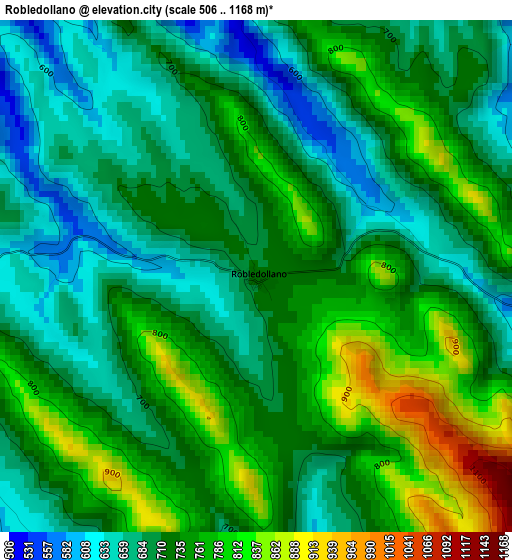
Below is the Elevation map of Robledollano, which displays elevation range with different colors. Scale of the first map is from 506 to 1168 m (1660 to 3832 ft) with average elevation of 726 meters (=2382 ft) [note 1]
These maps also provides idea of topography and contour of this city, they are displayed at different zoom levels. More info about maps, scale and edge coordinates you can find below images.
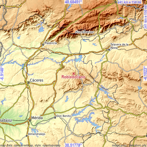
| \ | Map #1 | Topo.Map |
| Scale [m] | 506..1168 m | × |
| Scale [ft] | 1660..3832 ft | × |
| Average | 726 m = 2382 ft | × |
| Width | 7.53 km = 4.7 mi | 240.9 km = 149.7 mi |
| Height | 7.53 km = 4.7 mi | 240.9 km = 149.7 mi |
| ↑Max Latitude | 39.643467° | 40.68451° |
| Latitude at center | 39.60962° | 39.60962° |
| ↓Min Latitude | 39.575756° | 38.51778° |
| ← Min Longitude | -5.552495° | -6.9148° |
| Longitude center | -5.50855° | -5.50855° |
| →Max Longitude | -5.464605° | -4.1023° |
Nearby cities:
Cities around Robledollano sort by population:
• Castañar de Ibor elevation 650 m
8.1 km,  75°
75°
• Aldeacentenera 566 m
13.8 km,  228°
228°
• Deleitosa 567 m
12.3 km,  287°
287°
• Navezuelas 933 m
12.7 km,  151°
151°
• Cabañas del Castillo 771 m
6.9 km,  182°
182°
• Navalvillar de Ibor 677 m
8.6 km,  109°
109°
• Fresnedoso de Ibor 516 m
8.3 km,  359°
359°
• Peraleda de San Román 472 m
17.9 km,  35°
35°
• Mesas de Ibor 486 m
16.6 km,  348°
348°
• Campillo de Deleitosa 501 m
11.8 km,  331°
331°
• Garvín 502 m
18.5 km,  48°
48°
• Higuera 477 m
18.7 km,  313°
313°
Multilingual:
 En español:
Robledollano elevación 713 m.
 En France:
Robledollano élévation 713 m.
 Auf Deutsch:
Robledollano höhe über dem Meeresspiegel ist 713 m.

Sources and notes:
- [note 1] Map square and city borders are not equal. Map elevation data is calculated only from area inside that square.
- [src 1] Elevation data from geonames database provided with same terms of usage.
- [src 2] The elevation map of Robledollano is generated using elevation data from NASA's 3 arcsec (90m) resolution SRTM data.
- [src 3] Base (background) map © OpenStreetMap contributors tiles are generated by Geofabrik and OpenTopoMap.
Copyright & License:
This Robledollano Elevation Map is licensed under CC BY-SA. You may reuse any part from this page, if you give a proper credit by linking to this URL:
 More info on terms of use page.