Santanyí elevation
Santanyí (Balearic Islands, Illes Balears), Spain elevation is 65 meters and Santanyí elevation in feet is 213 ft above sea level [src 1]. Santanyí is a seat of a third-order administrative division (feature code) with elevation that is 538 meters (1765 ft) smaller than average city elevation in Spain.
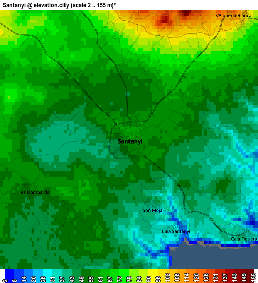
Below is the Elevation map of Santanyí, which displays elevation range with different colors. Scale of the first map is from 2 to 155 m (7 to 509 ft) with average elevation of 55.7 meters (=183 ft) [note 1]
These maps also provides idea of topography and contour of this city, they are displayed at different zoom levels. More info about maps, scale and edge coordinates you can find below images.
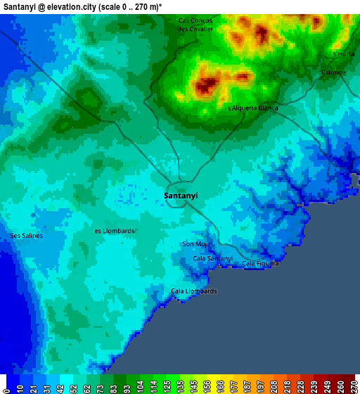
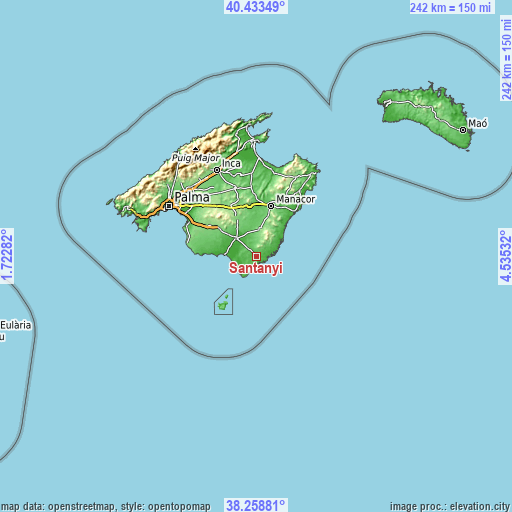
| \ | Map #1 | Map #2 | Topo.Map |
| Scale [m] | 2..155 m | 0..270 m | × |
| Scale [ft] | 7..509 ft | 0..886 ft | × |
| Average | 55.7 m = 183 ft | 61.7 m = 202 ft | × |
| Width | 7.56 km = 4.7 mi | 15.11 km = 9.4 mi | 241.8 km = 150.2 mi |
| Height | 7.56 km = 4.7 mi | 15.11 km = 9.4 mi | 241.8 km = 150.2 mi |
| ↑Max Latitude | 39.388582° | 39.422537° | 40.43349° |
| Latitude at center | 39.35461° | 39.35461° | 39.35461° |
| ↓Min Latitude | 39.320622° | 39.286617° | 38.25881° |
| ← Min Longitude | 3.085125° | 3.041179° | 1.72282° |
| Longitude center | 3.12907° | 3.12907° | 3.12907° |
| →Max Longitude | 3.173015° | 3.216961° | 4.53532° |
Nearby cities:
Cities around Santanyí sort by population:
• Manacor elevation 91 m
24.9 km,  16°
16°
• Llucmajor 150 m
25.4 km,  306°
306°
• Felanitx 116 m
12.9 km,  7°
7°
• Campos 25 m
12.7 km, 312°
• Porreres 128 m
20 km,  332°
332°
• Portocolom 1 m
12.9 km,  58°
58°
• Ses Salines 43 m
6.8 km,  254°
254°
• Cala d'Or 21 m
9.5 km,  73°
73°
• Colònia de Sant Jordi 4 m
12.5 km, 251°
• Montuïri 167 m
26.8 km, 331°
• Vilafranca de Bonany 101 m
24.1 km,  351°
351°
• Calonge 94 m
8.2 km,  51°
51°
Multilingual:
 En español:
Santanyí elevación 65 m.
 En France:
Santanyí élévation 65 m.


Sources and notes:
- [note 1] Map square and city borders are not equal. Map elevation data is calculated only from area inside that square.
- [src 1] Elevation data from geonames database provided with same terms of usage.
- [src 2] The elevation map of Santanyí is generated using elevation data from NASA's 3 arcsec (90m) resolution SRTM data.
- [src 3] Base (background) map © OpenStreetMap contributors tiles are generated by Geofabrik and OpenTopoMap.
Copyright & License:
This Santanyí Elevation Map is licensed under CC BY-SA. You may reuse any part from this page, if you give a proper credit by linking to this URL:
 More info on terms of use page.