Manacor elevation
Manacor (Balearic Islands, Illes Balears), Spain elevation is 91 meters and Manacor elevation in feet is 299 ft above sea level [src 1]. Manacor is a seat of a third-order administrative division (feature code) with elevation that is 512 meters (1680 ft) smaller than average city elevation in Spain.
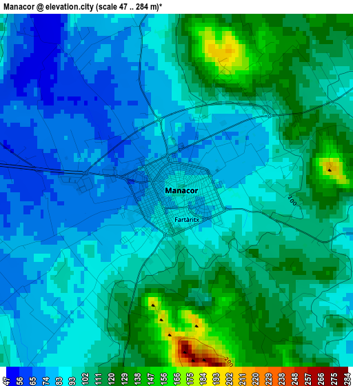
Below is the Elevation map of Manacor, which displays elevation range with different colors. Scale of the first map is from 47 to 284 m (154 to 932 ft) with average elevation of 97.7 meters (=321 ft) [note 1]
These maps also provides idea of topography and contour of this city, they are displayed at different zoom levels. More info about maps, scale and edge coordinates you can find below images.
| \ | Map #1 | Map #2 | Topo.Map |
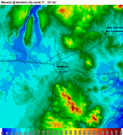
| Scale [m] | 47..284 m | 17..331 m | × |
| Scale [ft] | 154..932 ft | 56..1086 ft | × |
| Average | 97.7 m = 321 ft | 101.7 m = 334 ft | × |
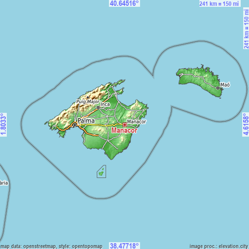
| Width | 7.53 km = 4.7 mi | 15.07 km = 9.4 mi | 241.1 km = 149.8 mi |
| Height | 7.53 km = 4.7 mi | 15.07 km = 9.4 mi | 241.1 km = 149.8 mi |
| ↑Max Latitude | 39.603507° | 39.637357° | 40.64516° |
| Latitude at center | 39.56964° | 39.56964° | 39.56964° |
| ↓Min Latitude | 39.535756° | 39.501856° | 38.47718° |
| ← Min Longitude | 3.165605° | 3.121659° | 1.8033° |
| Longitude center | 3.20955° | 3.20955° | 3.20955° |
| →Max Longitude | 3.253495° | 3.297441° | 4.6158° |
Nearby cities:
Cities around Manacor sort by population:
• Felanitx elevation 116 m
12.3 km,  205°
205°
• Son Servera 82 m
14.1 km,  66°
66°
• Santa Margalida 88 m
17.3 km,  327°
327°
• Porto Cristo 6 m
11.1 km,  107°
107°
• Porreres 128 m
17.2 km,  249°
249°
• Portocolom 1 m
17.6 km,  166°
166°
• Petra 103 m
9.6 km,  300°
300°
• Vilafranca de Bonany 101 m
10.4 km,  269°
269°
• Maria de la Salut 114 m
15.6 km,  311°
311°
• Ariany 117 m
12.4 km,  316°
316°
• Sant Joan 138 m
14.9 km,  281°
281°
• Sant Llorenç des Cardassar 76 m
7.8 km,  54°
54°
Multilingual:
 En español:
Manacor elevación 91 m.
 En France:
Manacor élévation 91 m.


Sources and notes:
- [note 1] Map square and city borders are not equal. Map elevation data is calculated only from area inside that square.
- [src 1] Elevation data from geonames database provided with same terms of usage.
- [src 2] The elevation map of Manacor is generated using elevation data from NASA's 3 arcsec (90m) resolution SRTM data.
- [src 3] Base (background) map © OpenStreetMap contributors tiles are generated by Geofabrik and OpenTopoMap.
Copyright & License:
This Manacor Elevation Map is licensed under CC BY-SA. You may reuse any part from this page, if you give a proper credit by linking to this URL:
 More info on terms of use page.