Palora elevation
Palora (Morona-Santiago, Cantón Palora), Ecuador elevation is 880 meters and Palora elevation in feet is 2887 ft above sea level [src 1]. Palora is a populated place (feature code) with elevation that is 65 meters (213 ft) smaller than average city elevation in Ecuador.
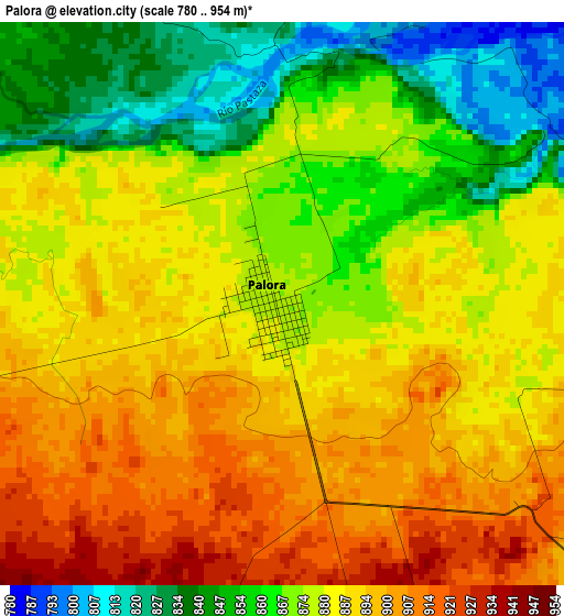
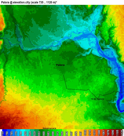
Below is the Elevation map of Palora, which displays elevation range with different colors. Scale of the first map is from 780 to 954 m (2559 to 3130 ft) with average elevation of 879.4 meters (=2885 ft) [note 1]
These maps also provides idea of topography and contour of this city, they are displayed at different zoom levels. More info about maps, scale and edge coordinates you can find below images.
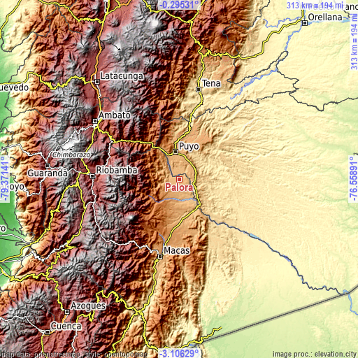
| \ | Map #1 | Map #2 | Topo.Map |
| Scale [m] | 780..954 m | 735..1120 m | × |
| Scale [ft] | 2559..3130 ft | 2411..3675 ft | × |
| Average | 879.4 m = 2885 ft | 894.7 m = 2935 ft | × |
| Width | 9.77 km = 6.1 mi | 19.54 km = 12.1 mi | 312.6 km = 194.2 mi |
| Height | 9.77 km = 6.1 mi | 19.54 km = 12.1 mi | 312.6 km = 194.2 mi |
| ↑Max Latitude | -1.657384° | -1.613456° | -0.29531° |
| Latitude at center | -1.70131° | -1.70131° | -1.70131° |
| ↓Min Latitude | -1.745235° | -1.78916° | -3.10629° |
| ← Min Longitude | -78.009105° | -78.053051° | -79.37141° |
| Longitude center | -77.96516° | -77.96516° | -77.96516° |
| →Max Longitude | -77.921215° | -77.877269° | -76.55891° |
Nearby cities:
Cities around Palora sort by population:
• Ambato elevation 2597 m
88.2 km,  304°
304°
• Riobamba 2758 m
75.9 km,  272°
272°
• Puyo 925 m
24.6 km,  350°
350°
• Macas 914 m
69.5 km,  193°
193°
• Tena 504 m
80.5 km,  12°
12°
• Pelileo 2589 m
76.4 km, 302°
• Guano 2666 m
74.7 km,  277°
277°
• Baños 1805 m
61.1 km, 303°
• Píllaro 2787 m
87.3 km,  312°
312°
• Sucúa 831 m
87.3 km,  195°
195°
• Quero 2962 m
79.8 km, 296°
• Santa Clara 590 m
49.4 km, 10°
Multilingual:
 En español:
Palora elevación 880 m.
 En France:
Palora élévation 880 m.


Sources and notes:
- [note 1] Map square and city borders are not equal. Map elevation data is calculated only from area inside that square.
- [src 1] Elevation data from geonames database provided with same terms of usage.
- [src 2] The elevation map of Palora is generated using elevation data from NASA's 3 arcsec (90m) resolution SRTM data.
- [src 3] Base (background) map © OpenStreetMap contributors tiles are generated by Geofabrik and OpenTopoMap.
Copyright & License:
This Palora Elevation Map is licensed under CC BY-SA. You may reuse any part from this page, if you give a proper credit by linking to this URL:
 More info on terms of use page.