Ambato elevation
Ambato (Tungurahua, Cantón Ambato), Ecuador elevation is 2597 meters and Ambato elevation in feet is 8520 ft above sea level [src 1]. Ambato is a seat of a first-order administrative division (feature code) with elevation that is 1652 meters (5420 ft) bigger than average city elevation in Ecuador.
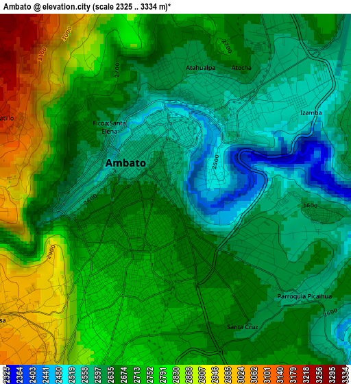
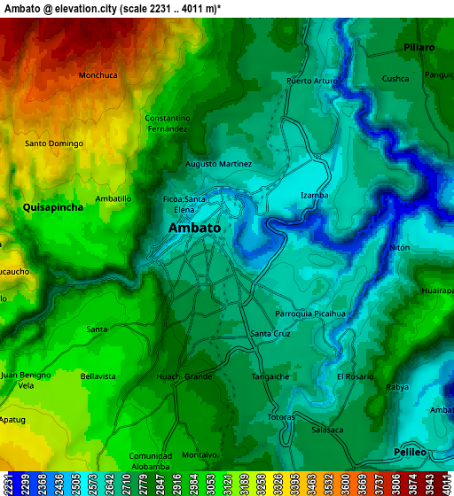
Below is the Elevation map of Ambato, which displays elevation range with different colors. Scale of the first map is from 2325 to 3334 m (7628 to 10938 ft) with average elevation of 2691.2 meters (=8829 ft) [note 1]
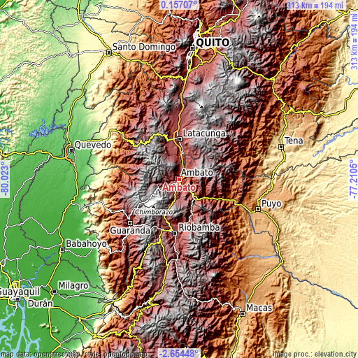
These maps also provides idea of topography and contour of this city, they are displayed at different zoom levels. More info about maps, scale and edge coordinates you can find below images.
| \ | Map #1 | Map #2 | Topo.Map |
| Scale [m] | 2325..3334 m | 2231..4011 m | × |
| Scale [ft] | 7628..10938 ft | 7320..13159 ft | × |
| Average | 2691.2 m = 8829 ft | 2868.3 m = 9410 ft | × |
| Width | 9.77 km = 6.1 mi | 19.54 km = 12.1 mi | 312.6 km = 194.2 mi |
| Height | 9.77 km = 6.1 mi | 19.54 km = 12.1 mi | 312.6 km = 194.2 mi |
| ↑Max Latitude | -1.205145° | -1.161209° | 0.15707° |
| Latitude at center | -1.24908° | -1.24908° | -1.24908° |
| ↓Min Latitude | -1.293014° | -1.336948° | -2.65448° |
| ← Min Longitude | -78.660695° | -78.704641° | -80.023° |
| Longitude center | -78.61675° | -78.61675° | -78.61675° |
| →Max Longitude | -78.572805° | -78.528859° | -77.2105° |
Nearby cities:
Cities around Ambato sort by population:
• Riobamba elevation 2758 m
47 km,  184°
184°
• Latacunga 2769 m
34.9 km,  0°
0°
• Guaranda 2680 m
57.3 km,  228°
228°
• Pelileo 2589 m
12.1 km,  137°
137°
• Pujilí 2944 m
33.6 km,  344°
344°
• Guano 2666 m
39.9 km, 182°
• San Miguel 2444 m
69.7 km,  222°
222°
• San Miguel de Salcedo 2650 m
22.8 km,  7°
7°
• Baños 1805 m
27.1 km,  127°
127°
• Píllaro 2787 m
11.4 km,  43°
43°
• Saquisilí 2919 m
45.8 km,  352°
352°
• Quero 2962 m
14.7 km, 176°
Multilingual:
 En español:
Ambato elevación 2597 m.
 En France:
Ambato élévation 2597 m.


Sources and notes:
- [note 1] Map square and city borders are not equal. Map elevation data is calculated only from area inside that square.
- [src 1] Elevation data from geonames database provided with same terms of usage.
- [src 2] The elevation map of Ambato is generated using elevation data from NASA's 3 arcsec (90m) resolution SRTM data.
- [src 3] Base (background) map © OpenStreetMap contributors tiles are generated by Geofabrik and OpenTopoMap.
Copyright & License:
This Ambato Elevation Map is licensed under CC BY-SA. You may reuse any part from this page, if you give a proper credit by linking to this URL:
 More info on terms of use page.