Friedland elevation
Friedland (Lower Saxony), Germany elevation is 181 meters and Friedland elevation in feet is 594 ft above sea level [src 1]. Friedland is a populated place (feature code) with elevation that is 77 meters (253 ft) smaller than average city elevation in Germany.
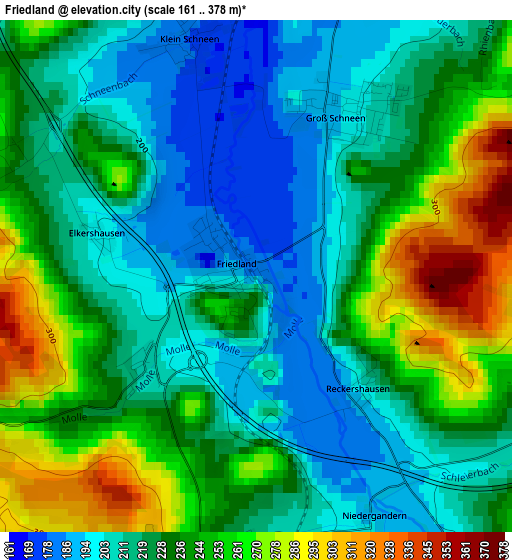
Below is the Elevation map of Friedland, which displays elevation range with different colors. Scale of the first map is from 161 to 378 m (528 to 1240 ft) with average elevation of 230.9 meters (=758 ft) [note 1]
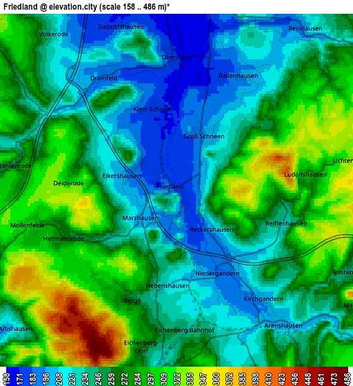
These maps also provides idea of topography and contour of this city, they are displayed at different zoom levels. More info about maps, scale and edge coordinates you can find below images.
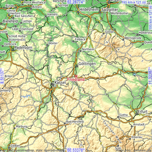
| \ | Map #1 | Map #2 | Topo.Map |
| Scale [m] | 161..378 m | 158..486 m | × |
| Scale [ft] | 528..1240 ft | 518..1594 ft | × |
| Average | 230.9 m = 758 ft | 258.8 m = 849 ft | × |
| Width | 6.09 km = 3.8 mi | 12.19 km = 7.6 mi | 195 km = 121.2 mi |
| Height | 6.09 km = 3.8 mi | 12.19 km = 7.6 mi | 195 km = 121.2 mi |
| ↑Max Latitude | 51.446567° | 51.473947° | 52.28774° |
| Latitude at center | 51.41917° | 51.41917° | 51.41917° |
| ↓Min Latitude | 51.391757° | 51.364327° | 50.53378° |
| ← Min Longitude | 9.873675° | 9.829729° | 8.51137° |
| Longitude center | 9.91762° | 9.91762° | 9.91762° |
| →Max Longitude | 9.961565° | 10.005511° | 11.32387° |
Nearby cities:
Cities around Friedland sort by population:
• Göttingen elevation 153 m
12.9 km,  4°
4°
• Heilbad Heiligenstadt 264 m
15.9 km,  106°
106°
• Witzenhausen 151 m
9.7 km,  206°
206°
• Rosdorf 168 m
9.1 km,  352°
352°
• Gemeinde Friedland 255 m
1.1 km,  104°
104°
• Bad Sooden-Allendorf 158 m
17 km,  166°
166°
• Dransfeld 309 m
14 km,  309°
309°
• Uder 234 m
12.4 km,  120°
120°
• Scheden 236 m
13.2 km,  285°
285°
• Landolfshausen 213 m
17.9 km,  44°
44°
• Jühnde 321 m
9.7 km,  302°
302°
• Arenshausen 204 m
6 km,  143°
143°
Multilingual:
 En español:
Friedland elevación 181 m.
 En France:
Friedland élévation 181 m.
 Auf Deutsch:
Friedland höhe über dem Meeresspiegel ist 181 m.

Sources and notes:
- [note 1] Map square and city borders are not equal. Map elevation data is calculated only from area inside that square.
- [src 1] Elevation data from geonames database provided with same terms of usage.
- [src 2] The elevation map of Friedland is generated using elevation data from NASA's 3 arcsec (90m) resolution SRTM data.
- [src 3] Base (background) map © OpenStreetMap contributors tiles are generated by Geofabrik and OpenTopoMap.
Copyright & License:
This Friedland Elevation Map is licensed under CC BY-SA. You may reuse any part from this page, if you give a proper credit by linking to this URL:
 More info on terms of use page.